
Monday, January 22, 2018
Today we say goodbye to Death Valley and the Mojave Desert and say hello to Las Vegas. Vegas, baby!
We drive north on 373 to 95 south. Vegas is about 110 miles away. The drive takes us through more desert, with more rocky peaks. We could see the tall buildings of Vegas in the distance. As if a Vegas magician did his magic, civilization suddenly appeared. No gradual scattering of buildings intensifying to a city, but whammo, houses and businesses magically appearing.
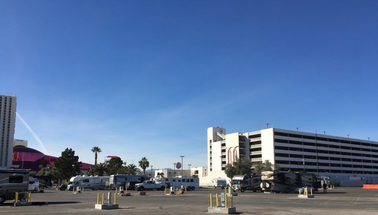
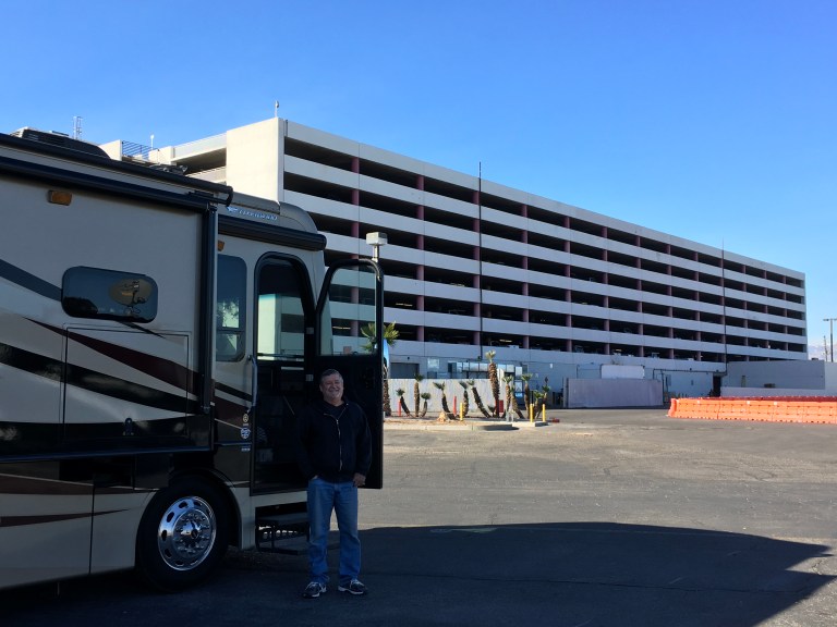
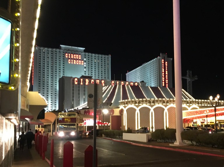
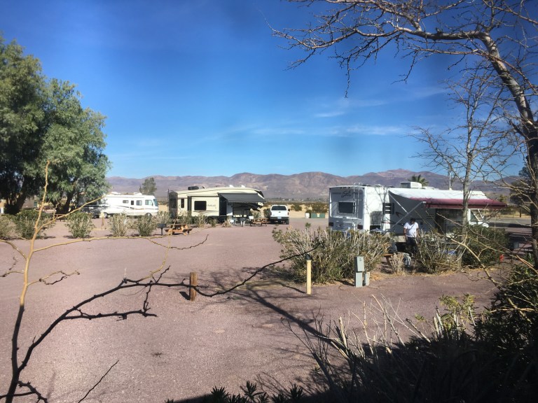
To get to the Circus Circus RV Park, we have to get on I-15. City interstates are crazy enough, but this section is under construction and totally insane! And bumpy. After getting to the park in one piece and setting up, we head out to Walmart to pick up meds and supples. 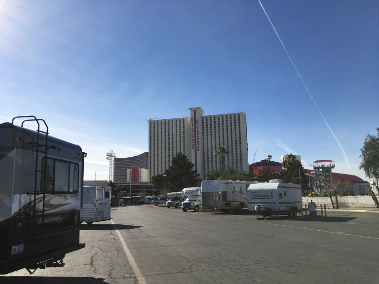

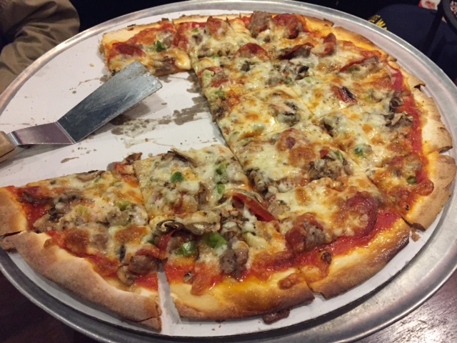
 We’re starving, this is becoming a habit! We decide to head into Circus Circus in search of food. This is going to lunner again, a meal halfway between lunch and dinner. We decide on the Pizzeria, of course, at the start of the casino floor. After we ate, we strolled down the strip watching the sites.
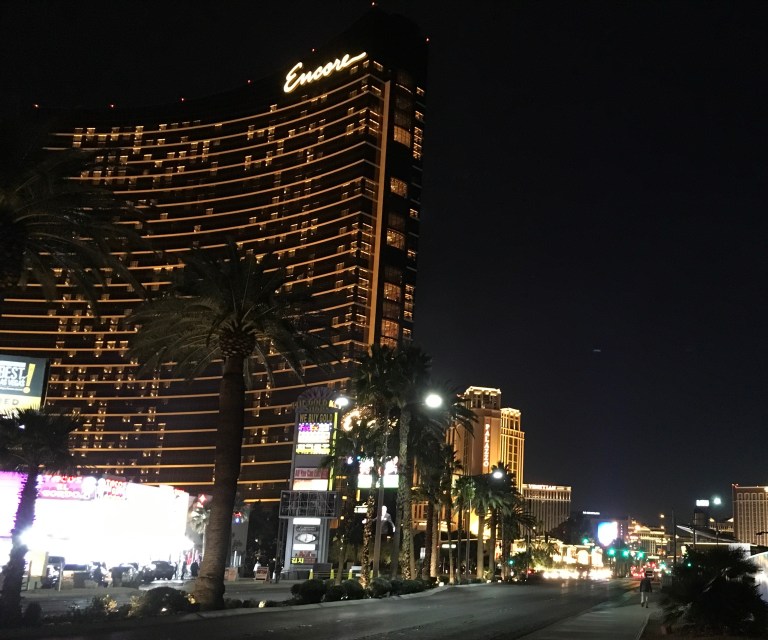


Sunday, January 21, 2018
Our last day here in Death Valley. It’s still windy, but we’re going back to,the park.
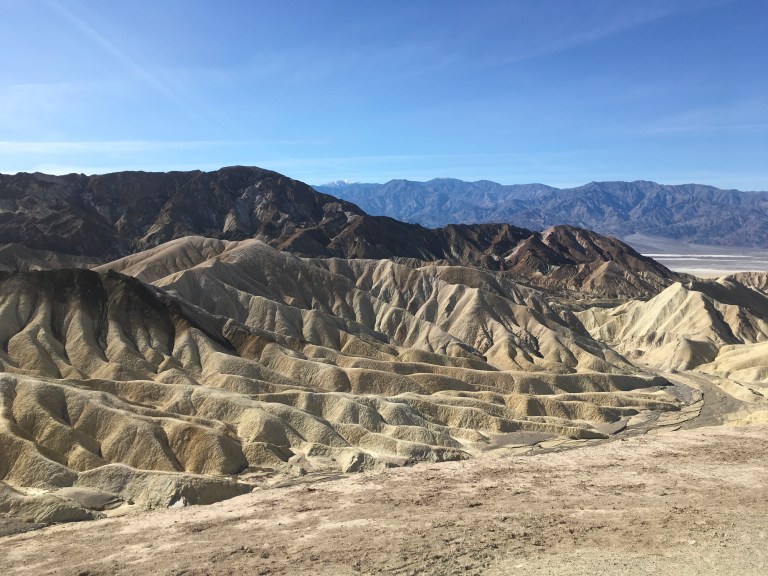
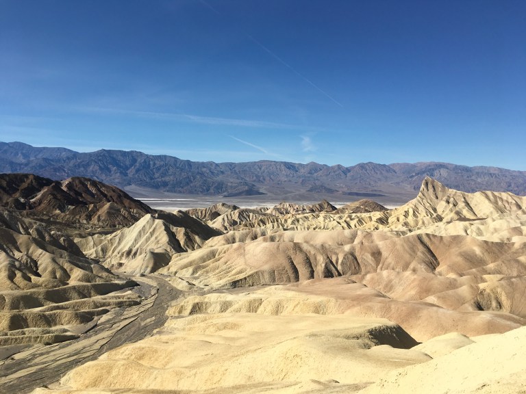
The first spot is back to Zabriskie Point. Alex waits behind while I hike up to check it out. Once I get to the top, I can see why they say this is the place to visit at sunrise or sunset. I am faced with a sea of mounts, odd shapes, jutting this way and that. It looks like some alien world. If extraterrestrials have come to this area, I can see why. It must remind them of home.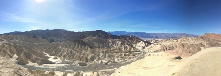
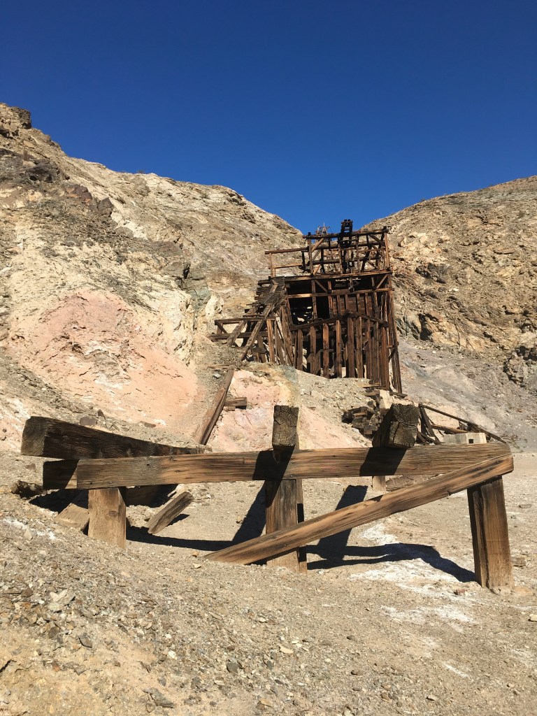
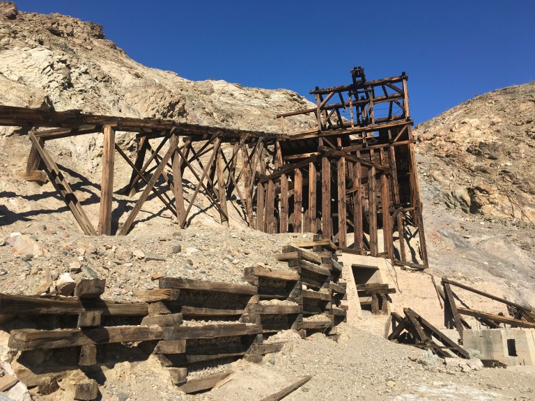
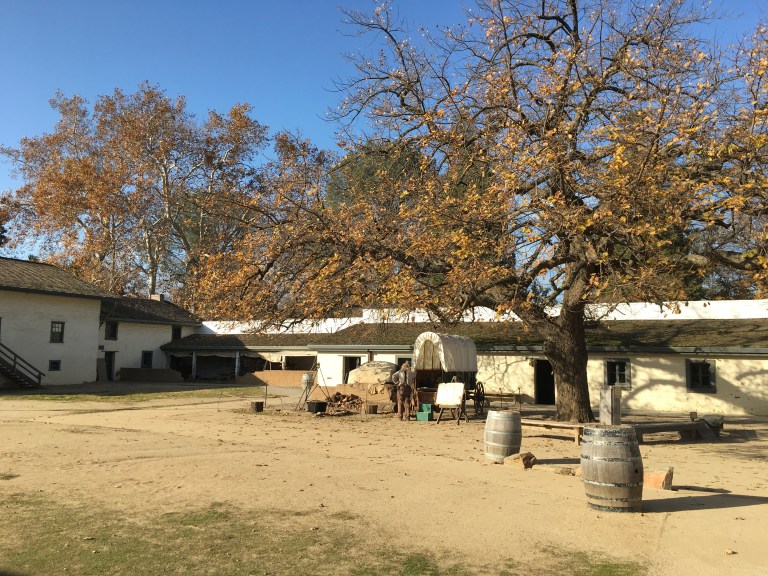
We stop at Keene Wonder Mines, one of the most successful gold mines in Death Valley. Traveling one thousand feet down in one mile, the tramway cars hauled up tons of gold ore. Seventy tons of ore each day traveled by tramway down Funeral Mountain. By 1912, the mine was tapped out and then abandoned. In that time, one million dollars of gold was moved on the tramway.

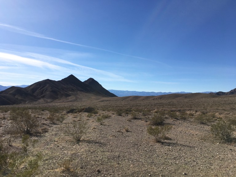
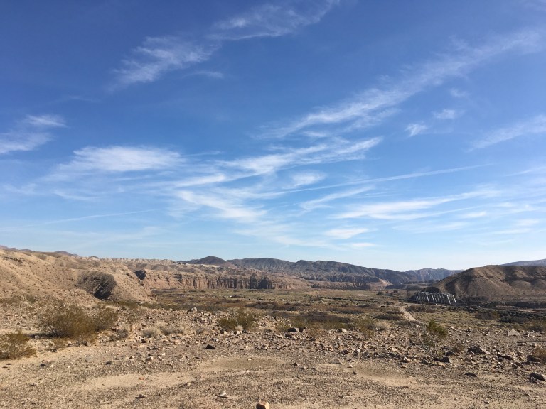
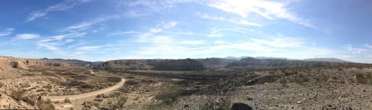
We continue driving to where the two roads of Beatty Cutoff and 374 intersect, at Hell’s Gate, the beginning of a vast desolate area, bordered by the Death Valley Buttes, rocky, craggy peaks jutting out of the desolation.

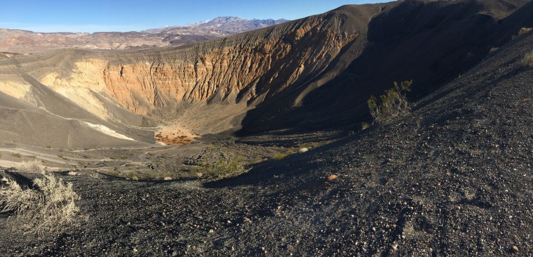
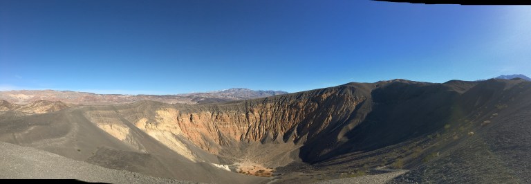
We stop at the rest stop to marvel at the landscape, then take 374 back down to Scotty’s Castle Road and make a right turn to head to Ubehebe Crater. The crater is about forty miles from this intersection. Remember there are 800 miles of road to this park!
Ubehebe Crater is a great spot for anyone who can’t or doesn’t want to hike to see nature’s beauty. You can drive to the parking lot and never even get out of the car to see it, but I highly recommend walking the few feet to the edge. Ubehebe Crater is a 770 foot deep steam-explosion crater that began its life when water beneath the surface turned to steam and shattered the rock above, spewing debris at one hundred miles an hour. You can hike up a steep trail of deep gravel to see Little Hebe. Either way, you won’t be disappointed.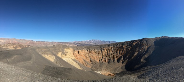
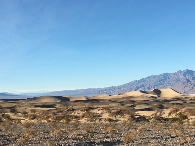
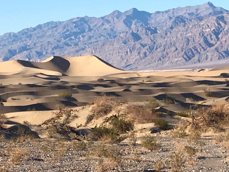
It’s getting late. You don’t realize how far you have to drive between each location, so we head back down to the Mesquite Flat Dunes, about an hour drive. It’s late in the afternoon and the sun is starting its decent, casting the dunes into shadow and light. The perfect time for a visit. These 150 foot dunes are nearly surrounded by mountains on all sides. The Cottonwood Mountains, on the north and northwest side of the dunes, are the primary source the sand. The sand is composed of quartz and feldspar that began as large pieces of rock. Erosion made the rock sand sized. You can take off your shoes and walk through the sand or just sit and admire the beauty.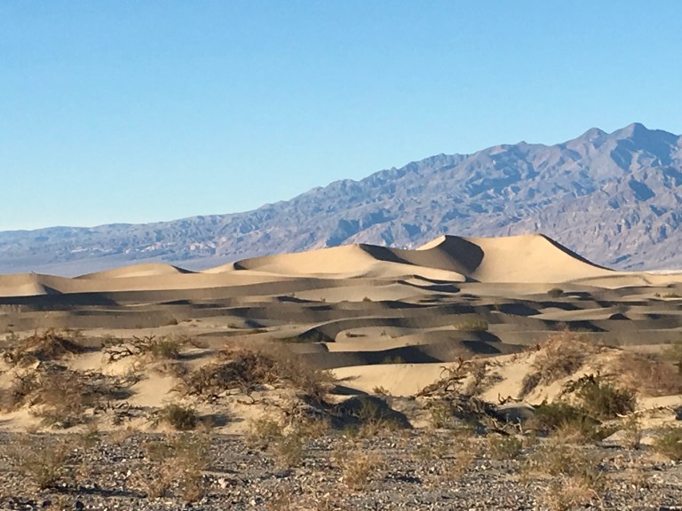
We have another hours drive to get out of the park and back on 127 to go to the Casino campground. The sun has just set and we haven’t eaten since breakfast, so we head over to the Casino restaurant for dinner. We’re starved!
Saturday, January 20, 2018
Day two of the wind storm.
What a horrible night’s sleep! The wind kept the coach rocking and rolling. Everything was moving and squeaking. I was hoping we wouldn’t come apart during the night. The roller on the bedroom topper over our heads was rattling and making such a racket that I couldn’t sleep. I don’t know if the wind calmed down or it was my exhaustion, but I did finally fall asleep and stay asleep till morning.
When we woke, there was no dust storm in front of us and the wind seemed a little bit calmer, still not great, but calmer.
Since Alex has never seen any Star Wars movie, I had planned for us to sit outside in the otherworldly landscape of Death Valley, and watching from start to DVD finish. I thought it would be an awesome backdrop. However, Mother Nature has not agreed with me. If it’s not the cold, it’s the wind, so today, since we’re confined to quarters, we watch the first three movies in episode order, not chronological order of release. Today was “The Phantom Menace“, “Attack of the Clones” and “Revenge of the Sith”. Darth Vader is born!
Friday, January 19, 2018
We are not going anywhere today. High winds blew in during the night and are expected to continue through tomorrow ahead of the rain. I know the weather report says the sustained winds are twenty to thirty miles an hour, depending on where you are, but one step outside and it feels like you are going to get knocked over. You can’t stand, the wind is trying to blow you over and walking is a challenge. It feels like a hurricane. The coach is rocking and rolling. We watch the dust storm blowing by on the flat land in front of the coach.
When I go to the bedroom closet, I can feel air in my face. The wind is blowing so hard it is finding its way into the gaps in the coach. We grab beach and bath towels, roll them up and stick them on top of the big slide. That’s the direction the wind is blowing. Once we do that, the temperature makes a giant leap forward. When we get to Vegas we will find a Joann’s, buy fabric and make one long barricade against Mother Nature.
Thursday, January 18, 2018
The Ash Meadow National Wildlife Refuge entrance is about a mile from our campground. However, to actually get to the Visitor Center, you have to travel another twenty on a dirt gravel road. Ash Meadow National Wildlife Refuge is the largest remaining oasis in the Mojave Desert. Within the Refuge, there are at least twenty six plant and animal species that are found nowhere else on the planet.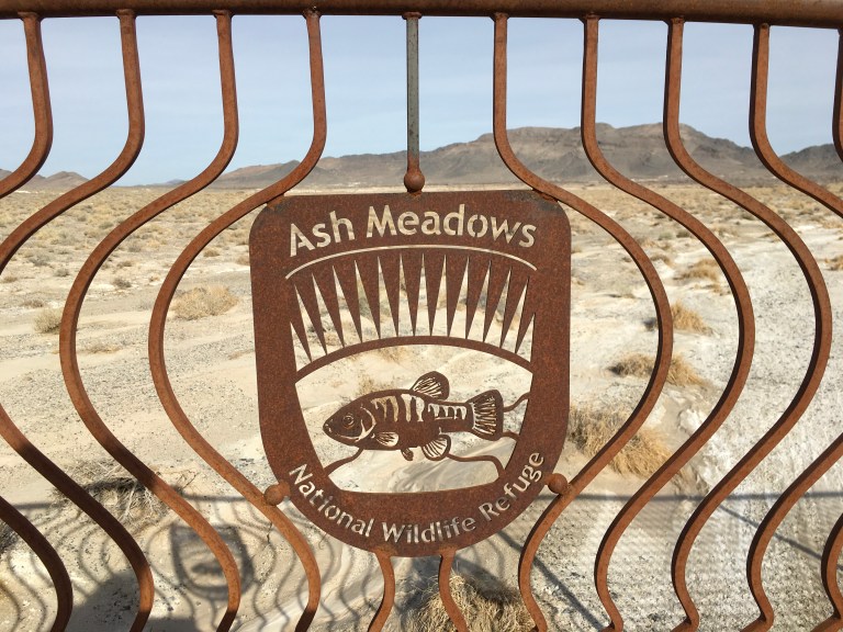
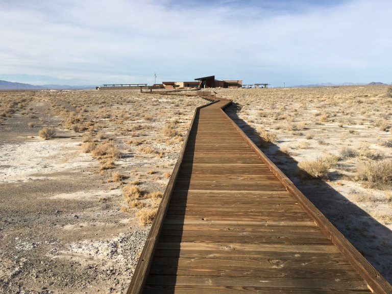

The Crystal Spring Boardwalk starts behind the center. The mile long boardwalk takes you to a brilliant turquoise blue spring that flows at 2,800 gallons of water a minute. 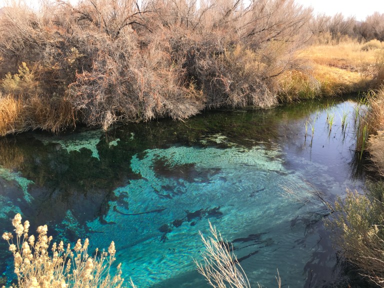
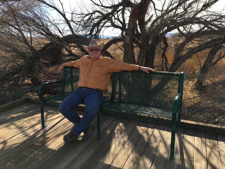
 Along the way there are benches were you can sit and look at the scenery. The spring itself is beautiful, but the real star of the show is what is living in it. Pupfish, named for their playful movements, reside here in the springs of this Refuge and nowhere else on earth. These fish are little more than an inch in length. Back in the days when the west was being settled, this area was home to the largest wetlands in Nevada. But, with water being precious in the desert, man devised ways to drain or divert the wetlands, devastating the environment and nearly destroying the pupfish. Many other species didn’t fare as well, but it was the pupfish, living in Devil’s Hole, that stopped man from further destruction. Each of the pools that remain have pupfish that have evolved to meet the conditions of the pool they live in. Sadly, the area can never be returned to the way it was, but the Refuge is working to restore it to a sustainable ecosystem.
Back on the gravel road, we drive to see Crystal Reservoir, a beautiful turquoise body of water that is a stopping point for the waters of Crystal Spring, on its way to the sea.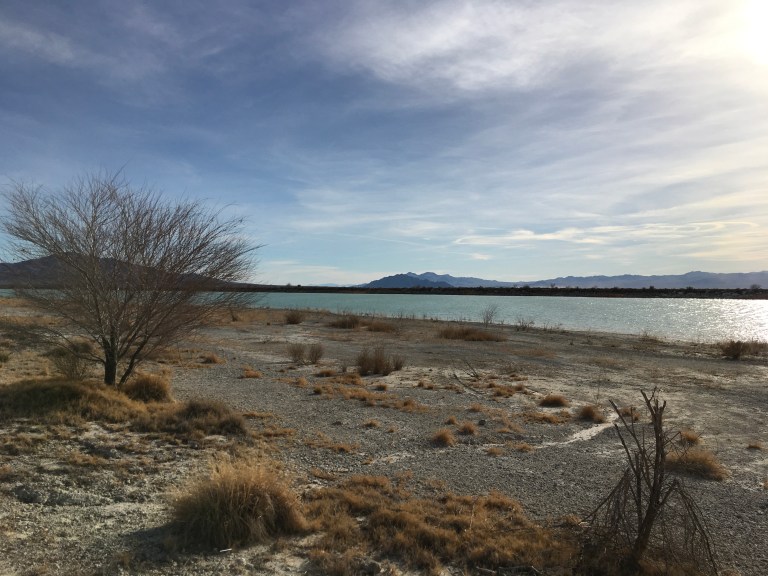
We decided to see the 1800’s cabin of Jack Longstreet, an infamous gunslinger in these parts. It was said, Jack cut a notch in the grip of his gun for every man he killed. Looking to hide out from the law and his enemies, Jack found a spring and built his cabin. His second wife, Suzie, lived there with him from 1895-1899. The cabin was destroyed by a flood, but has since been rebuilt using old photos as the guide.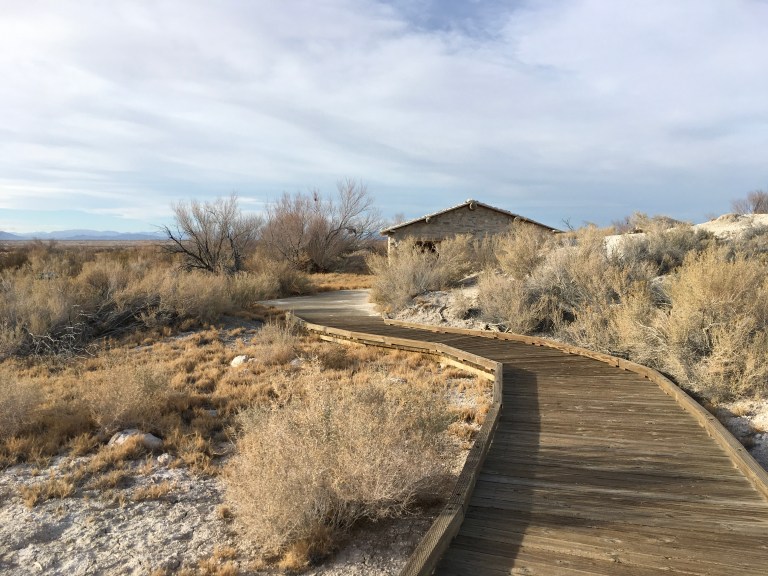
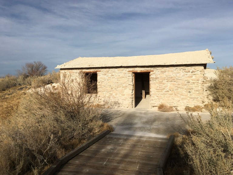
As a side note, the sign at the turnoff said it was 3.4 miles to the cabin. What the sign didn’t say was it was three and a half miles of dirt, gravel and a washboard road. You couldn’t drive more than a few miles an hour or you ran the risk of your car self destructing. I guess if you had a truck or Jeep, the ride wouldn’t be so bad, but Sergio is low to the ground and has those funky low profile tires, making for a very rough ride. Somehow, we survived the trip there and back!
Wednesday, January 17, 2018
Today we start out by going sixteen miles north on 373 to the intersection of 95, to Lathrop Wells, where we visit the Alien Travel Center. We are in extraterrestrial country. Area 51, of infamous repute, is in Lincoln county. Disappointingly, this is just a convenience store with tee shirts and alien souvenirs.


After we check it out, we continue on 95 to Beatty, about thirty plus miles, where we stop and have a second breakfast for lunch at Denny’s in the Stagecoach Casino on theExtraterrestrial Highway, or 375. Denny’s is my last choice for a meal, but they do make a good breakfast, especially if you make your own grand slam.
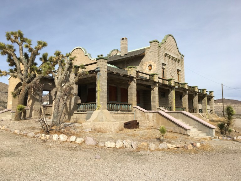
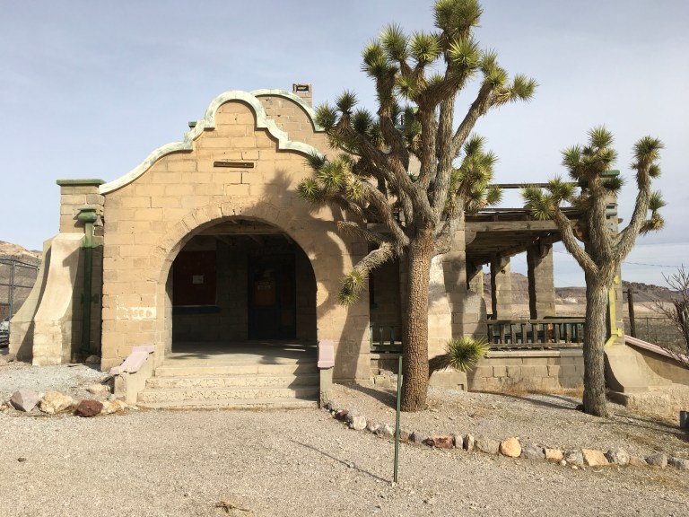
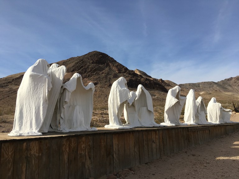
Then we head for our real destination of the day, Rhyolite Ghost Town. This is the largest ghost town near Death Valley. At its peak, between 1905-1911, there were 10,000 people living there. It had two churches, fifty saloons (we see where their priorities were), eighteen stores, two undertakers, nineteen lodging houses, eight doctors, two dentists, a stock exchange and an opera. Many of the old ruins remain, including the Bottle House, the train depot, and the remains of a three story bank and the jail. I fell in love with the train depot. To me, the building was amazing. I would love to restore it.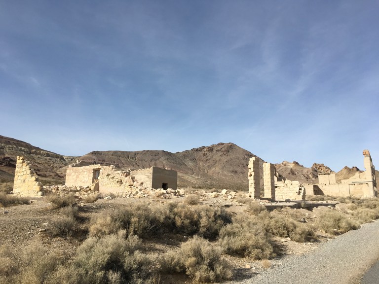

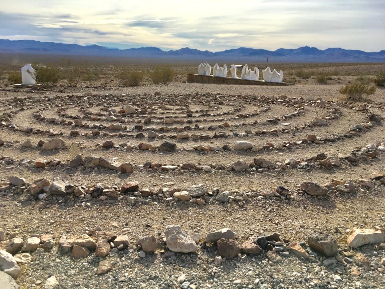
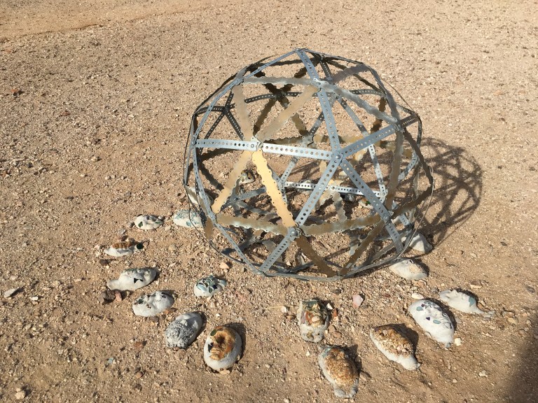
There is a museum a little bit down from the town on the hill. It is an open air museum with sculptures created by various artists. It began in 1984 with Belgian artist Albert Szukalski’s “The Last Supper”, a ghostly interpretation of Christ’s last meal set against Amargosa Valley. The sculpture is plaster coated with fiberglass. Over the years, other pieces were added. There is a circular maze made of stones that I traveled to the center and back out again.


On the way home we spotted some of the wild burros that roam these parts. We parked on the side of the road and I walked into the brush with my camera to see how close I could get before they spooked and ran off. To my surprise, they allowed me to get right up to them. One guy, quite easy to tell he was a male, came right up to me, so close I had to back up to get any shots. He kept nuzzling towards me. I think he was looking for food. 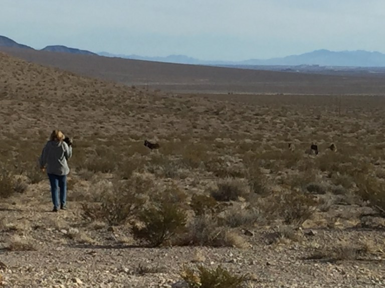
 It’s hard to believe the Federal Government is proposing legislation to have these beautiful animals slaughtered. You can learn more about this at www.WildBurroRescue.org.
Tuesday, January 16, 2018
Death Valley became a national monument in 1933 and a national park in 1994. At 3.4 million acres, twice the size of Delaware, it is the largest national park in the lower forty eight. Death Valley is famous for being the hottest, driest place in the country and the lowest point in all of North America. Badwater Basin in 282 feet below sea level. On the western boundary of the valley is Telescope Peak, at 11,049 feet high, while Dante’s View, at 5,475 feet, is the east boundary. The hottest temperature ever recorded anywhere in the world, 134 degrees, was here in Death Valley at Furnace Creek. Death Valley only receives 1.9 inches of rain annually. While the storms come from the Pacific and roll east, little rain gets to the valley itself. The storms have to cross three separate mountain ranges. Each time the storm reaches a range, it dumps rain or snow on the west side of the mountains. The east side get less precipitation. By the time the storm gets to the third mountain range, there is nothing left for Death Valley.
With 800 miles of road providing access to hiking, camping and sites, a car is essential to getting around the park. Some roads are paved, some are gravel and some you need a four-wheel-drive vehicle with high clearance. Make sure you are gassed up and your vehicle is in good road condition. Gas is only sold at Furnace Creek, Panamint Springs Resort and Stovepipe Village. And don’t count on the location being open, storms can wipe out access to a location at any time. Plus, gas is over four dollars a gallon. There is cheap gas about twenty four miles past the park entrance at Lathrop Wells at the intersection of 373 and 95.
That being said, we head out. First, stop is Furnace Creek where the Visitor Center is located. From the park entrance, it is about thirty miles. We have senior passes, so our entrance fee is free and good for seven days. Without the pass, a vehicle fee is $25, motorcycles are $20, and bicycles or crazy people on foot are $12, for the same seven day period. The Visitor Center also has a museum and gift shop, where we purchased sandwiches for our days adventure.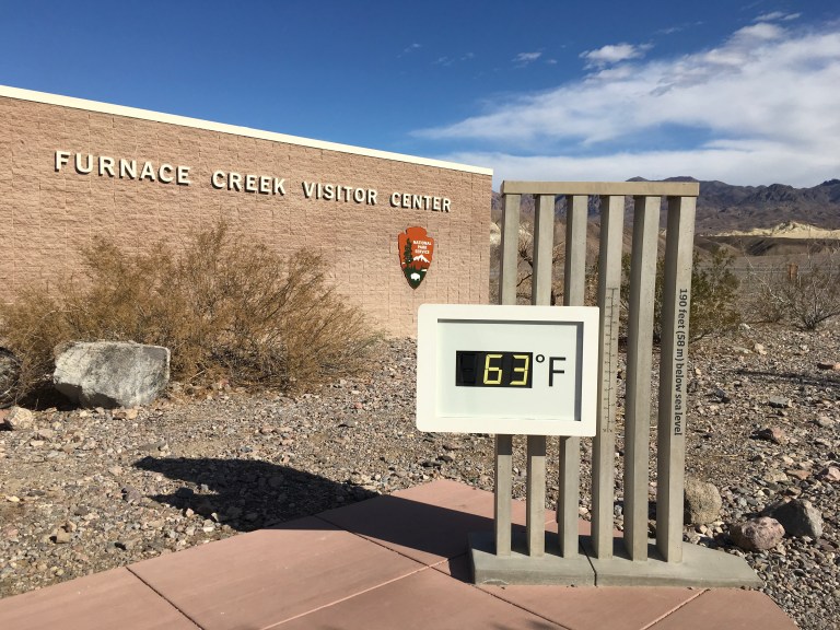
Once we’re finished, we start our drive down to Badwater Basin, the lowest point in North America, 282 feet below sea level. It is also the most distant spot we’re planning on going to today, about seventeen miles from Furnace Creek. Several thousand years ago, the basin was the site of a thirty foot deep lake that evaporated and left a one to five foot layer of salt. Four time saltier than the ocean, the pond reduces to a puddle in the summer heat. With the Black Mountains as a backdrop, you walk along a boardwalk and view the salty projections. You are asked to stay on the boardwalk to protect the tiny Badwater snails that live under the salt crust and feed on algae. A human’s weight can crush them.


We stop at the Natural Bridge, but it’s about a mile up a steep incline. Alex stays behind in the car and I start the hike. The path is a smooth trail, but very steep. The bridge had lots of faults or cracks in it and all I could think of was please don’t come apart while I’m under it. 
 Farther up the trail there is a dry waterfall cut into the rock.
 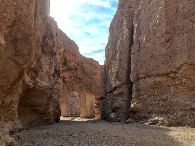 Farther still, the Natural Bridge Canyon narrows and there is a fifteen foot vertical cliff that you may, or may not want to climb. For me, it was a not climb, Alex was waiting in the car long enough.
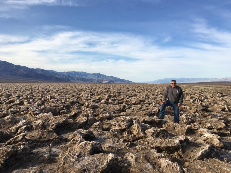
We drive on to Devil’s Golf Course, part of the 200 square miles of salt crusted land. Here, gnarled crystalline salt spires cover the landscape, looking like a giant coral reef. You can walk among these strange shapes, but take care. The surface is uneven and the salt spires can cut you up if you land on one.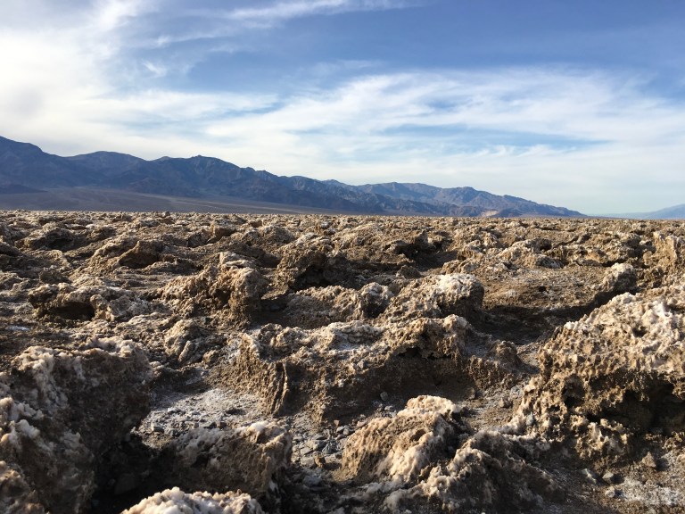

Next it’s on to Artist’s Drive and Artist’s Palette found along the drive. Artist’s Drive is a nine mile dipping, diving, curving, one-way paved road that weaves through ravines and colorful rock formations. Along the way, is Artist’s Palette, where sea green, lemon yellow, periwinkle blue and salmon pink mineral deposits look like they were dapped on the mountain by an artist, hence the name. This is one of the places I want to come back to at sunset. The sun setting makes the colors even more spectacular.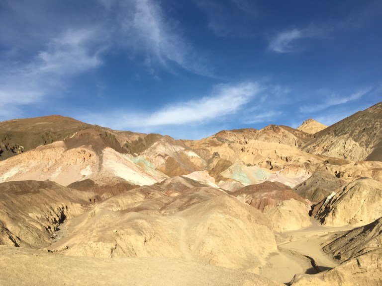
Zabriskie Point, on our way back out of the park, is one of the most popular lookouts, providing breathtaking views of Death Valley. I think the views are better in the morning, when the sun is not so directly in your face. We will be stopping here again earlier in the day.
It’s been a long day and a lot of miles, so us old folk are calling it a day.
Monday, January 15, 2018
We’re off to Death Valley National Park. This has been on my bucket list, so I’m excited.
Once we’re packed up, we head north on I-15. We are planning on stopping in Baker, California, gateway to Death Valley, to check out the world’s largest thermometer and Alien Fresh Jerky. This is where we have to turn off anyway, so it is a bonus.
When we get off the exit, we look for a parking lot for RVs and find one next to a diner, directly in front of the world’s tallest thermometer.  We have a few feet to walk to get to Alien Fresh Jerky. Holy guacamole! This is one wild looking place. The owner got it right. The main items they sell are jerky and hot sauces, common items sold everywhere, but because they put the Alien twist to it, the place is mobbed. They came up with a great gimmick. In addition, you can buy tee shirts, nuts, candy, drinks and souvenirs, all alien themed.


After we make our purchase, we walk next door to Jack in the Box. We’ve never been to one and figured it would be quick, so we could get back on the road. The place was slammed, no place to sit, so we took lunch to go. We ate in the coach, then it was on the road again.
The campground where we are staying for the week, is seven miles from the entrance to the park. Technically, we are staying in Amargosa Valley, Nevada, at Longstreet Casino Inn and RV Park. This is a small hotel and and even smaller casino, with only slots and video poker at the bar, and a small restaurant. Behind the hotel is the RV park with fifty pull through full hook up sites that include cable, all for $149 for the week. Not a bad deal! It’s a gravel lot looking at the mountains. Quite, peaceful and dark.


We setup, and around five, head over to the restaurant. The restaurant advertises a rib eye steak, baked potato, soft drink and slice of pie for $15.95. The rest of the menu consists of sandwiches and appetizers. If you want an alcoholic drink, you have to go to the bar and bring it back. A short walk. Your drinks become a separate check from your meal. Being the beef junky that I am, I had the ribeye and Alex had a meatball sub. Not five star, but no complaints.


Sunday, January 14, 2018
A day of chilling and chores. Tomorrow is moving day.
Saturday, January 13, 2018
Today we’re taking a ride, about thirty miles north of where we are staying, to Afton Canyon, known locally as “The Grand Canyon of the Mojave” for its dramatic geological formations. The area boasts it is “the only place where the Mojave River flows above ground year-round – providing significant riparian (riverbank) wildlife habitat amid the desert.”
When you get off the highway, or the freeway, as it is called on the west coast, you have a few feet of blacktop and then three miles of dirt road to get to the campground. The campground has no services other than a bathroom, with no plumbing, so basically, a nicer porta potty. This is truly wilderness camping. The dirt road is steep at times and has boulders in it, as well as ruts and washboard bumps. I would not recommend a Class A drive on this road. A four wheel drive vehicle would be perfect, but our Sergio made it, although we had to go slow to maneuver around the boulders imbedded in the road. He is low to the ground and we didn’t want any problems in the middle of nowhere.
We stopped at the campground, mainly because the road in front of us, or should I say below us, it was a step decline, was nastier than what we just drove on. The recent storm did a number on it. We wandered around, checking out the area. Everything was extremely dry. The only wildlife we saw was a tiny lizard, and lots of nasty flies, no river. I didn’t think we would see it. Every time we have crossed the Mojave River, it has been bone dry. I think their website needs to be updated to reflect the current climate change.
Friday, January 12, 2018
The Mother Road. The Main Street of America. Will Rogers Highway. Route 66.
Whatever name you choose to call it, it will forever mean the freedom of travel. From Chicago to Los Angeles, all 2,295 miles of it. Early travelers used the Mojave Road and the Santa Fe Trail to make it from one desert stop to the next while migrating to California. The sand, rocks and unimproved land led to repairs and delays, and sometimes broken dreams. When the railroad arrived in the 1800’s, they could follow the rail line across the country. They forged this ragtag route into the National Old Trails Road. In November of 1926, the Federal Government created the numbered highway system and the National Old Road was reborn as Route 66. This stretch of Route 66 near Barstow in the Mojave Desert was the most difficult to complete and was the last to be paved.
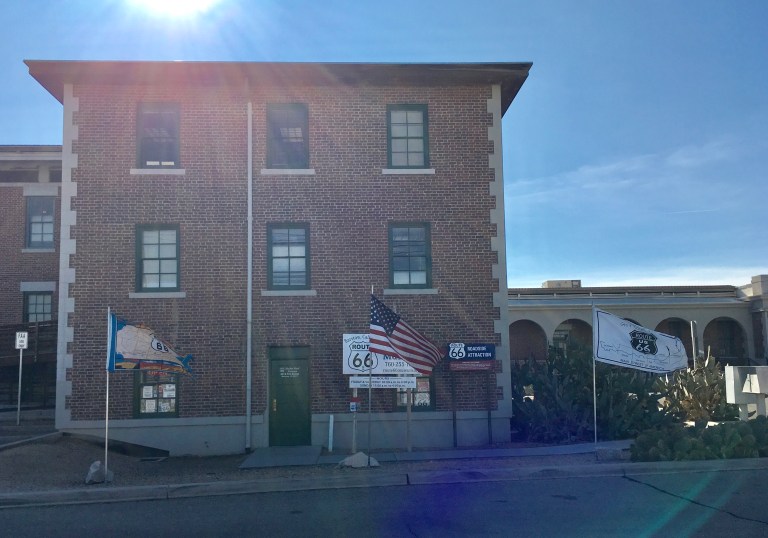
We’re off to learn more about this American icon at the Route 66 Mother Road Museum in Barstow. The museum is housed in Casa del Desierto, also know as the Historic Harvey House, named after Fred Harvey, a restaurateur and railroad man. This magnificent old building, now on the National Register of Historic Places and the California Register of Historic Landmarks, was once the Barstow railway station and hotel. It now houses the Route 66 Museum, the Western America Railroad Museum, government offices and a NASA exhibition.
 The minute you open the door, you are back in time. There are collections of photos and artifacts, exhibits of the road’s development, automotive history, and a look at the old businesses that once thrived along the highway. There is just so much to see and learn.
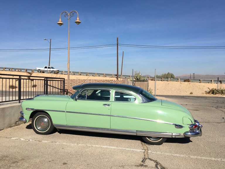


The gift shop has more Route 66 things than you can imagine.
When we left, we walked to the back of the building and found the railroad tracks. Trains were coming and going.  We found the entrance to the main part of the building and found ourselves in what once was the rail station and hotel entrance. As you stepped inside, your breath was taken away. This place is gorgeous! The light fixtures were works of art as were the air vents. Simply beautiful!
 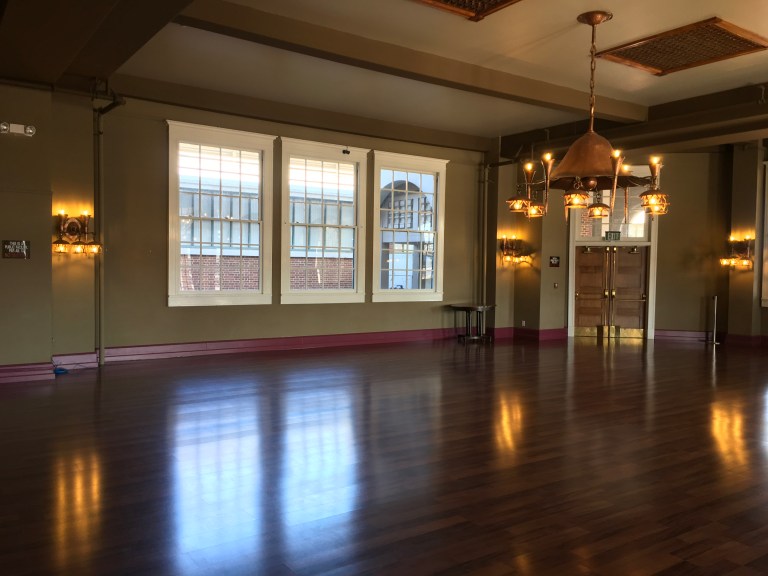 Upstairs, we wandered through the NASA exhibit and learned about out planets, the telescopes we’ve put in space and the various space crafts and probes we have sent out to explore our vast universe.
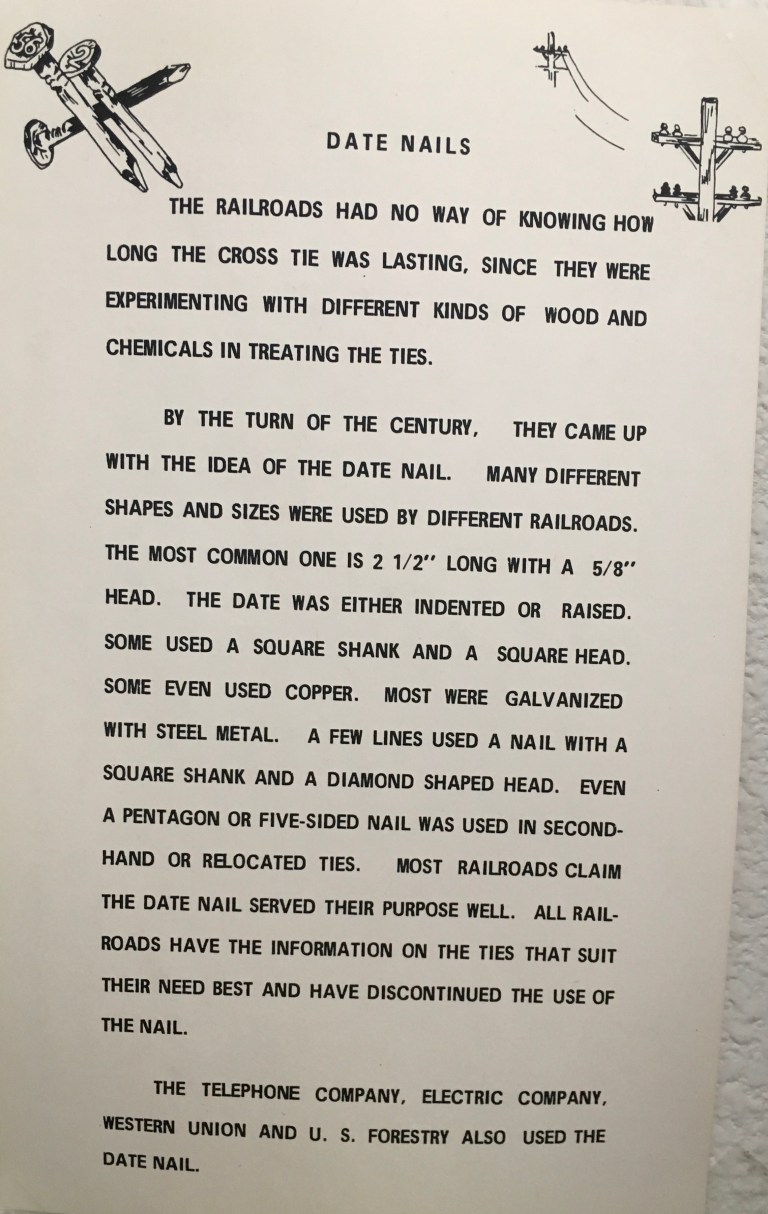
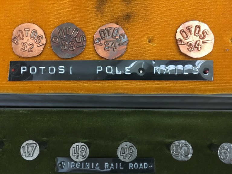
Continuing to another section of the building, we came upon the Western America Railroad Museum, nothing like the museum in Old Sacramento, but it had many other interesting things. My two favorites were the date nail room, and the model train layout, of course.
To know the life expectancy of railroad ties that were installed, the railroad came up with a system of nails that were put into a railroad tie indicating the date. The date nails came in all sizes, shapes and metals. They had one entire room filled with different date nails.
Their model train layout beat the layout in Old Sacramento hands down. It was so detailed and real. I would swear the mountains were made of real rock. They don’t let you touch, so I’ll never know. Their switching yard would make any train aficionado weep. I stood on a step stool so I could get better pictures for my future train layout.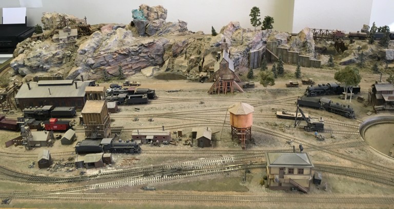


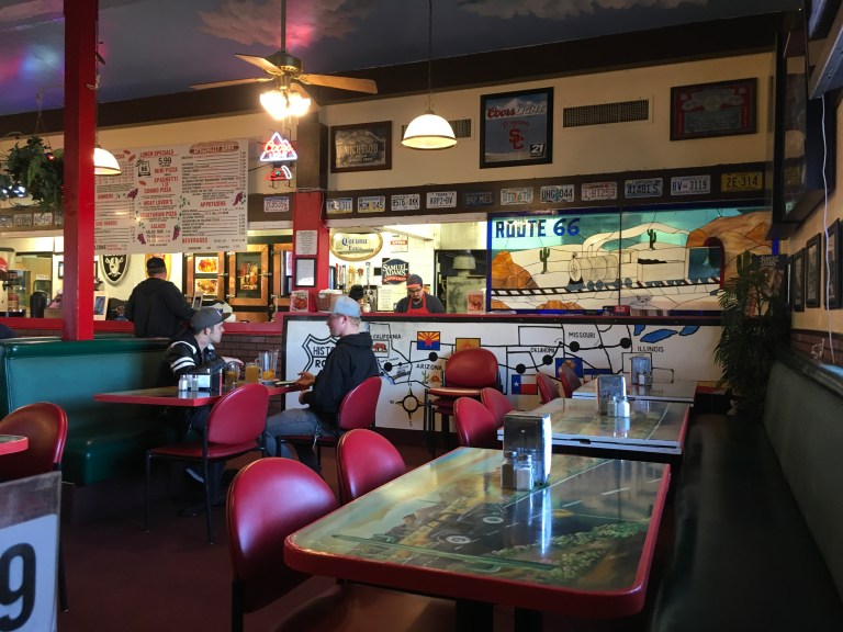
When all was said and done, we were hungry. It was mid afternoon. We drove down Route 66 to the Pizza Palace and had their lunch special, all the salad you could eat at the salad bar, and what a salad bar, a personal pan pizza with one topping, and a twenty ounce drink, for $8.99. Alex upgraded his drink to a half pitcher of beer for $8.99. 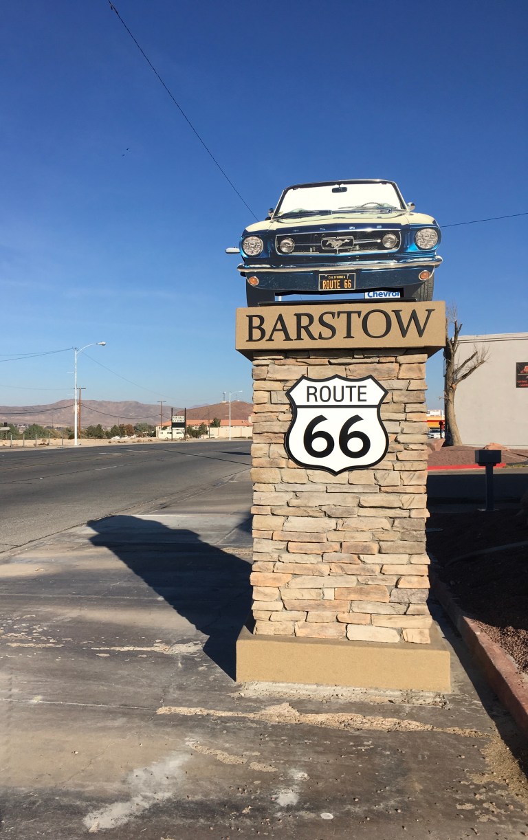

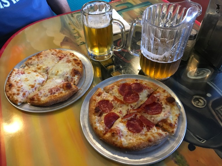
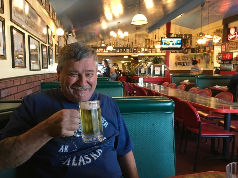 This was the best pizza we had in a long time! I want more! When we were finished eating, I wattled out to the car while Alex sloshed out behind me, and we went home to digest.
Thursday, January 11, 2018
A home day today. Alex is working on cleaning and protecting Claudia’s tires and I’m getting stuff down around the house. Later in the afternoon, I take a walk around the campground to see what there is to offer.


Wednesday, January 10, 2018
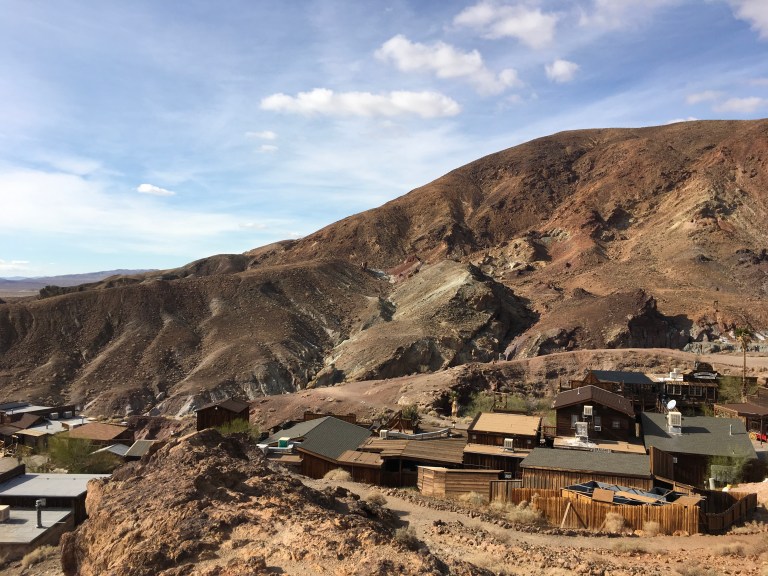
From our campground, you can see the word Calico in white letters up on the mountain. This is where the Calico Ghost Town sits. One hundred thirty one years ago, it was one of the richest silver mining districts in California. It produced $86 million in silver, $45 million in borax and had a population of 1,200 with twenty two saloons, a Chinatown and, of course, a red light district. When the price of silver dropped, Calico became a ghost town. It is one of a few original mining towns left, thanks to Walter Knott, founder of California’s Knott’s Berry Farm. He bought the land and restored the town, then, in 1966, donated it to San Bernardino County, which operates it as a County Park. There is a campground a short way down from the town. Staying there gives you free access to the town, otherwise admission is $8.
We are not staying at the campground, we are at the KOA, so we take the three mile drive up the mountain to the town, pay our admission, then park. The town is built into the mountain. 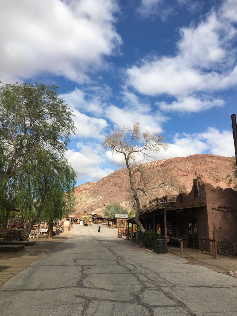 As you walk, you go farther and farther up. The farther you go, the windier it gets. At the top of Lookout Point, the wind was so strong my eyes were running like faucets and it took two hands to keep my iPad from flying away, not to mention me.
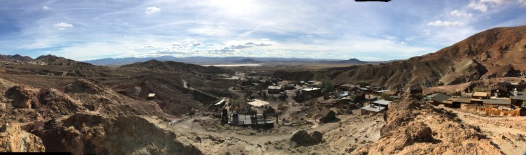
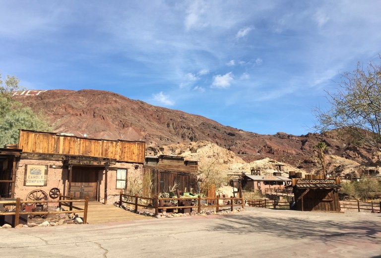
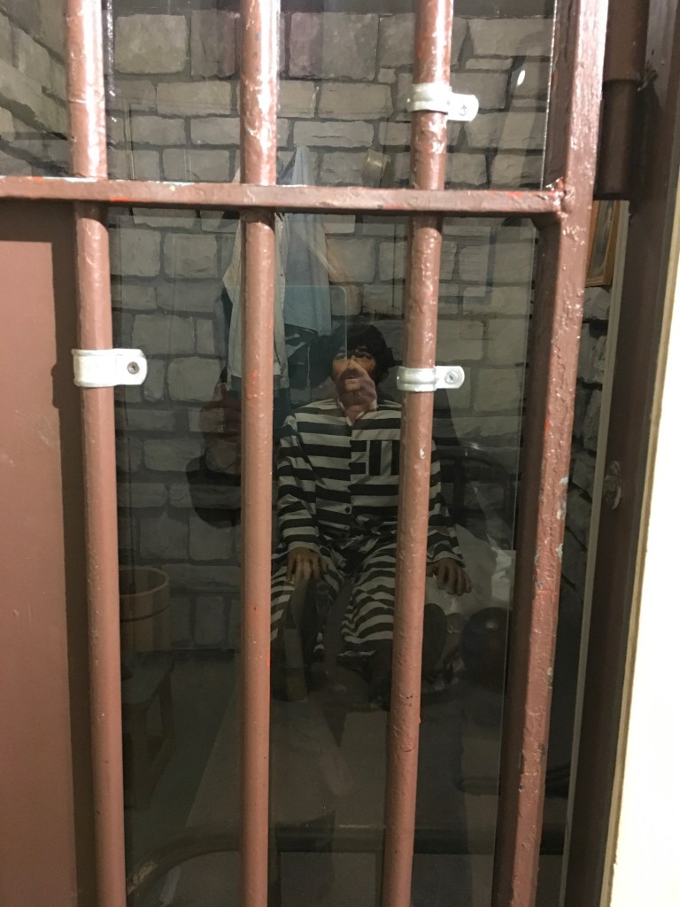
The town has a main street with buildings that now house shops or replicas of businesses that would have been there way back when, like a blacksmith, a marshal office and jail. 


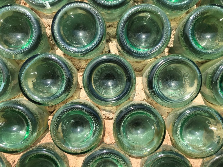
 There are a few side streets with interesting buildings. One was the Other Side, made of glass bottles.
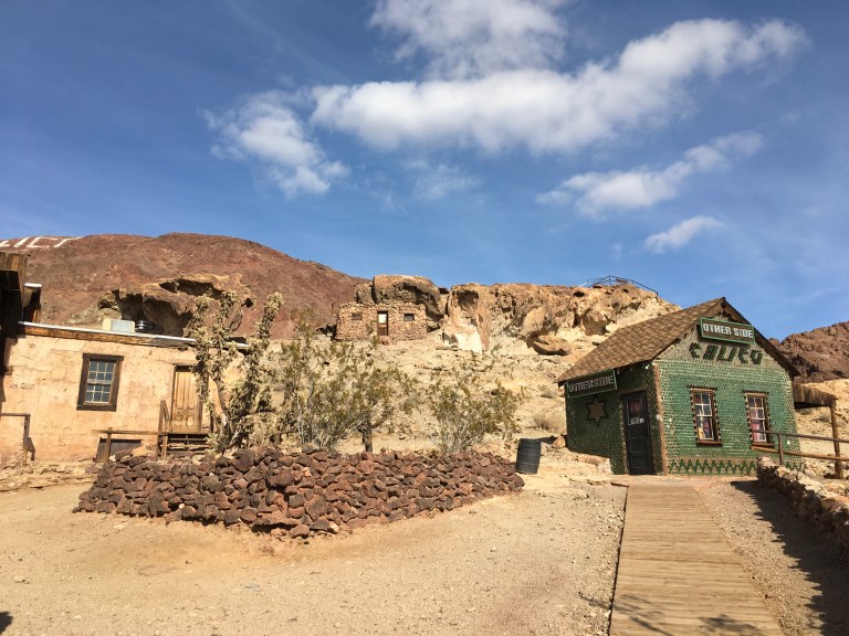
 Besides the stores, there are three restaurants, serving anything from sandwiches to a full meal. We ate at the Calico House Restaurant. The drinks, alcoholic or not, are all thirty two ounces.
 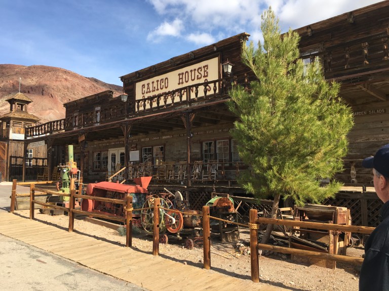 You can pan for gold or go into the mine or explore the Mystery Shack. You can take a ride on the train or learn about them in the Railroad Museum. Then there is the Calico Cemetery, their local Boot Hill.
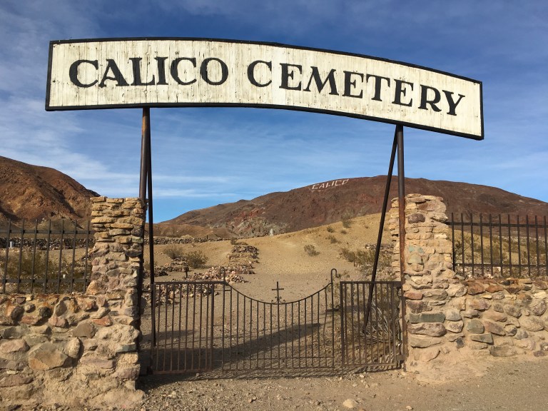
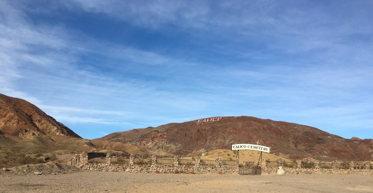 There are a few modern headstones, but most of the graves no longer have any identifying marker. Time and mother nature have destroyed the wooden head stone.
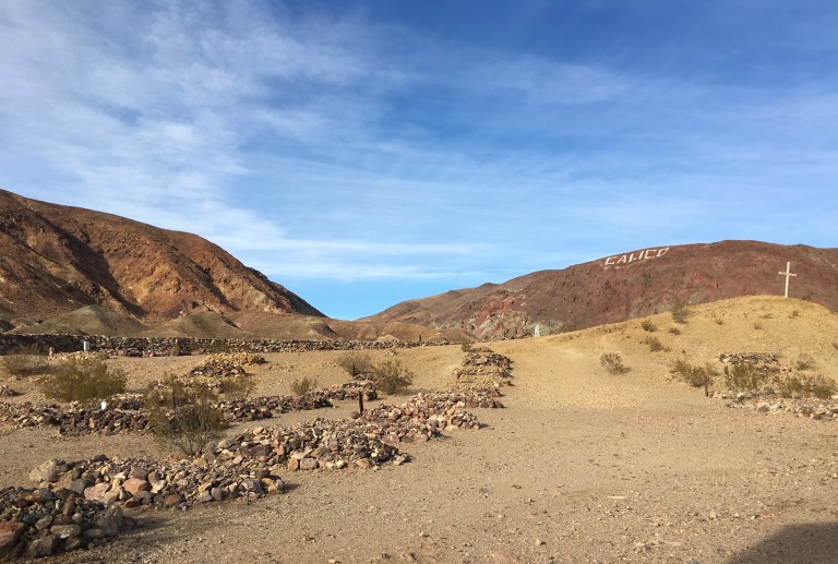
 The few that remain no longer reveal who lies beneath. All that is left are the pile of rocks marking the final resting place of the town’s first citizens.
Tuesday, January 9, 2018
Alex has still been struggling with his kidney stone. He gets bouts of pain, then seems to pass the stone, only to have the cycle start again. This is how it has been going for the last four days, but today, he called me into the bathroom. The scene in the toilet had tiny stones, but also specks of blood, so off to Barstow Community Hospital, we go.
The second the door to Emergency opened, we were greeted with the overpowering smell of urine. A homeless man, by the name of Stanley, who turns out to be someone who frequents the ER, was taking up residence. He was the source of the stench. The general consensus was the storm last night chased him into the hospital. Can’t say I blame him for finding someplace dry. An inch or so of rain yesterday, caused Armageddon, with floods and mudslides. Anyway, Stanley has issues, to say the least. He was cussing and fighting with everyone at the top of his lungs. Turns out Jesus was Stanley’s son, and Stanley was in charge of the hospital. When the police came, we were all moved into another waiting area while they took poor Stanley out to the car to take home to a mental health facility.
Three hours later, and blood work, scans and whatever else, we find, yes indeed, Alex has multiple stones in his kidney. They give him a prescription for pain meds and Flomax, to help open up the plumbing. My only complaint about the hospital was lack of privacy. Any conversation was in a hall or waiting room. His discharge conversation was in a small room with two other patients, within arms length, listening and commenting. So much for HIPAA laws!
We make a quick stop a Walmart, to get Alex’s prescriptions filled, and get him cranberry juice and decaf coffee. Caffeine is now the enemy. Then it’s time to take my poor baby home to rest!
Monday, January 8, 2018
We say goodbye to Bakersfield today. I can’t say I’m sorry to go. The area is depressing, the air is oppressive and the noise of the trains and road don’t make for good sleep. If we had a site that was on the other end of the campground, the road noise might not be so bad, but that wasn’t the case.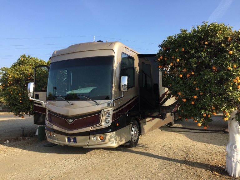
We are packed up and out of the campground by eight thirty. The first winter storm of the season is heading for us. The high winds and rain are due around noon, and since it is coming from the west, we want to put us as far east as possible, as fast as possible. As we get on 58 eastbound, we notice the sides of the road are littered with trash and blown out tires, adding to the impoverished look of the area. We are headed for “the pass”. I put “the pass” in quotes because it is the nemesis of travel. Weather in the valley is one thing, but weather in “the pass” is another. We have been in valleys making our way south, so by nature, to be in a valley, there must be mountains. To get to the other side of the mountain, you have to go through the “pass”, the road that you travel up and through the mountain. The “pass” we are traveling through is only one of many in California. They are carved into the mountains at different places up and down the west coast allowing for east-west travel. The high elevation turns moisture to snow or ice, and the craved out section of the mountain pushes the winds, intensifying them to dangerous levels. They are calling for eighty mile an hour winds through “the pass”, so you can see why we are trying to beat feet out of here.
It’s one hundred thirty miles to our campground, almost all of it on 58. The scenery is arid, with dried sage brush everywhere. The high winds will pull some of them out of the ground and turn them into the tumbleweeds that we see crossing our path along the highway. There are rolling hills of gold, with houses on the top, looking like tiny Monopoly board pieces. We are ahead of the storm, so our journey has only had a few gusts that move the coach as we drive. Looks like we will beat the storm. We enter the Mojave Desert and drive past Edwards Air Force Base on our way to the Barstow area, our last stop in California for now.
We get on I-15 to take us the last leg to Yermo, where the KOA is that will be our home for the next week. Yermo is about eight miles north of Barstow. Even though it is around eleven, when we get to our exit, we’re both hungry and we have been seeing signs for Peggy Sue’s 50’s Dinner along the way, so we decide to eat before going to the campground. Technically, we are a few hours early for check in, so this spot will feed our bellies and kill some time.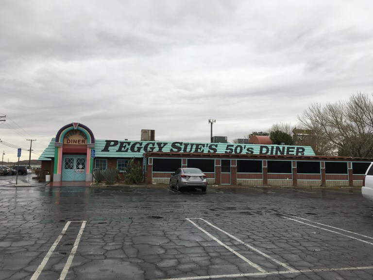

We park and walk to the entrance. The sign on the door says, if the door is unlocked, then they are open. They are open. As soon as we open the door, we are cast back in time. There is 50’s music playing and everywhere there are pictures and memorabilia from that time. My apologies to the children of the millennium, but, in the history of mankind, there was no better time to grow up, then the fifties and sixties. Music, food, and freedom! No internet, social media, and no video games. If someone bullied you, it was to your face, and pretty much resolved then and there. We designed our own games, ate and drank whatever we wanted, and wandered free! We grew up strong, creative, social and well rounded!
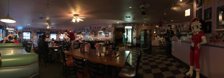
We took a booth in the Lucy section, right under a picture of her infamous Vitameatavegamin scene. Joining Lucy on the walls were the characters from the Wizard of Oz, Laurel and Hardy, May West, the Blues Brothers, Elvis, and James Dean, to name a few. 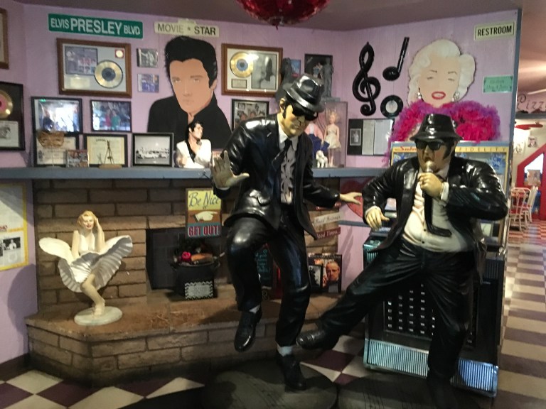 The waitress tells us the dinner has been in business for thirty years. I can see why. The food was good and the atmosphere was great. Alex had a second breakfast of an omelette and I had the Patty Page, a burger with two different cheeses on toasted rye. All the items on the menu had 50’s related names.
 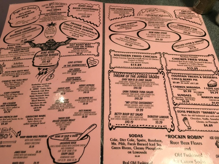 They have an ice cream parlor and a pizza parlor in the back section of the building and beyond that, is the dinosaur park. Being pizza junkies, we will have to give it a try!
Sunday, January 7, 2018
I’m making pizzelles for the first time in the coach. This is usually a holiday thing, but somehow I didn’t think of it this year. Now I’m jonesing for them, so here we go.
It’s day three of Alex and his kidney issue. He gets better only to have the wave of pain return. Poor baby!
Saturday, January 6, 2018
One of my biggest gripes about living in an RV is the kitchen. Anyone who knows me personally, or has ever been to any house I’ve owned, knows, I have always had a kitchen with plenty of storage and counter space and plenty of toys. Not so in an RV. I have learned how to work around the counter space, as long as no one gets in the way, but storage is another issue. Whoever designs RV space has never spent any real time living in an RV and certainly has never cooked in one. I have tried to understand the logic. Do they think everyone eats out three meals a day, or cooks outside, or maybe they don’t realize people DO like to cook? Anyway, my current kitchen has been a challenge that keeps me up at night.
When we set out on our journey, our world was chaos. We were packing up things for storage, or selling things, or putting things into the coach, all while I was still working. Our first priority was getting things into storage, then getting rid of things, then getting stuff into the coach. Needless to say, organizing the coach fell to the bottom of the list and then time ran out, the house was sold and we were full timers. And we have been living with stuff here and stuff there. Groceries are stored in five different places, making knowing what you have a fun job!
So today is the day! I devised a plan and I am finally reorganizing the kitchen cabinets!
While Alex is busy trying to give birth to a kidney stone, I pull everything out of every cabinet. I’ve measured the cabinets over the dining table and found pull out drawers that can work. This is going to become my new pantry, since the “panty” Fleetwood gives me is really just a cave that requires you to empty the contents to find anything. When we get to our next stop, I can order the drawers through Amazon Prime. With two day shipping, Amazon Prime is such a wonderful thing for RVers. My goal is to put all the groceries in one spot, all my small appliances in another and all the bigger household items, like a salad bowl and pasta pots and other things in another.
After several hours and much gnashing of teeth, I arrive at the new normal for the kitchen cabinets. It’s not perfect, by any means, but it is much better. I had to sacrifice the middle cabinets of my new pantry to a few of the bigger household items, but I think I can make it work. It will get adjusted again when I can get the drawers, hopefully, next week, but there are quite a few things we want to see on our next stop, so I have a feeling this might take awhile. The wonderful “pantry” Fleetwood has given me, once again proves useless. It is too narrow to hold anything of worth and forces me to make compromises and waste space. RV manufacturers get with the program!!
Well, this is a work in progress! Now if I can only remember where I put everything!
Friday, January 5, 2018
Alex was outside with Rick this morning when a kidney stone attack happened. That put an end to his fun! He was down for the rest of the day. So Rick and I took a ride to the Walmart Neighborhood Store. He was getting a cold and wanted Airborne and I needed a few things to make pizzelles. No need to unhitch his car when ours was free to travel.
On our way home, Rick and I stopped at California Fruit Depot, a family owned farm that sells and ships all different kinds of oranges, dates, nuts, vegetables, olives, honey, jams and jellies, snack and trail mixes, and dried fruits. This place is so close to where we are staying, that, if there was a hole in our campground’s back fence, you could walk to this place with ease. Without the hole, you could still walk, but you would have to go around the perimeter of the campground to get there, about a half a mile or so. Driving is easier, especially if you plan on buying anything. I purchased a few different nuts, and peanut pretzels and licorice for Alex. There is just too much to choose from. The woman at the checkout gave me some Cara Cara oranges with my purchase. One of my favorite! Yum!
Thursday, January 4, 2018
Our friend, Rick, who we met at Purgatory West in Coburg, is coming into our campground today on his way home to Oregon. He is the person who told us about this orange grove campground. Once he arrives, we spend the afternoon and dinner in conversation. Always nice to find friends on the road and spend some time together.
Wednesday, January 3, 2018
We are going to downtown Bakersfield to check out a few sites and a western store. But first we drive over to the local Post Office. If things looked dismal before, this area makes things look worse. First, we discovered the source of the train whistles we hear all through the night, and I mean ALL through the night. Second, we see some of the industry and businesses along the road. They look like they are one dollar away from closing up for good.
We get on 58 to head to the heart of Bakersfield and exit on Chester Avenue. There aren’t many things to see here. The Buena Vista Museum of Natural Science is only open on weekends. There are a few parks and kid recreation areas. There is a casino and a few local theaters, but the top ten list of things to see are snapshot moments, as their visitor guide says. And they are, drumroll please, the Bakersfield Arch, Beale Memorial Clock Tower, Mill Creek Covered Bridge, Guthrie’s Alley Cat Sign(think red light district), The Big Shoe, Kern Veterans Memorial, Mill House, Woolworth’s, Kern Row, and Ethel’s Old Corral. You can cover them in a day.
We drive to The Big Shoe, an actual shoe repair shop inside a giant shoe, and take a quick picture.  We couldn’t find Beale Memorial Clock Tower, so we drove past the Woolworth store to see the old sign, then went to the western store. I’m sorry to say, downtown did look much better. This place is too depressing, so after the western store we head home.
Tuesday, January 2, 2018
We’re almost out of milk and Rose’s Lime Juice for Alex’s Gimlets, among other things, so we need to go shopping. This will be our first venture into Bakersfield. The smog warning today is extremely high. Cough!
First stop, a Super Walmart about eight miles from the campground, jammed pack with people and crazy drivers. The area is not a nice looking neighborhood. Homeless camps are all over. My city kid instincts kick in. While loading our groceries, we are approached by a panhandler looking for money. Next up, Kroger’s which turns out to be Foods Co., a subsidiary of The Kroger Company. This neighborhood is not much better.
The people, the buildings, the roads, everything looks like it is in sorry need. Add in the smog and the world looks bleak and gray. Not loving Bakersfield!
Monday, January 1, 2018
Today we are spending the day working on the plan to get from here to Arizona. Arizona, like Florida in winter, gets booked up with snowbirds, which, I guess, we have become. The game plan is to spend a few months in Arizona, hiding from the cold and annoying our friend Barry. So, being New Years Day, with nothing much open, we figured this would be a good way to spend our time.
It took our two brains working one whole day to get us booked all the way to Arizona and get doctor appointments scheduled, as well. What a chore to find campgrounds for a decent price that weren’t dumps or have a million and one rules. There is a brand new one in Chandler, Arizona, called the MotorCoach Resort, that claims to be a resort for $65 a night, or $1150 a month. It has more spacious sites, but little else. It is completely open with some native vegetation. No pool, no spa, no fitness center, no cable, right next to I-10 and across from a motor racetrack. I’m sorry, how is that a resort? I haven’t been there, but I plan to check it out when we are there just to see what would command that price.
Sunday, December 31, 2017
Today we move to Bakersfield, California, 233 miles south and a bit east. This is a long drive by our standards. It doesn’t sound like much, but California law has us driving at a maximum speed of fifty five miles an hour. If you are a truck, with three or more axles, or you are towing anything, your max speed is fifty five, so this will take awhile.
As we drive south, we are greeted by California’s infamous smog. The very pale sun is hiding behind layers of apocalyptic haze. This looks like a sci-fi movie after the big one drops. Forget breathing, you can eat the air. My allergies are not happy. It doesn’t take long for my eyes to start weeping, my nose to start running and, for me to sneeze and cough more than I usually do. Ugh!
As we drive, we take notice of the scenery. Arid, bone dry, like the land could burst into flames with just hot breath, and tent cities everywhere. America seems to have become the land of the free and the home to the homeless. You see people living on the streets everywhere in America. No city, no countryside is without their share of destitute people, but I don’t think I have ever seen a greater concentration, than I have here on our west coast. And Bakersfield seems to have a bumper crop. People are camped everywhere. Their shopping carts are parked next to their tent or tarp lean-to. Between the smog and the tent cities, this really does look like a post-apocalyptic world.
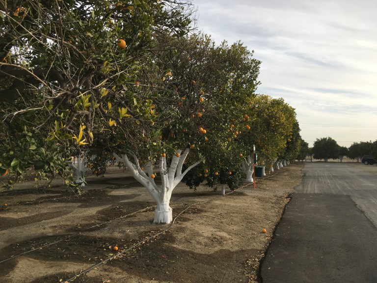
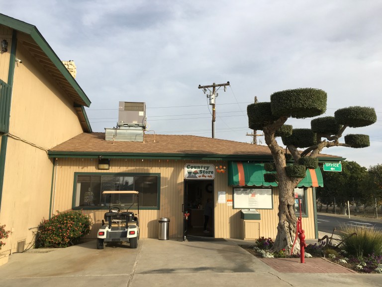
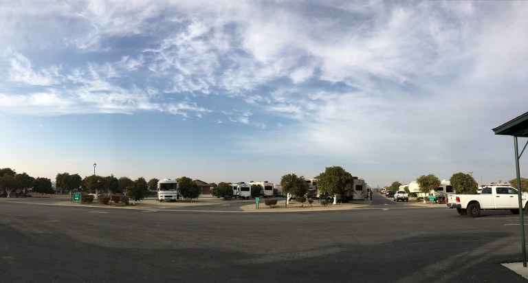
We arrive at Orange Grove RV Park in Bakersfield, a short distance from 58. Just as the name suggests, we are in the middle of a huge orange grove. All but a few spaces are pull through, and large enough to keep your dingy attached, if this is just a one night stop over. The sites are the usual width, gravel, which, in California means dusty, and you have a picnic table. Oh, did I mention you have three orange trees on each side of your coach and you can pick as many oranges as you like. If you don’t like these oranges, you can wander in the grove and find ones you do like. Since this is considered a resort, in addition to water, sewer and electric, you have cable, wi-fi, showers, laundry, a pool, fitness center, a meeting room that can be reserved for gatherings, and you can wash your coach or car at the RV wash for no cost. It is forty five dollars a night, but the weekly rate isn’t bad, $265. There is one section that is for monthly stays. We didn’t inquire as to the extended rate.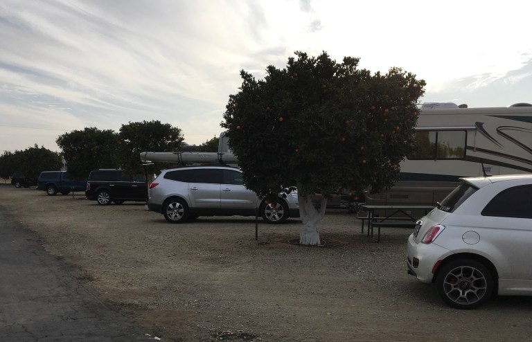
It’s New Years Eve and we have three fifth wheels across from us that are all friends partying for the holiday. The place is pretty well packed so Happy New Year, everyone! I hope it brings the world peace! ☮️
Saturday, December 30, 2017
Day two of taking a break. We are starting a Route 66 jigsaw puzzle that we got in Oroville at the store Bird in Hand where the Yo-Yo Museum is housed.
Friday, December 29, 2017
Today is a chilling day. There isn’t much more of interest for us here so we’re taking the day off. Time for some catching up on paperwork and The Man in the High Castle on Amazon Prime.
Thursday, December 28, 2017
We are going to The Fruit Bowl today. Opened in 1947, The Fruit Bowl offers local produce, baked goods, nuts, jams, local honey and olive oils, and Lodi wines. They advertise being “a great place to stop for lunch and enjoy our lawn and shade trees or pick up the perfect imported Italian ingredients to stock your pantry shelves.” So off we go!
We drive the thirteen miles to The Fruit Bowl only to find they are closed till April. That’s not what their web site says! The guy working on the property apologized and said he would get his web site updated. Oh, well!
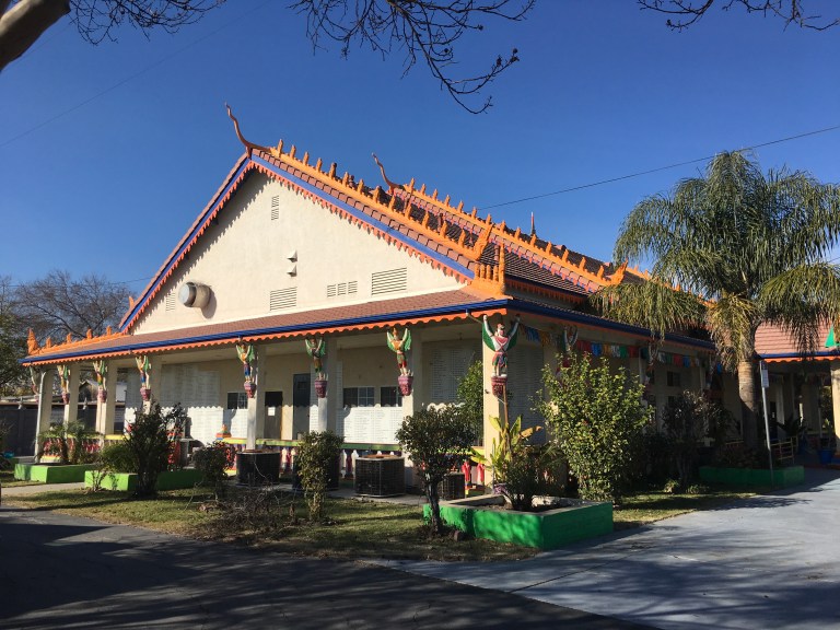
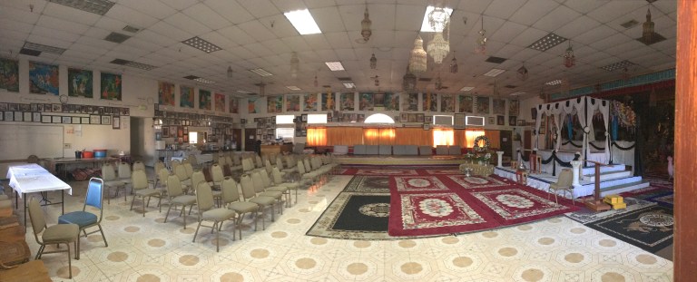
We decide to drive to Wat Dhammararam Buddhist Temple. When we get there, it looks closed as well, but we find an open gate and go in. The grounds are extensive. We didn’t know what to expect. Their web site wasn’t too informative. They have a building that serves as a temple, no shoes allowed, and giant statues all along the grounds. Unfortunately, everything is written in their native language, no English anywhere. So, while we could admire the statues, we had no context as to who or what they represented. 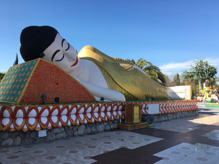
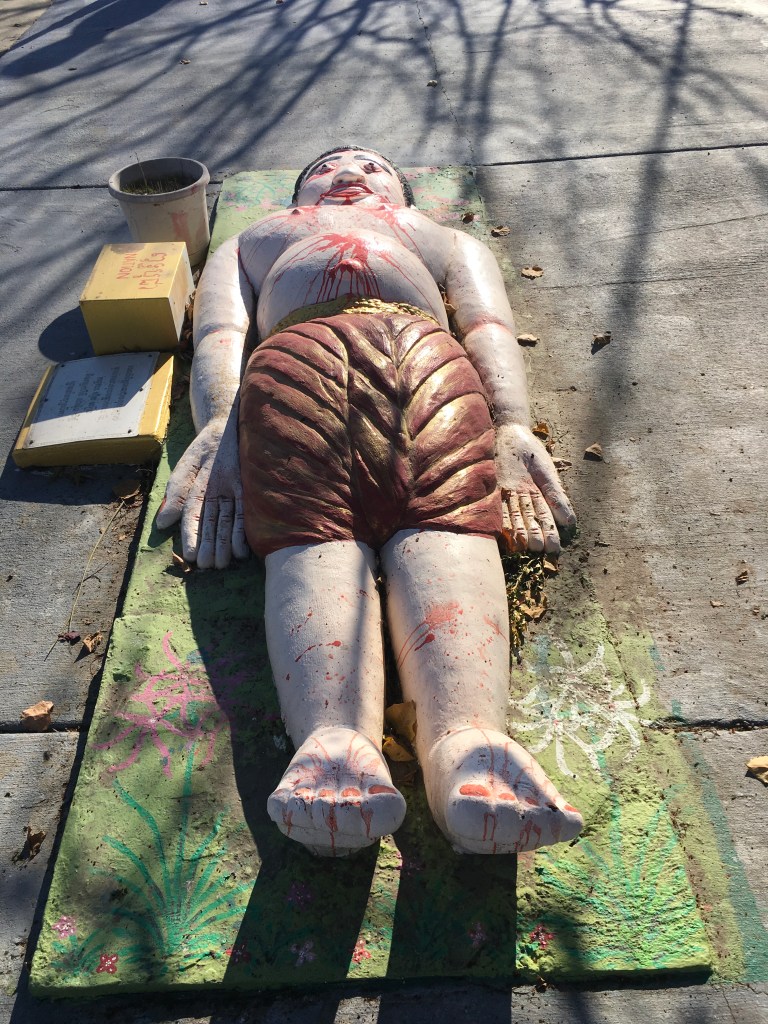
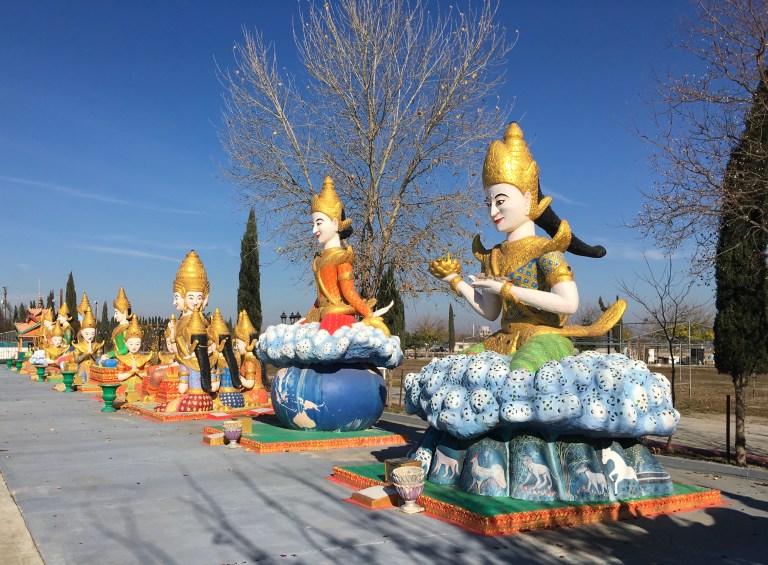 One thing I found interesting was, the statues had real jewelry imbedded in the sculptures, as if they were really wearing it.
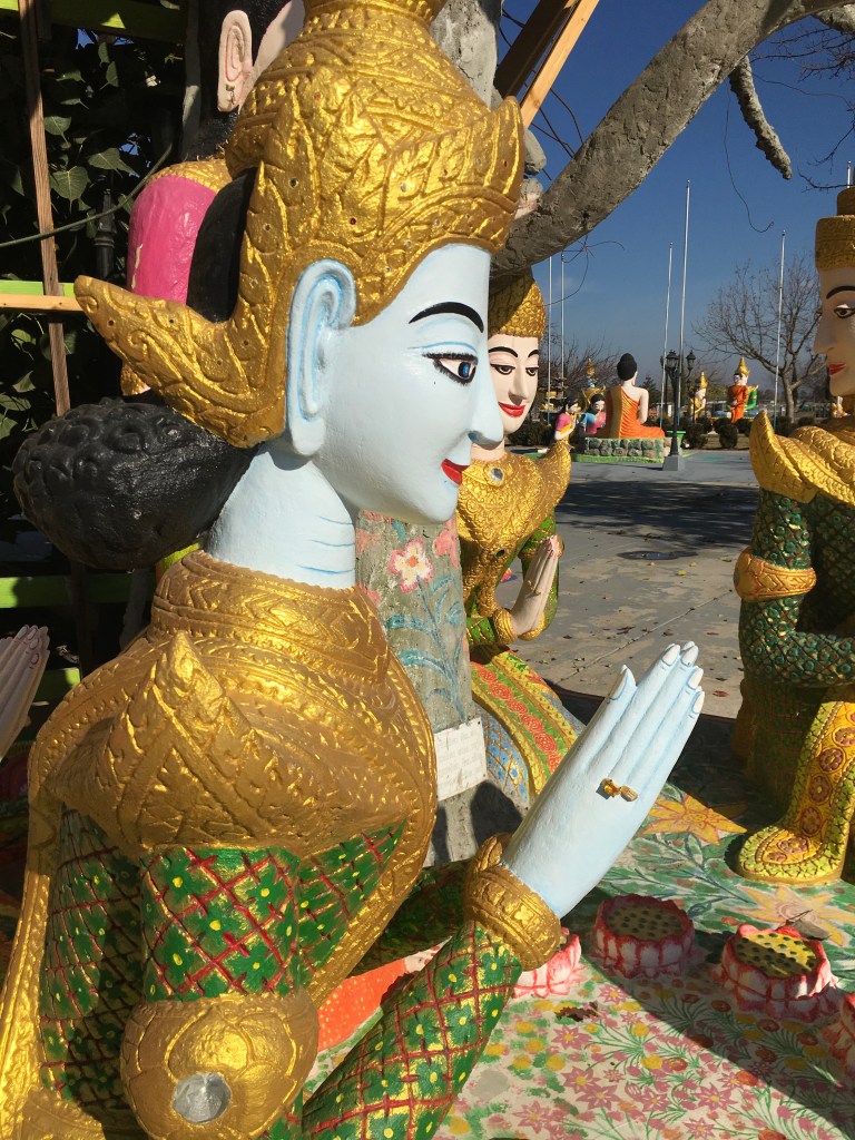
We head back to the campground and stop at French Camp Sports Bar & Grill for lunch. This is a small bar on the campground premises. 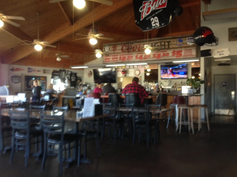 We had chicken salads, beer and wine. We’ll be back for burgers!
Wednesday, December 27, 2017
We’re heading sixty mile south to Manteca, California and French Camp RV Resort, right off 99. The 196 site park is a little south of Stockton. A typical park with the usual, plus an outdoor pool and indoor fitness center.
Once we get to the park and setup, we have lunch and decide to just continue to binge watch The Man in the High Caste. I’ve been fighting the onset of a sinus infection, so relaxing feels real good to me.
Tuesday, December 26, 2017
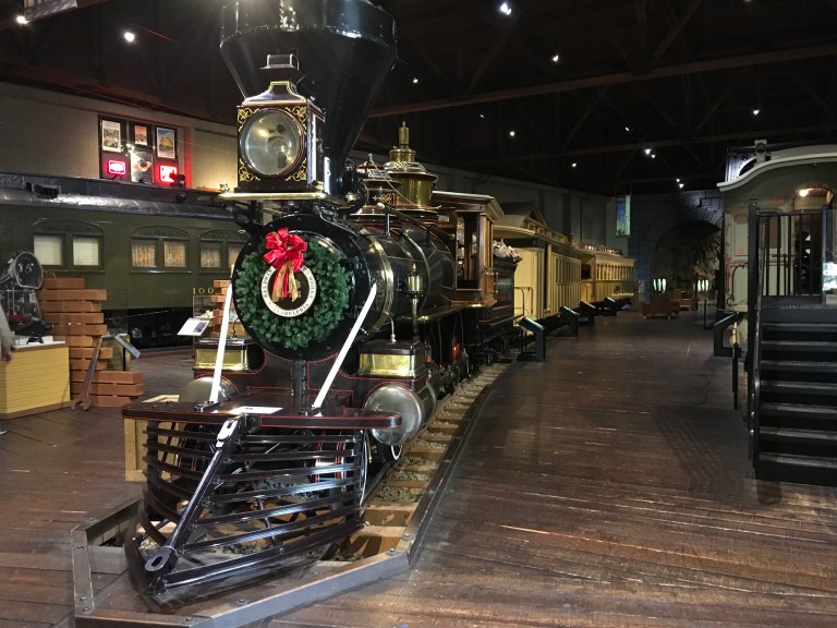
We’re going back to the California State Railroad Museum in Old Sacramento to see the things we didn’t get to the other day because we ran out of time when the museum closed.
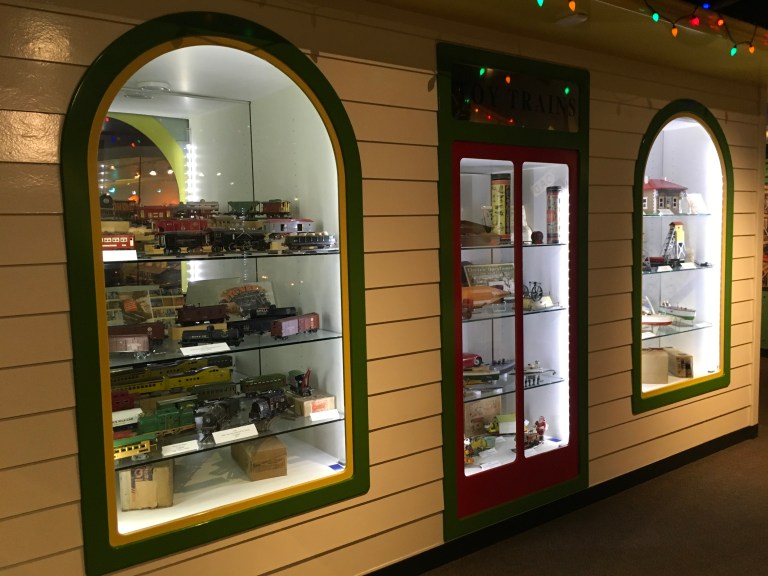
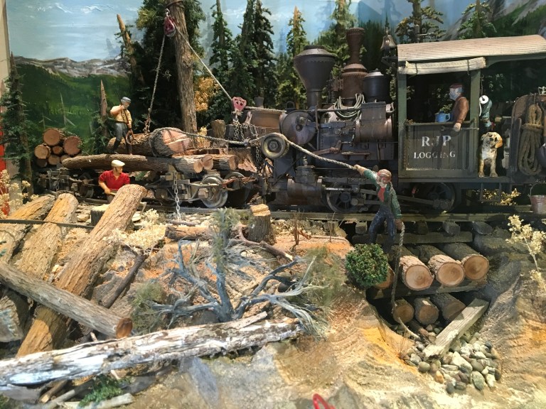
We opted not to park in the parking garage for $10, but look for parking on the street, since the museum was the only thing we were coming to see. We got lucky, a metered spot in front of the building. You would think that was a good sign, but no, the place was packed. We had to wait in line to get in. We headed straight to the third floor to see the toy train gallery. A complete history of toy trains! From G to Z gauge. My father would have been in his glory! I would not have been able to tear him away if he were with us. It brought back good memories of my dad and I working on his train city that filled his entire basement.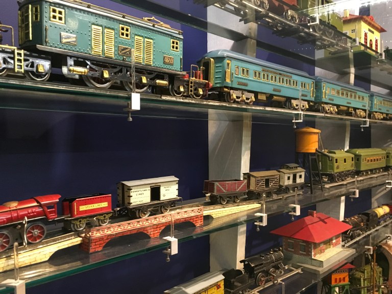


This floor also has the history of the railroad’s push west and how it was a major factor in President Lincoln’s 1860 election. I never realized it was also a factor in the debate over slavery until I read about it here. The federal government wanted the railroad to only go through non-slave states, a major factor in California becoming a slave free state when it entered the Union in 1850. He believed the railroad necessary to unite the country. It was interesting to learn Lincoln only received forty percent of the popular vote in a four candidate race. He won the electoral vote, but never got one vote from any of nine Southern states. A few weeks after Lincoln took office, the Civil War began and eleven southern states seceded. After the war, the push was on to complete the transcontinental railroad. A private presidential railroad car was built for him. He thought it too ornate. Sadly, he never got the chance to ride in it, as he was killed. The only ride he took in the car was when his body was placed in the car to carry him home for burial.
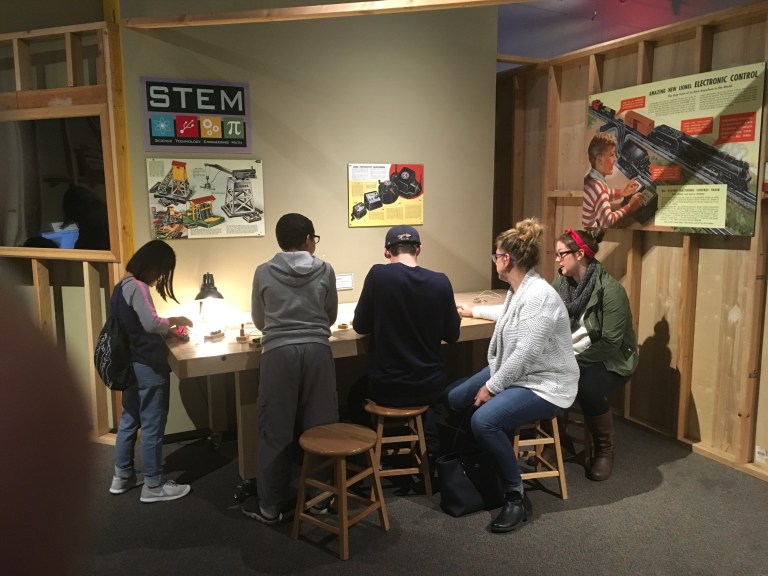
We went to the second floor, which is dubbed the technology floor, and watched a movie on the history of trains in California and their relationship to the railroad in the rest of the country. This floor also allows kids to work on STEM technology projects, engineer a train in a simulator and other fun, educational things.
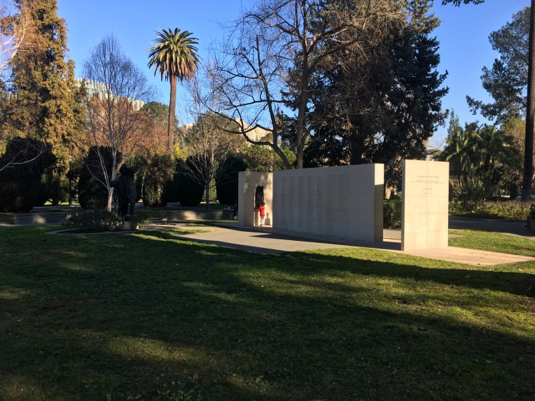
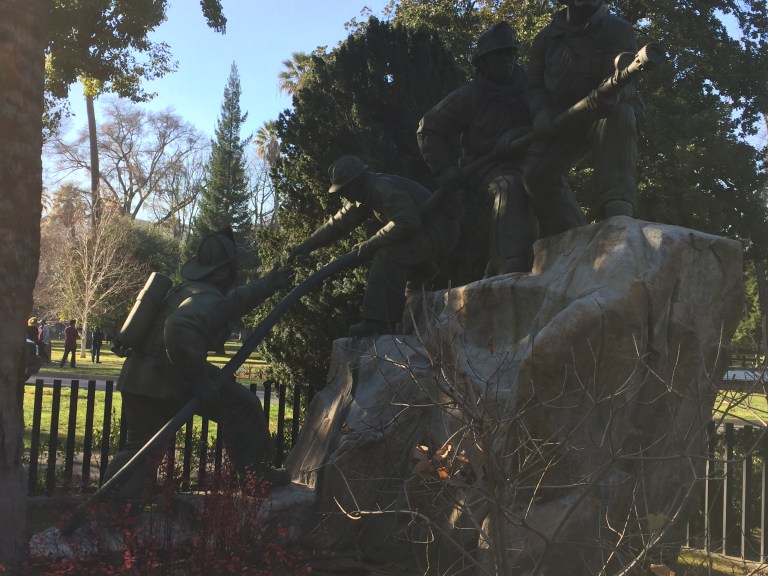
Afterwards, we took a ride to the Capital building and State Capital Park, which is the back area of the State Capital block, to see the Veterans Memorial and the California State Firefighters Memorial.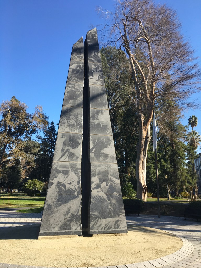
 Monday, December 25, 2017
Everything is closed today for Christmas, so we are home binge watching and eating prime rib. Enjoy the holiday!
Sunday, December 24, 2017
It’s pajama day, not for me, but the Sacramento Zoo. I don’t think anyone would want to see me out in public dressed for bed! Admission is free today and you can wear your pajamas to see the critters. I thought everyone would be home, getting ready for Christmas, but I was wrong. The place was packed full of people and little kids.
We got to see the baby flamingos and the adult flamingos. Lions, and tigers and giraffes and so many birds, monkeys and primates. A nice way to spend Christmas Eve with the animals.


Saturday, December 23, 2017
Today we are going to the Sacramento Underground. No, it’s not some hidden, secret organization, it’s the original city, or what’s left of it, that in now under the existing city of Old Sacramento.
When they raised the streets, beginning in the 1860s, the new support structures remain under the original buildings, creating their own space. Tour guides, dressed in authentic garb and telling the story of their character’s existence, explain how the streets and buildings were “Jacked Up!” to avoid further flooding. You are given headsets to hear the story of the people and the times as told by the guide, which was quite interesting. They used hundreds of men to turn the jacks under the buildings a quarter turn at a time on a synchronized command to raise each of the buildings a few inches on every day’s shift. We got to see a model and I acted as one of the laborers to do the “jacking up”. The average height each building rose was a little over nine feet, but the buildings closest the river were raised as much as twenty two feet. This enterprise was paid for by the merchants, so it was business as usual in order for them to pay. All this jacking up went on while businesses and people were inside going about their normal activities. A few of the businesses didn’t get around to contracting the endeavor, and you can tell which they are based on their being only one story high. These buildings still have their original first floors, only now the first floors are literally underground. Some use the space as an office or storage. 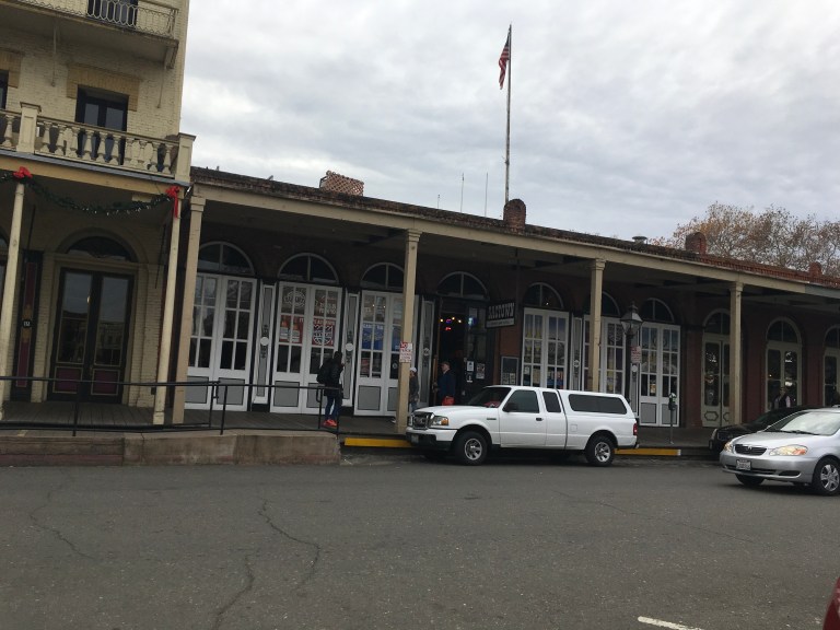 We got to explore two of the underground spaces that were created by the city’s successful raising process. Unfortunately, you are not allowed to photograph the underground space, so I can’t show you what it looks like. You will have to take the tour to see.
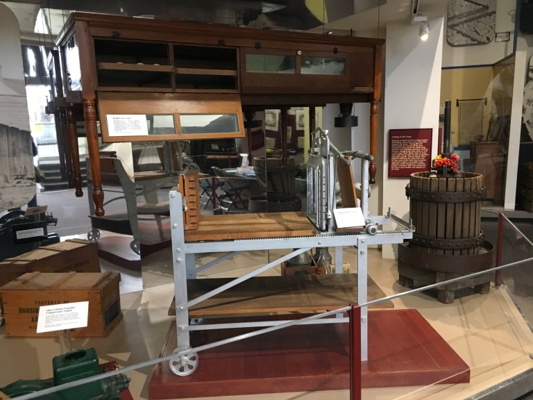
The tour is part of the Sacramento History Museum. Because you took the Underground tour, the Museum was half price. Inside the museum, the first room you encounter is the agricultural gallery filled with old farm equipment. That may not sound exciting, but we got to see an almond huller, used to take the shells off almonds, butter cutters and asparagus bundler, to name a few, all things you typically don’t see in a museum or anywhere else for that matter. 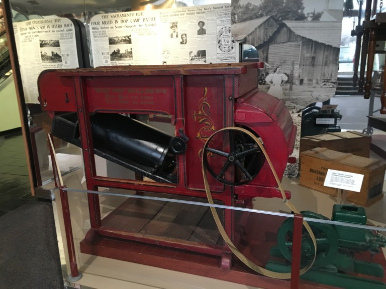
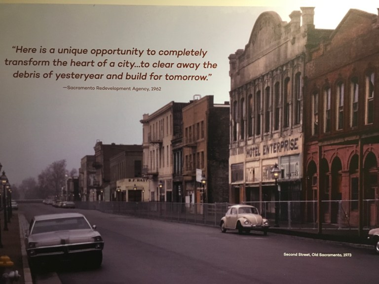
 The third floor explained how Old Sacramento was Skid Row and then, in the 1960s, transformed into the historical tourist destination it is now.
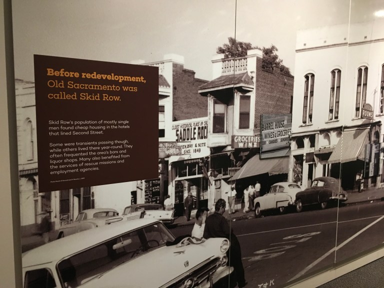
Friday, December 22, 2017
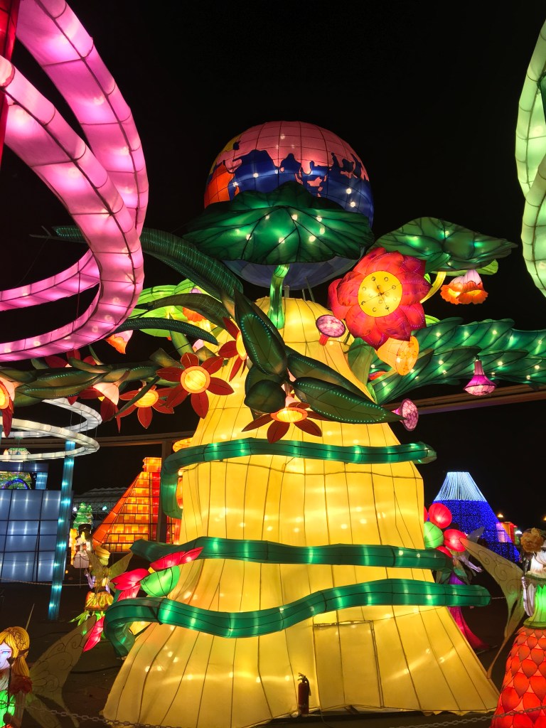
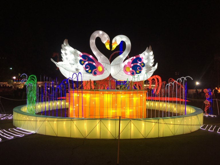
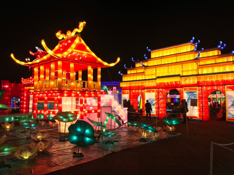
We are hanging out in the coach during the day, getting ready for this evening. Tonight we are going to the Global Winter Wonderland at the Cal Expo, which is part of the RV Park complex where we are staying. It is a holiday festival of illuminated landscapes from around the world, international cuisine, entertainment, rides, crafts, ice skating and arcades.
Since the event is illuminated, darkness is the key factor. When five o’clock comes around, we drive over to the main gate. They don’t have any signage telling you where to go or anyone directing traffic, so after some trail, and a whole lot of error, we get to the parking lot. As we walk to the main gate, we realize it’s cold already, and the sun just set. It’s in the forties and getting colder. The lighted displays are wonderful. You walk into North America, which looks remarkably like New York City, with the Manhattan skyline and the Statue of Liberty. 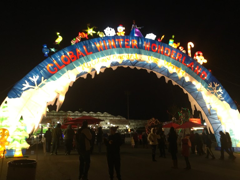
 There’s Europe, South America, Africa and Asia, Fantasyland, Oceania and a Global Plaza.
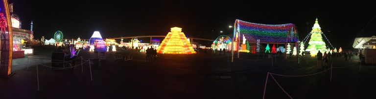


 One section has rides and games. There’s a daredevil performance and motorcycles zooming around a global cage. Inside the buildings you can find vendors selling their wares, rides and food. The outside food court has hot dogs, hamburgers, sausage sandwiches and a Hungarian vendor selling traditional food. We tried LÁNGOS, a deep fried flat dough bread. It can be made with all sorts of toppings, including chocolate for dessert. We opted for chicken, garlic and green onions. Very, very good!
After wandering around for two hours, freezing our tails off, we took our langos and a huge pretzel home to eat in the warmth our our coach. On our way out, we had the same lack of traffic direction as we did on the way in. We couldn’t find the exit. We had a parade of cars driving around the lot and we all ended up turning around in the area next to the entrance. We finally found a sign and managed to escape!
Thursday, December 21, 2017
Today is all about us getting ready to spend Christmas Day in the coach. Everything is closed on Christmas Day, so we need to be self sufficient. We are off to Walmart and Raley’s, a local grocery store to stock up.
Wednesday, December 20, 2017
Today we are going for a ride with Santa, and a gizzillion kids, big and small, on the Sacramento Rivertrain. The fourteen mile track, built in 1911 by Northern Electric Company, goes between Woodland and West Sacramento, along the Old Garden Highway, at a whopping, break neck speed of three to five miles an hour. The train doesn’t just run at Christmas, but all through the year with different excursions. They have the Great Train Robbery, Murder Mystery Train, a Beer or Wine Train, Sunset, Valentine, Easter, Pumpkin, Thanksgiving, well you get the picture. They cover it all. I would have loved to be here to do one of the others, but maybe somewhere else along our trek there will be another train. After all, this is the west!
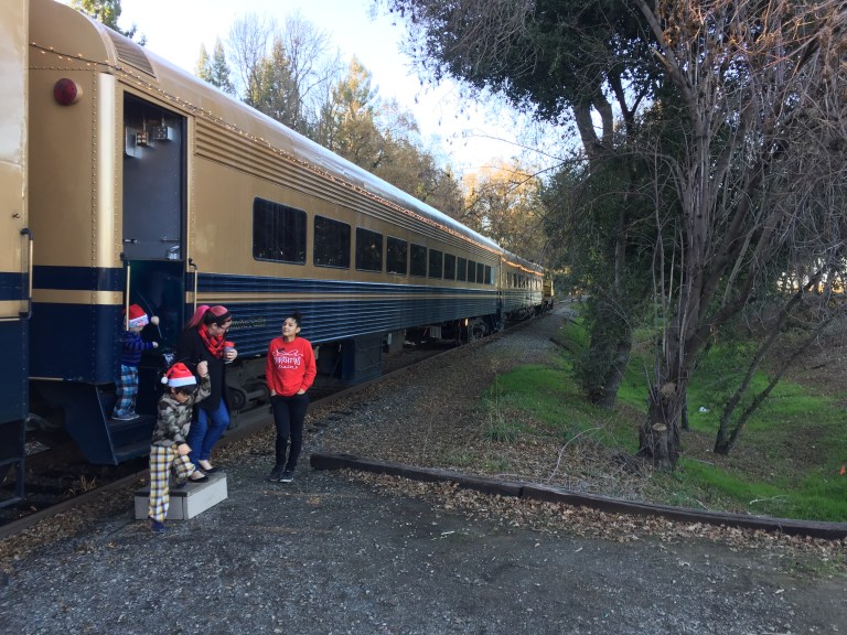 We booked the two o’clock train ride and boarded at one thirty. You can get table seating or the lounge cars with booth seating, at different prices, of course. Everyone gets cookies and hot chocolate in a souvenir cup.
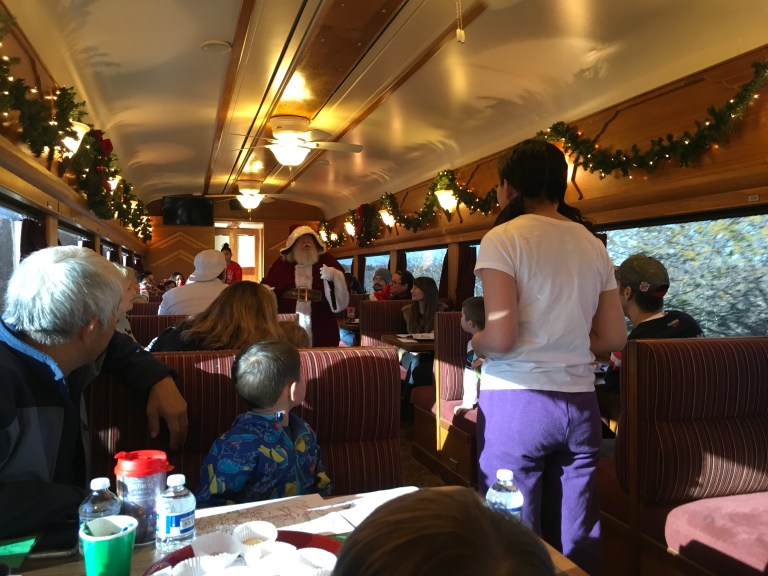
  For those who would like something a bit stronger than hot chocolate, you can get beer, wine or soda in the first rail car as you board. We were in the Yosemite Falls lounge car, which was the last car, so we got to walk through all the railway cars, each very different from the last. The ninety minute ride features Christmas carols, games and, the elves, Santa and others, enact a story of a little girl who lost her Christmas sprit because she moved from her friends in Minnesota to Sacramento and was feeling lonely.
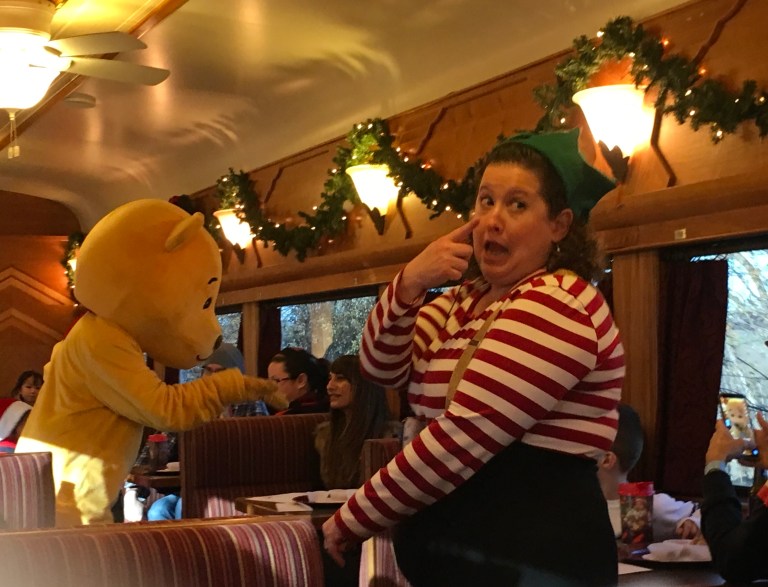
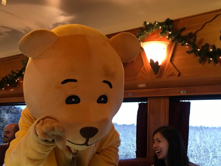
 One of the games was getting your elf name. You picked two slips of paper out of a box, and an elf is born. Alex was Piney Cuddle-bear, I was Stripy Biscotti. The trivia game awarded correct answers with holiday candy. Kids of all ages leave the train in the holiday spirit.
We stopped to pick up a few things in the IKEA store that we passed on our way to the station, then started our journey home. It was around four thirty. Bad, bad, bad! We only had to travel 9.8 miles, but it took us exactly one hour to cover the distance. Traffic was horrific. I forgot how miserable it is to be in traffic with a stick shift! So much for Christmas sprit!
Tuesday, December 19, 2017
Today we are taking the thirty minute drive east to Folsom, California to see the Folsom State Prison Museum. This is one of the most famous American prisons, due to Johnny Cash’s song, Folsom Prison Blues. The prison was also made famous by a number of movies including, Riot in a Cell Block 11, American Me, The Jericho Mile, and Another 48 Hrs., just to name a few.
The walls of the prison were made by the prisoners themselves, beginning in 1878, of gray granite from the surrounding rock quarries. The outside walls were finally completed in 1923. Folsom was one of the country’s first maximum-security prisons. Technically, it sits one mile from the city of Folsom on the banks of the American River and has its own zip code. The people of Folsom were not too happy being associated with the prison, so giving it its own zip code and town name, Represa, separated it from the city and the stigma attached to it.


The first cellblock had 324 cells and officers quarters. The 8 foot by 4 foot cells had no heat or plumbing, and contained a solid iron door with a 6 inch by 2 inch opening for guards to peer in, no windows. Later, they drilled holes in the iron doors for ventilation, as the heat and smell in the cells became unbearable. Later still, ventilation ducts were also added. Since there was no plumbing, inmates got a bucket to do their business in. In the morning, they lined up to dump the contents. Now you can understand the need to add ventilation!
The inmates got one candle to last a month. It had to burn down to nothing before they could get the next month’s candle. They had to budget their candle usage to last. In 1895, electricity came to the prison, making it the first prison in the world to have electricity, provided by the first hydroelectric powerhouse in California. This prison housed California’s most violent and notorious criminals, gaining it a bloody reputation. A second prison, known as New Folsom, was built down the road and got its first prisoners on October 1, 1986. The name was changed to California State Prison, Sacramento County on October 1, 1992. The worst of the worse are now housed there. Folsom State Prison has medium-security prisoners.
There is a museum and gift shop on site. Founded in 1975, the prison museum was officially named the Retired Correctional Peace Officers (RCPO) Museum. The museum was dedicated July 1, 1987. It details the bloody history of the prison. It was annexed in 2011 by the Old Guard Foundation (OGF). In 2014, it became the Big House Prison Museum.
The museum is a small building packed with information about the prison and some of its most famous inmates. Charles Manson, Erik Menendez, Superfreak Rick James, and actor, then drug and robbery convict, Danny Trejo, all served time here. Contrary to popular belief, Johnny Cash was never an inmate. He performed a concert at the prison.  The museum features a wealth of photographs, old hemp ropes used to hang prisoners, memorabilia from Johnny Cash’s famed concert shows, a hand-cranked Gatling gun, many inmate manufactured weapons and an eight-foot motorized Ferris wheel created by a prisoner in the 1930s, made of a quarter million toothpicks.

Afterwards, we went in search of the Folsom Dam, but it is off limits to visitors, so we had to settle for a peek from the road. 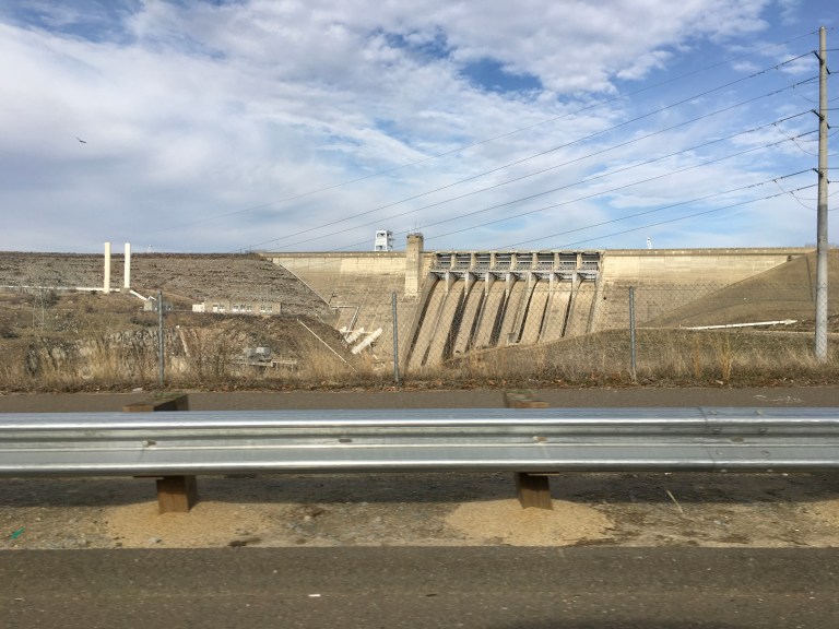 Then it was off to the Folsom Zoo to see rescue animals that are non-releasable. Many of these animals were raised from babies, and then rejected, by their owners when they became too big or showed their natural instincts. Others were injured or orphaned in the wild. Without momma to teach them, their survival would be bleak. Most of them are native to North America, the more exotic are not. These were typically pets. Each has a name and their own unique personality. Their individual stories and information are posted at their home enclosure.
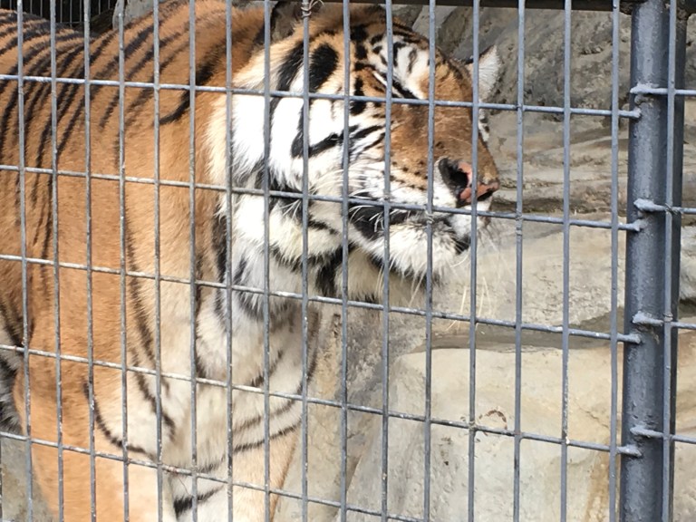


In addition to the red fox, which keeps popping up in rescue zoos because it is a non-native to California, we saw two beautiful tigers that were rescued. Someone in Southern California was keeping them as pets. When the place was raided, they found twenty eight cub carcasses and as well as other dead adult cats. There are many species of birds, but peacocks rule the zoo. They roam the entire area, parking themselves in other animal enclosures and anywhere they please. Beautiful birds with a wonderful sound! There was a giant enclosure with mountain lions and one with bears. It is sad that they are in these enclosures, but most, if not all would be dead if they hadn’t been rescued. They get to live long, lazy, well-fed lives with no danger, so I guess it’s not all bad.
Hunger was setting in, us, not the animals, so we went in pursuit of food. We made our way to Sutter Street. Sutter Street is part of old historic Folsom. The streets are lined with the old, original buildings that currently house shops, bars, restaurants and local businesses. Built in the hill, with narrow streets, traffic, parking and navigation can be a bit of a challenge. We found Chicago Fire, for two reasons, one pizza, naturally, and the other, a parking lot, on a hill, with delivery trucks. Good thing Sergio is tiny! We ordered a pie with thin crust. This was probably the thinnest crust ever, like a cracker. It was good, just very thin and cut into tiny pieces. I miss New York pizza!
Monday, December 18, 2017
The stream that has been running underneath the coach has now turned into a river with a lake, or maybe an ocean. Alex is doing battle with the park office to move us to another spot. Our jacks are shifting in the mud, causing the coach to become un-level. Not a good thing. He finally gets them to agree for us to move to another site. This one is smaller in width and length, but is directly behind us. It takes us longer to pack up than it does to move the fifty feet back. But at least we are not in the middle of water.

By the time we do battle, pack up and move, and then setup again, it’s lunch. Half the day is gone. We decide to go to Sutter’s Fort, a State Historic Park.
In 1839, John Sutter, a Swiss immigrant, received a land grant in the Sacramento Valley from the Mexican government, which he used to create an agricultural empire called New Helvetia (New Switzerland.) Remember, California was part of Mexico at the time. This was the earliest Sacramento settlement and the first non-Indian settlement in California’s Central Valley. In 1847, a group of immigrants, known as the Donner Party, who were trapped by a winter storm in the Sierra Nevada Mountains, were rescued when Sutter sent aid. Word spread making New Helvetia the destination for early immigrants to California, affording them refuge and hospitality. Less than a decade after New Helvetia was established, it was overrun by gold seekers. All that remains is the fort, that was restored based on an 1847 map. The Fort tells the story of the Mexican Citizens, emigrating Europeans, Native Americans and the American pioneers, who made up the area of the 1840’s. It is open daily from 10 a.m. to 5 p.m. Closed only on Thanksgiving, Christmas and New Year’s Day. There is a $5 fee for adults, kids 5-17 are $3 and under five is free. Bring lots of quarters or a credit card to feed the parking meter, as street parking is all that is available.
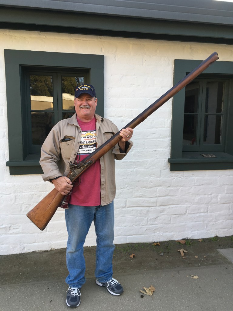
We spent a pleasant afternoon walking back in time checking out the cooper’s shop (barrel and box maker), blacksmith shop, bakery, weaving room, candle shop, and of course, all the gun and guard rooms and equipment. Alex got a private tour, from one of the park employees, into the gunsmith shop, because we asked a question about a pistol in the orientation room. He got to hold a wall or punt gun. This six foot long, forty pound, zero gauge gun was used to guard the fort where canons couldn’t be placed. It is not the type of gun one holds, but needs to be supported. The kickback from it could do some serious damage to a human.


 It was after four when we headed home. A word to the wise, don’t travel on the roads between four and seven. Traffic is a giant parking lot. You go nowhere fast!
Sunday, December 17, 2017
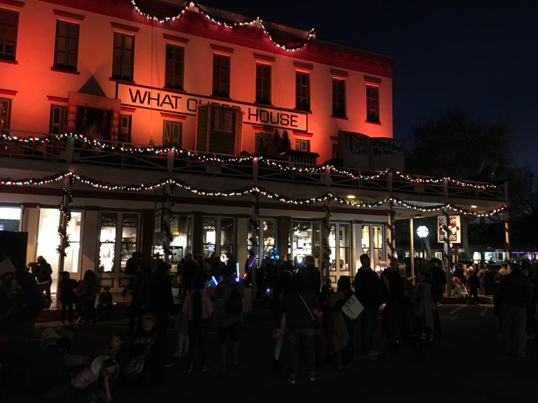
Historic Old Sacramento dates back to 1848 when gold was discovered. It was the last stop on the Pony Express route, the terminus of the transcontinental railroad and home of the original California Supreme Court Chambers. Gold, goods, miners all passed through Old Sacramento. The original Sacramento suffered fires and floods. Mother Nature tried to wipe her off the map more than once, but she always rebounded. They raised the streets beginning in the 1860s and built levees to combat the flood waters. They replaced wood buildings with brick to fight fires. The 28 acres on the Sacramento’s historic waterfront are now home to shopping, entertainment, as well as a global tourist destination.
We park in the parking garage for a $10 all day fee and make our way out onto the streets of Old Sacramento. The buildings look like they did back in the day. 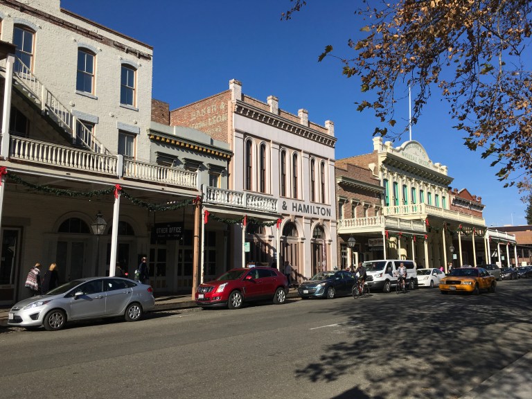 There are stores of every sort selling sweets, socks, crafts, tees, clothing and a few that defy description, but I can only call them oddity or curiosity shops. Restaurants and bars abound. There’s a comedy club, psychics and a shooting gallery. Something for everyone. We had lunch on an old riverboat called the Pilothouse Restaurant.
 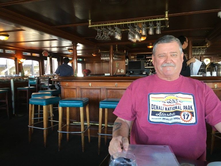 A stop at the Wells Fargo Museum and we learn about the Pony Express. Fun fact, it took ten days to get a letter from Missouri to Sacramento and 200,000 horses to get the job done. Riders and horses were changed frequently at the many stops along the way.
  We went to the California State Railroad Museum.
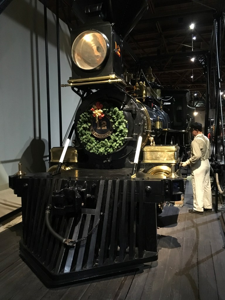
 The person at the entrance said it would take about an hour to an hour and a half to tour the museum. Wrong! We didn’t even get through the first floor when the museum closed at five. We will have to come back another day to finish seeing everything. If you like trains, this is the place to go, not only to see the trains, but learn the history of the iron horse, its move west and the impact it had on the west and America in general.
At six and seven thirty, in front of the Stage Nine Entertainment store, the Theatre of Lights show is performed, complete with real snow blowing down on you. It is a Christmas show mix with the Grinch, Santa, Jack Frost and the Night Before Christmas story. 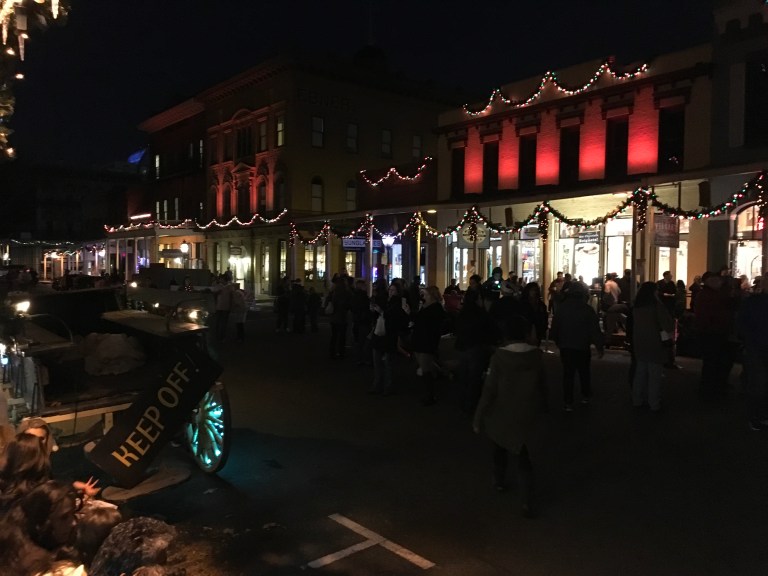
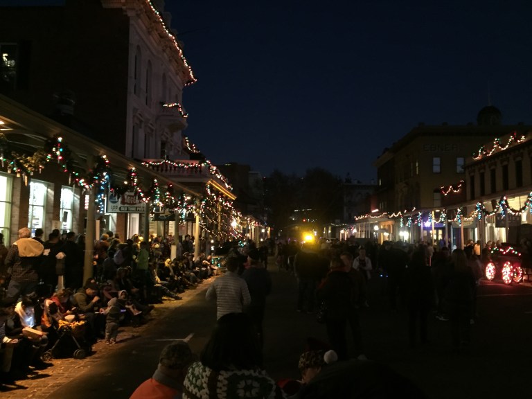
 After the twenty minute show, we head to River City Old West Saloon for a beer and some food. I got to push through my first set of barroom swinging doors as I entered the old bar. Feeling like I’m part of the old west!
Saturday, December 16, 2017
Today is a red flag day. Don’t get excited, it’s not like a red letter day. It’s a severe alert in California. High winds, twenty to thirty miles an hour, with gusts over forty plus miles an hour, and extreme dryness, are a wildfire threat. Any spark or cinder can set off a fire. No burning, take care with sparks from cars and other metals. The worse, so they say, starts around four this morning and will last until around ten tonight. By the time we get up, the coach is rocking and rolling.
As an observation, this fire thing is something I find odd. The entire state is one giant tinderbox, ready to become an inferno with just one spark, yet you can burn your leaves and yard trash. Any “controlled burn” can set off a massive monster that just consumes everything in its path. But you can burn. Never mind that all the smoke is air pollution in a state that claims to be eco-green. One of the Southern California fires we just had last week was caused by a cooking fire at a homeless camp. The authorities said they will not be able to ever determine who was the person responsible. Talk about playing with fire!
Anyway, we’re staying home today and minding the fort, or should I say battening down the hatches, and figuring out where to go for the next twelve days. And it’s a good thing with this wind. Yikes!
Friday, December 15, 2017
On we go to Sacramento!
The journey is about seventy five miles south. Not long at all. When we got off the highway, we followed the signs to the RV Park, but when we turned right, as the sign said, we ended up in a closed parking lot entrance. There wasn’t enough room to do a K turn, so we had to unhitch Sergio so Alex could get Claudia turned around. When we finally got to the RV Park, we were told there was a break in the water lines. They had no water. But it was being worked on and would be up and running shortly. The only problem was our site, and the surrounding ones, have water bubbling up from the ground. Things could be wet. Back and forth, round and round, we were going into our bubbling spot and see what would happen. They are claiming to be full.
When we got to our spot, the water was back on and you could see a small lake and stream with bubbling water running through the sites in our row. We were able to get our jacks on dry land, so it wasn’t a problem, so far. You just had to maneuver around the waterways. Not loving this so far! It was close to four by the time we were set up, so we decided to call it a day.
Thursday, December 14, 2017
We are home today doing laundry and trying to find a suitable campground in the Folsom, Sacramento area. Not turning out to be an easy task. We have looked miles in every direction. Everything is either not accommodating for a large rig, filled up, extremely expensive or not something you would want to stay in. After spending the entire morning searching, we found Cal Expo RV Park in Sacramento on RVParky.com. This site has been proving to be very useful. It’s not the best solution, nothing but a gravel parking lot with full hook ups, as part of the California Expo Center, but it will have to do if we want to checkout the Sacramento area.
Once we have our reservation secured, we spend the rest of the day in what turns out to be our private hot tub and pool. I am going to miss the hot tub, again!
Wednesday, December 13, 2017
Today we are driving north from our campground to Chico, California to visit the National Yo-Yo Museum. The museum features the worlds largest public display of yo-yos, memorabilia, and contest awards. 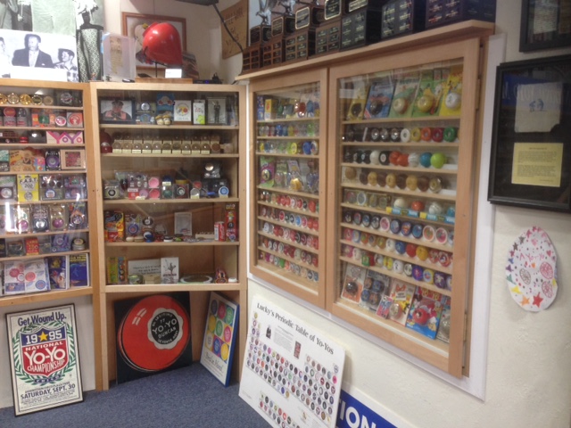 It also is home to Big-Yo, a scaled up working version of the iconic No-Jive 3-in-1 yo-yo from Tom Kuhn. At 256 pounds, 50 inches tall, Big-Yo is in the 1982 Guinness Book of World Records as the ‘Worlds Biggest Working Wooden Yo-Yo’. With the help of a 150 foot crane, Big-Yo was test-launched in San Francisco on October 13, 1979.
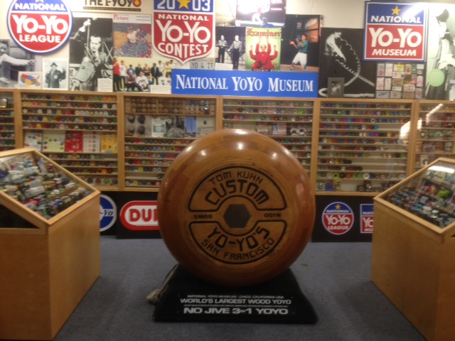
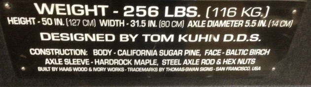
Oddly enough, the museum is in the back of a very cool and unique store called Bird in Hand. This place has every toy, game and puzzle you can imagine. And not the average run of the mill toys, but the odd and different kind. The kid in us just had to check it out and leave with a few puzzles and a roll up piano.
We walked both sides of what I would call the main drag of this cute, old time town, stopping at Burgers and Brew for lunch.  The streets are lined with shops, bars, restaurants and art galleries. People and their dogs are enjoying the California weather, which I simply love. Sunny, sixties, dry and not a cloud in the sky. I could get used to this!
Afterwards, we drive to the 238 foot long Honey Run Covered Bridge which was built by the American Bridge And Building Company of San Francisco, to create a route to connect Butte Creek Canyon to the Paradise Ridge. The wood reinforced bridge with steel cables and three unequal spans of 30 feet, 128 feet and 80 feet, was completed in 1886 at a cost of $4,300. It was originally built to take a load of 1,500 pounds. The bridge was built with Pratt style trusses and is the only three span Pratt-style truss bridge remaining in the United States. The bridge was first opened to the public on January 3, 1887.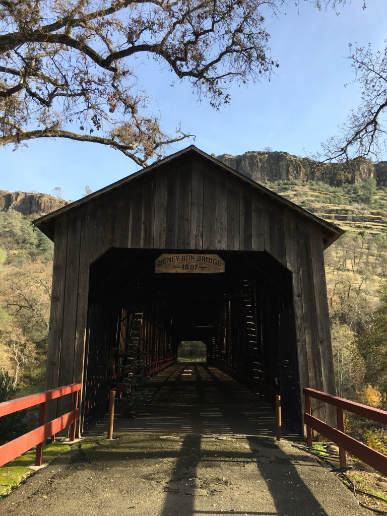
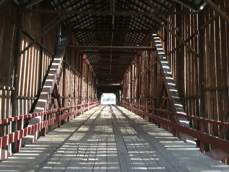
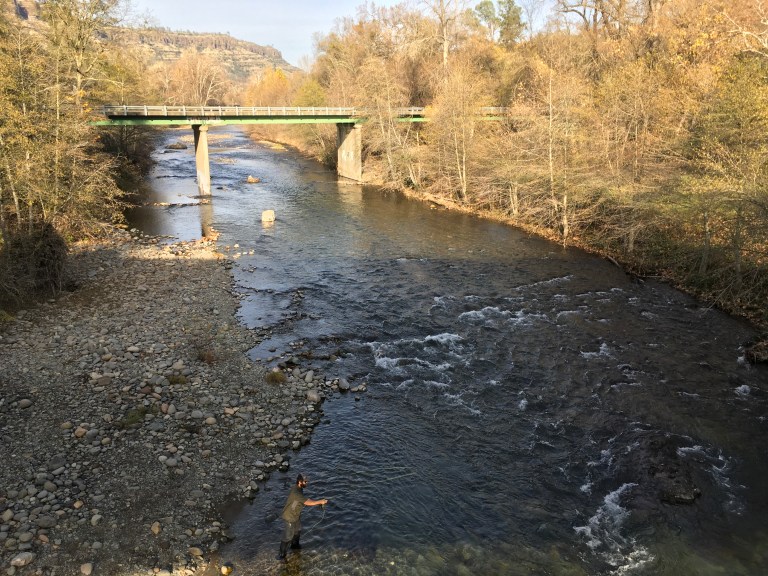
Because the bridge was damaged by flood some years later, Butte County approved funds for the bridge to be covered to protect it from future damage. It took ten days and six men to to complete in 1901. The Honey Run Covered bridge was in continuous use until one section was damaged by an out-of-control panel truck in 1965. As a result, the county decided to replace the damaged bridge with a new one a few yards upstream and tear down the covered bridge. Community efforts preserved the bridge and created the adjacent park which opened in 1972. The Honey Run Covered Bridge is listed on the National Register of Historic Places and can be rented for weddings and events.
Tuesday, December 12, 2017
For the first 20 years of the start of the California Gold Rush in 1849, the Chinese arrivals in Oroville were only men, since they were not allowed to bring their families. Around 1850, the Chinese population of around 10,000, pooled existing resources and built the first Chinese temple in the area. The temple of wood, burned down, as did a second rebuilt structure. The third, was built of red brick and was completed in September 1863. Over the years the structure withstood many fires and floods. However, in 1907 a massive flood caused damage affecting not only the temple but the entire Oroville area. This resulted in a large exodus of Chinese from the area to other larger U.S. cities and even back to China. Chinatown, with its stores, other businesses and culture, were no more. The remaining Chinese kept the temple operating until the 1930s when they deeded the complex to the City of Oroville in 1937. It is open to the public as a museum, and it also continues to be used occasionally for worship. The entry fee is three dollars, cash only.
After paying our entrance fee, we are given a map and start on our self guided tour. There are three temples within the compound, a museum with a tapestry room, the old general store, a workers hut and the council room. 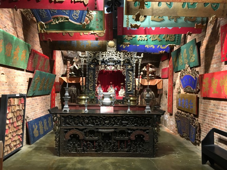

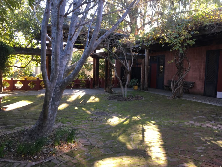
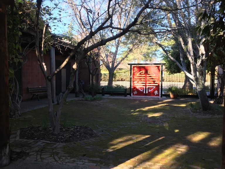

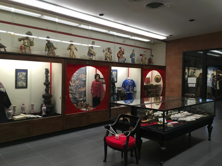

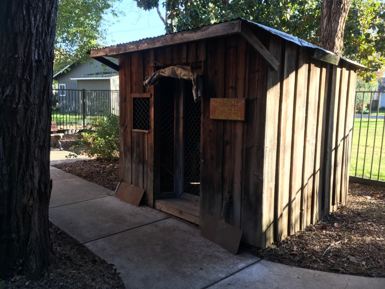
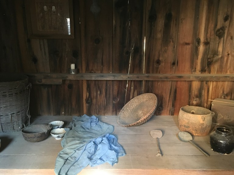 Somewhere along the tour, in the garden, we found a beautiful golden kitty with gorgeous pale green eyes. Or maybe I should say she found us. She was the most friendly and affectionate kitty. I say she, but she could have been a he. I didn’t check.
  She followed us everywhere and wanted nothing more than to get some loving. I thought she was coming home with us, but when we crossed the street to our car, she took a stroll into the brush and didn’t come out until after we backed out.
Monday, December, 11, 2017
We are off in pursuit of the Oroville Dam. California, being a dessert, has masterminded the greatest water retention and distribution system, turning it into the country’s agricultural Mecca. We plan on checking out these engineering marvels.
After MapQuesting the dam’s location, we set off. Sophie, our GPS wiz, is telling us to turn on Canyon Drive. There’s only one teeny, tiny problem, the road’s closed for construction. We drive on looking for another way in the direction of the dam. It’s not working. We turn around and try a different way. Still skunked. Another direction, this time back towards the way we first came. Road block. We drive over to the person sitting in her car under the construction tent and ask for directions only to learn the dam is closed for repairs for the next twenty months. So much for Oroville Dam. You think they might mention this on their website!
So, we stopped at the grocery store for a few things and head back to the RV Park. It’s hot tub time! And the pool, got to check it out too.
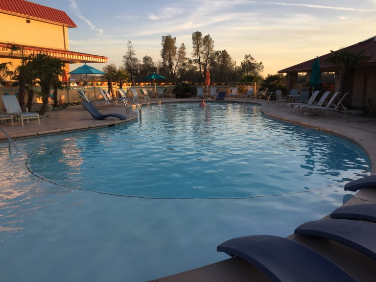
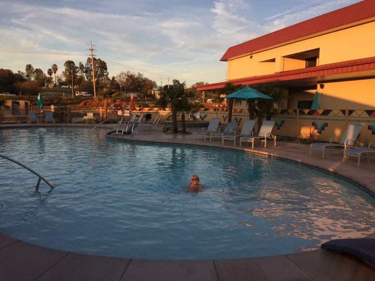
Sunday, December 10, 2017
We are driving southeast, to Oroville, California. Our destination is Berry Creek Rancheria RV Park, which is part of Gold Country Casino & Hotel. The Casino and RV Park, as well as the gas station and grocery mart, are owned and operated by the Maidu Indian Tribe. It is about and hour and a half south of Redding.
This is a brand new RV Park. It hasn’t been open long, a few weeks, and work is still being done. The smell of fresh mulch fills the air. There are mounds along the perimeter that workers are spreading. The park is a bit more pricey than Seven Feathers. We took a standard pull through site, which is only 50 feet long, that was $52 a night before our Good Sam discount. I guess I got spoiled with Seven Feathers. This park has a very nice heated outdoor swimming pool, that they claim is at 84 degrees. The jury is still out on that one. It is not deep by any means. It is made to be able to sit or lounge in shallow water during the heat of the California summers with only a very small center area of about five feet in depth. The hot tub sits next to the pool. Both are fenced in and you need your key card to enter. The laundry and showers are to one side of the compound.
Since you don’t have the room park you car in your site, you are parking on the street, which is two lane. I would have liked more site space and less roadway, but that’s not the case. There is grass between the sites that has an underground sprinkler system. You are warned not to drive on the grass or damage the sprinklers in any way or you will be financially responsible. They give you a picnic table and cable television is included in the price of admission, as well as water, electric and sewer. There is a free shuttle to the casino and you get a few discount coupons for meals, but nothing like Seven Feathers.
After we get settled in, we drive the short distance to the casino to check it out and have dinner. Gambling is on the first floor. Most of the restaurants, the gift shop and the hotel check in are on the second floor. The Steakhouse is on the sixth floor with rooms in between. Someone we met while checking in, recommend The Cafe, so we gave it a try. The food was good and reasonable priced. 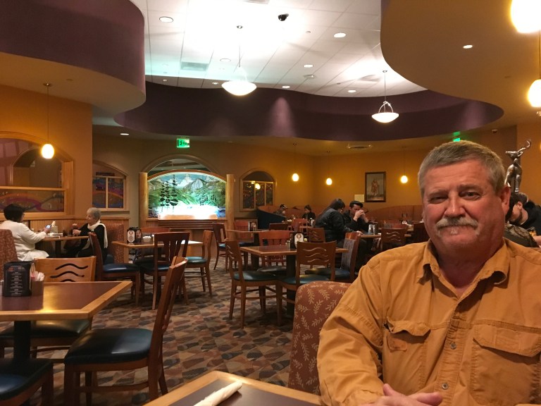 There is also a bingo hall in another building and a separate bowling center.
Saturday, December 9, 2017
Today is good housekeeping day. We need to figure out where we are heading tomorrow, do laundry and clean. Fun filled day!
Friday, December 8, 2017
Turtle Bay Exploration Bay in Redding, California is a 300 acre non-profit park featuring the Sundial Bridge, a museum, a forestry and wildlife center, arboretum and botanical gardens. This is today’s destination.
First stop is the museum, which does charge a $16 fee, but offers a senior discount.  In the museum, there is an art gallery and a exhibit room that changes periodically. Currently, the exhibit is textile fashions of the 1800’s. Most of the art in the gallery is local, but I did find a roped off corner that had a few Maxfield Parrish works. I have always been a big fan, so this was a treat.
The museum proper has a river aquarium where you can see fish, ducks, and, if you are there for feedings, beaver.
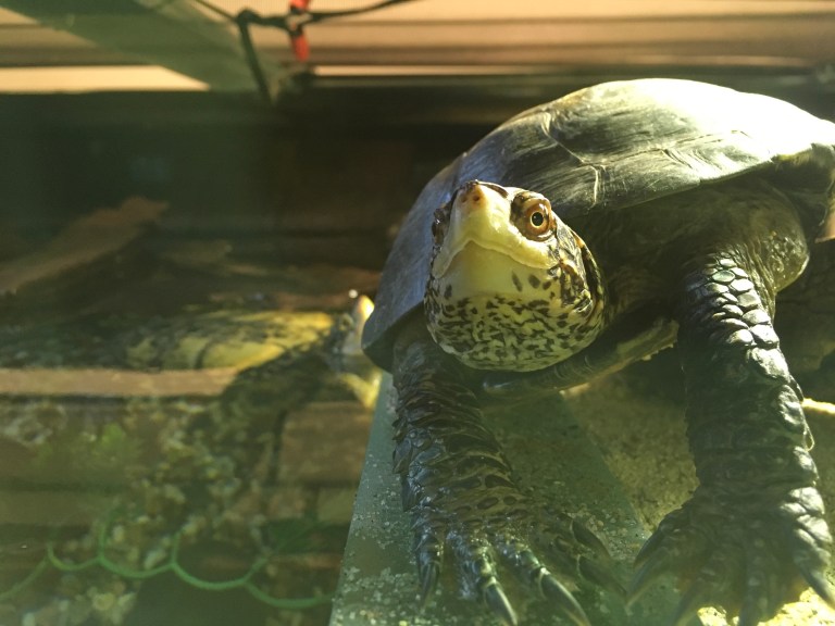
 There are interactive areas for kids to learn about wildlife, geology, bees and the like. One whole section was devoted to Fire Jumpers. Like the name suggests, these are the men who respond to the many wildfires the west coast is noted for by jumping into the blazing infernos. Here you learn the history of their successes and losses. If you go to the Forestry & Wildlife Center, you can test your skill by jumping in a simulator. Here you will also see different animals that have been rescued, and, for various reasons could not be released back into the wild. We watched a demonstration with a red fox, which is an invasive species for California, who is now a wildlife ambassador, teaching people about foxes. He was captured as a baby and would have been euthanized by the state, but instead came to the park to live out his life as a teacher.
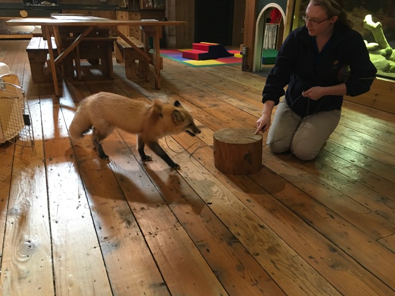
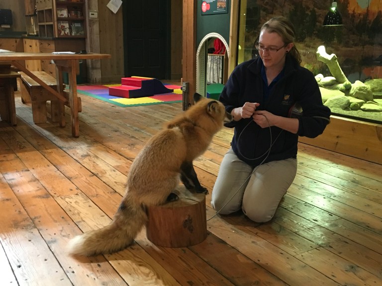 We entered the Parrot Playhouse and Alex had fun with all his bird friends, bird poop included.
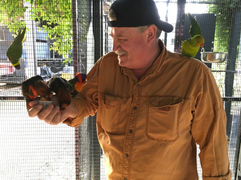
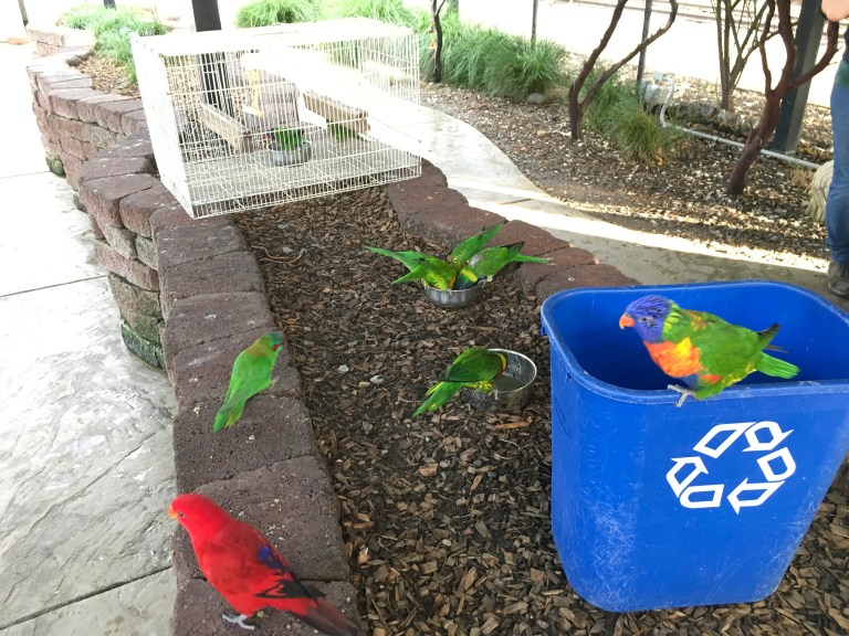
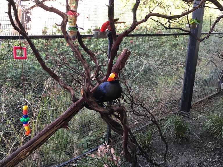 The Butterfly Garden was closed because of the time of year. I would have loved to be in the enclosed garden with them, but I guess I will have to visit when the weather is warmer.
We stopped at the Museum Store & Coffee Bar before crossing over the Sacramento River on the Sundial Bridge designed by Santiago Calatrava. This magnificent architectural wonder connects the north and south sections of the park and is the entrance to over two hundred miles of trails that make up the Sacramento River Trail System. The glass decked, cable-stayed cantilever suspension bridge, which opened on July 4, 2004, is 217 feet high, spans 710 feet across the Sacramento River, and forms a working sundial. That’s right, a working sundial! The pylon of the bridge points due north at a cantilevered angle, allowing it to serve as the gnomon of a mammoth sundial that casts its shadow on a large dial plate on the bridge’s north end. The tip of the shadow moves at a speed of approximately one foot per minute, so the Earth’s rotation can be seen with the naked eye! It has no river footings, allowing the salmon-spawning habitat undisturbed. At night, the glass deck is illuminated from beneath and glows aquamarine, which causes less shadow on the river and has less of an impact on spawning salmon.
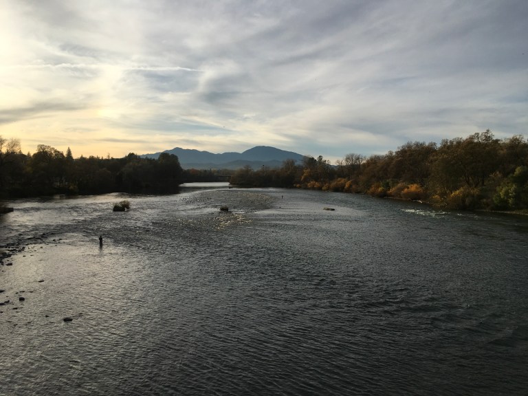
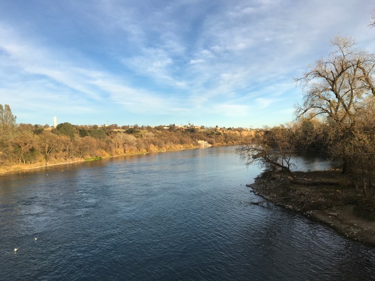
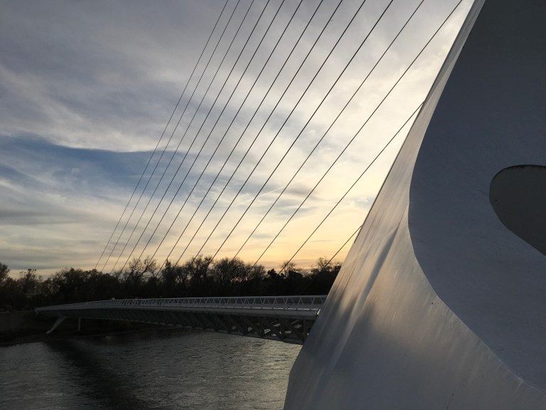 On this side of the park, there are twenty acres of botanical gardens, a children’s garden, two water features, environmental art, a pond and way more. There is a plant nursery that features Mediterranean-climate zone species, California native and drought tolerant plants. This is the place for a walk through California flora.
If you come to the park, plan on spending the day, there is a great deal to see and do. They are building a hotel and restaurant, but there are places you can picnic. This is a great place to see.
Thursday, December 7, 2017
We are driving about an hour east into the mountains to Lassen Volcanic National Park. It boasts incredible mountain scenery that is reminiscent of Yosemite, as well as fascinating thermal wonders like Yellowstone, with only a fraction of the visitors. A best kept secret. It has steam vents, mud pots and hot springs that you can see by hiking the 1.5 mile trail to Bumpass Hell. If that’s not enough, all four types of volcanoes, shield, plug dome, cinder cone and composite, all live here. It also has the largest plug dome volcano in the world. The road near Lassen Peak reaches 8,512 feet, making it the highest road in the Cascade Mountain range. The geek in me is stoked!
As we climb up the mountain, we see snow on the side of the road in the grass and on the shrubs. The higher we climb, the more snow we encounter. Hmmm, not making me fell warm and fuzzy!
By the time we reach the park entrance, the piles of snow are high. As we turn into the park road, we discover the roads in are closed. We decide to go in as far as we can and then turn around. Lake Manzanita is the first thing we see. Beautiful, covered in snow. Along the side of the road we find a young guy from Arkansas trying to get his van out of the snow by putting on snow chains. We stop to help and Alex pushes the van while the guy drives out and after thanking us, goes farther up the road. While we admire the snow covered lake, he makes his way out past us. We continue our drive into the park and find a parking lot for the museum, which is closed. We park and start wandering around. There is a bridge over a stream that connects to another part of the park. Even though there is snow, lots of snow, we are walking around in long sleeve shirts and we are quite comfortable.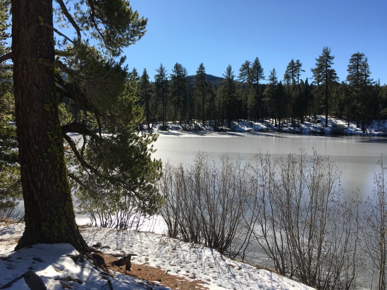

 It’s still early when we leave, so we decide to go to Shasta City Ghost Town. About six miles west of Redding on Highway 299 stand a row of old, half-ruined, brick buildings that was once the lusty “Queen City” of California’s northern mining district. Shasta was the entrance to the rich mines as well as a stage stop between the Valleys of the Sacramento River and the commercial hub and county seat. It was a supply depot for mule trains heading for the mines. It was said a hundred mule trains and teams were known to stop at Shasta on a single night. It was booming until 1872 when the California and Oregon Railroad laid track to the city of Redding, six miles away. The railroad signaled the demise of Shasta, which occurred around 1888.
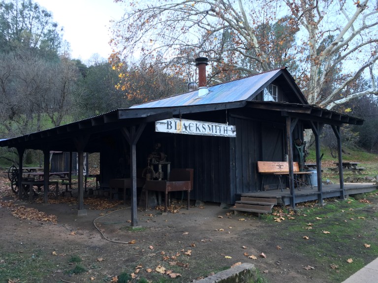

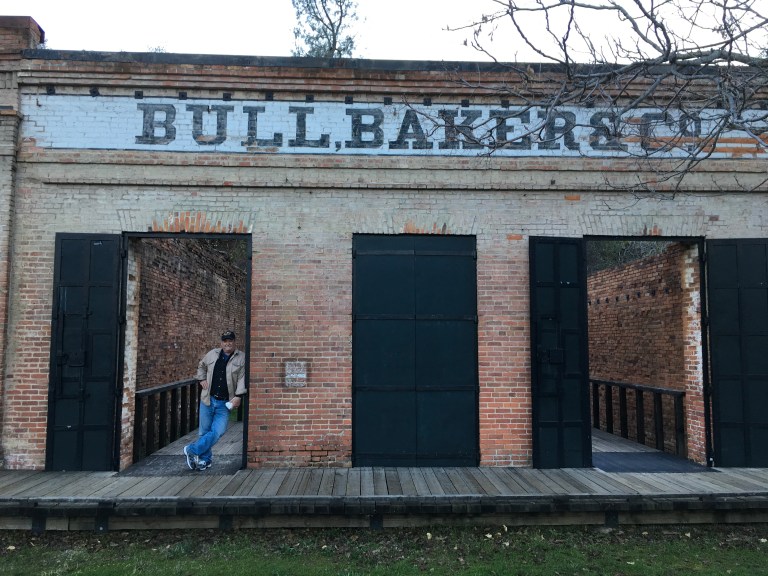
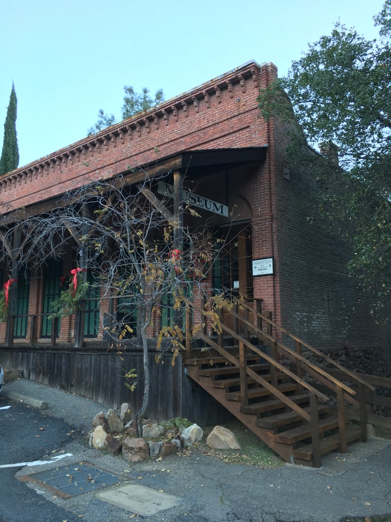
Across the road from the old brick buildings, is another old brick building that has been restored to its 1861 appearance, when it was converted from commercial use to become the Shasta County Courthouse, complete with jail and gallows. Today, it is filled with historical exhibits, and a collection of historic California Artwork that make it the central figure of Shasta State Historic Park. We spent a good deal of time examining everything in the museum. There are other brick ruins and an old Trinity River hay barn located in the twenty acre Park. 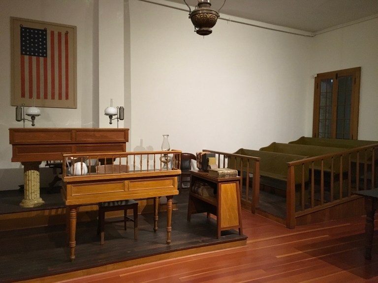
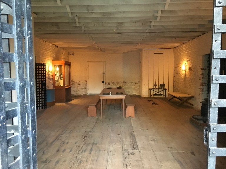
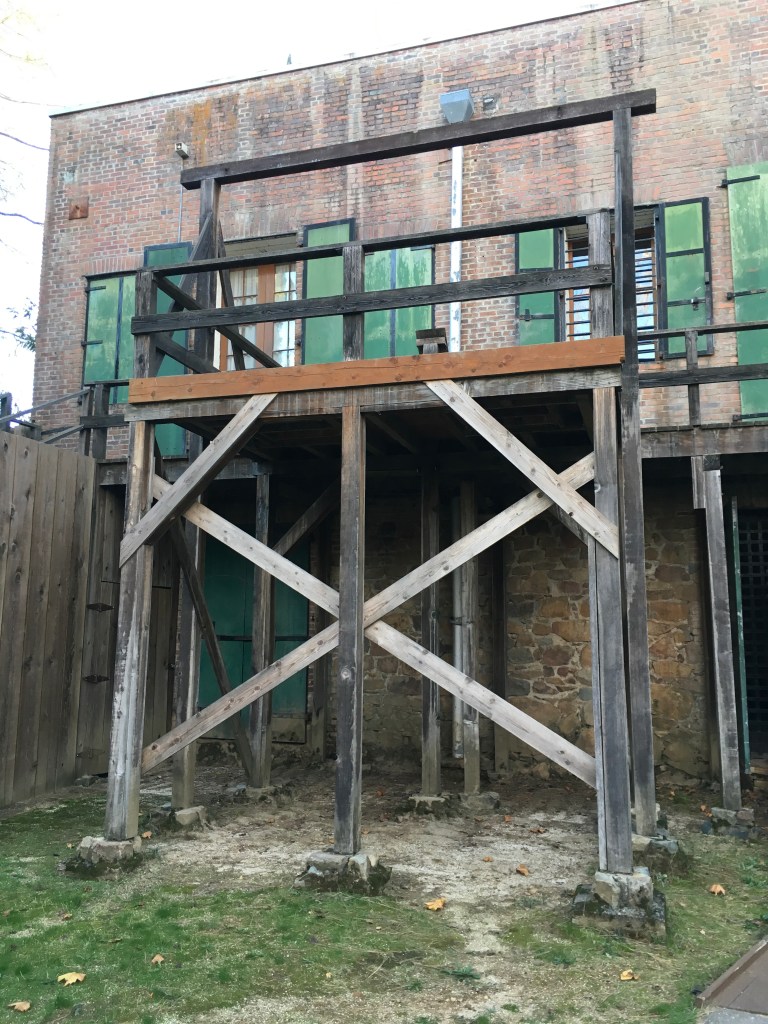 A stroll to the end of the historic buildings reveals a replica of the general store and Shorty’s Eatery, an old time bakery that also serves coffee. We spend some time chatting with the owner and buy some Ghirardelli brownies and incredibly lemon, lemon cakes.
 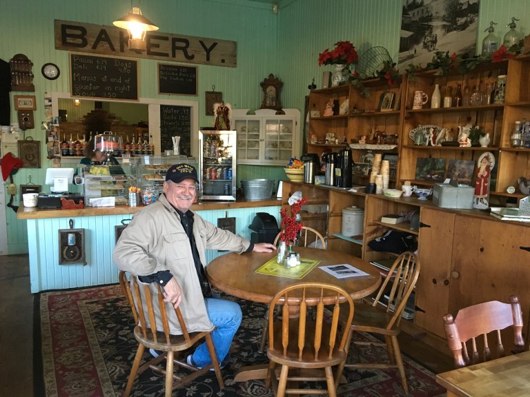 It’s getting dark, so we head on home.
Wednesday, December 6, 2017
Today we are looking for ET, extra terrestrials. Life other than our own, somewhere other than here, on planet earth.
We are driving east to Hat Creek, California to the Hat Creek Radio Observatory. Think the movie Arrival. This is the home of the Allen Telescope Array (ATA) made up of 42 individual antennas that work as a team. This is the primary tool used by the SETI Institute in its search for signals from other star systems. These signals would indicate the presence of intelligent life somewhere else in the galaxy. This location is the place where data is gathered. The analysis is done elsewhere.
This is a self guided tour of five stations that explain why this array is essential, the probably of communicating with another civilization, how research is conducted, what you can do and the history of the station. But, the coolest part of visiting the Observatory is seeing the giant antennas pointed towards the skies. You are out in the middle of nowhere and it is dead silent. You are walking among these monstrous dish antennas, when suddenly you hear an eerie sound. The antennas are moving, positioning themselves to listen to a different location. We didn’t find ET, but this was a very cool, geeky experience.
Tuesday, December 5, 2017
We took a drive to Shasta Dam today. The dam crosses the Sacramento River, although it is also fed by the Pit and McCloud Rivers, and Squaw and Salt Creeks. Begun in 1937, it was officially completed in 1945. At 602 feet high, it is eight tallest dam in the United States and creates Shasta Lake, with a surface area of 30,000 acres and an elevation of 1,067 ft. Sadly, many of the old mining ghost towns are submerged beneath the waters of the lake. The dam’s purpose is for water storage, flood control, hydroelectricity and protection against the intrusion of salt water. It is also the largest reservoir in the state. Seventy five percent of the rainfall in California is in this area. The remainder falls in the rest of the state, which explains how and why there are so many fires in California.

 You can walk across the dam or you can take a guided tour, which we did, and learn all about the dam and power plant. This is the only way you can see the inner workings of the dam. Tours are every two hours, beginning at nine and ending at three. There are rules to the tour, many rules, and you will have to go through a metal detector before descending into the dam. After the hour tour, we walked back across the dam to the Visitor Center and our car and home.
Monday, December 4, 2017
After breakfast, we drive to Lake Shasta Caverns. This time of year, they only have three tours of the Caverns, 10, 12 and 2. We arrived before twelve, but were told it was too late for us to make the noon tour. We would have to wait, so we order a couple of hot dogs, which will take about twenty minutes to make. While the dogs are cooking, we check out the gift shop and chat with the workers.  They tell us it is windy on the lake. The determination to sail is in the hands of the Captain. If he thinks it is too windy, there is no tour. So we have to wait until the Captain sails back from the twelve o’clock tour for a decision. A little before two, he radios in saying the winds are better and there will be a tour. We buy our tickets and head down the long stairs and dirt walk to the boat.
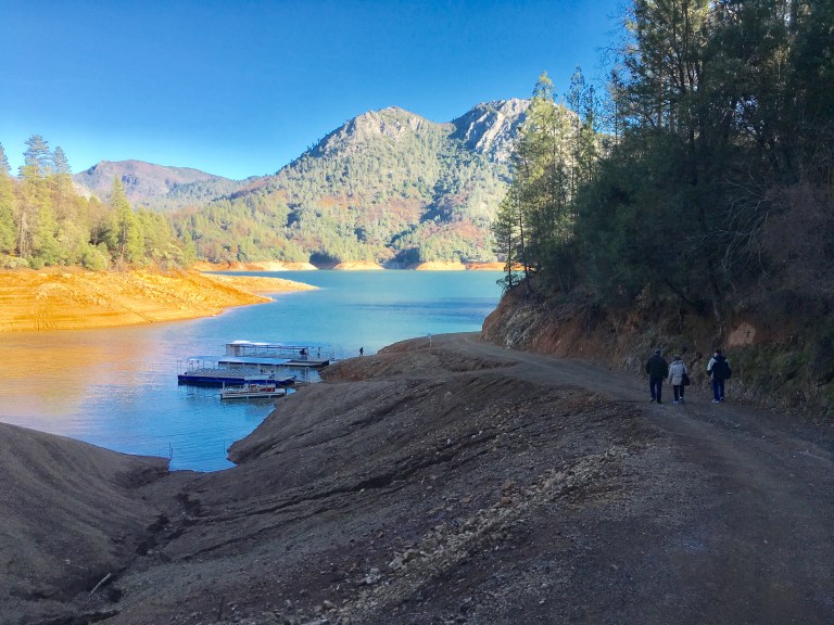
It is a ten minute ride across the beautiful man made Lake Shasta. Depths average four hundred feet, with the lake reaching 580 feet at the dam. It is breathtaking! 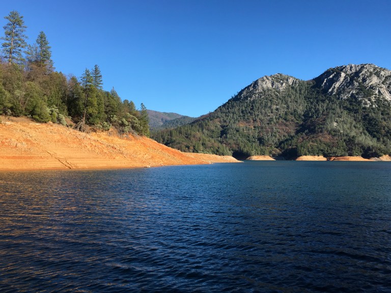
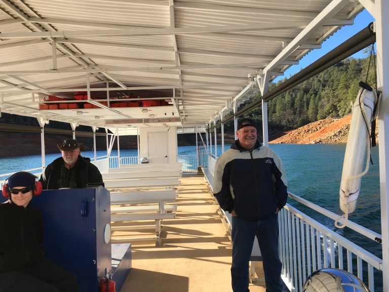 Once we get to the other side, it is a long walk up a steep concrete sidewalk to a bus.
  Then the bus climbs up a very narrow road with dizzying drops and no guard rails. We pile out of the bus at the Visitor Center. Now the fun starts!
We have been in other caverns before, but this one was definitely a challenge. What we didn’t know until now, is there are 680 steps within Lake Shasta Caverns. Quite the hike! These were very wet caverns, making the need to hold the handrails a must. Alex found the climb extremely difficult. Once we got to the end of the tour, we had 280 steps down to the Visitor Center. These steps were of uneven height and width, making the decent very dangerous. The railing was a chain link fence, not giving the greatest ability to grip, adding to the danger. The caverns were beautiful, but if you are out of shape or have other physical ailments, I wouldn’t recommend this tour.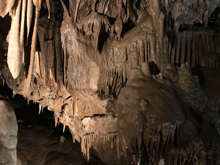

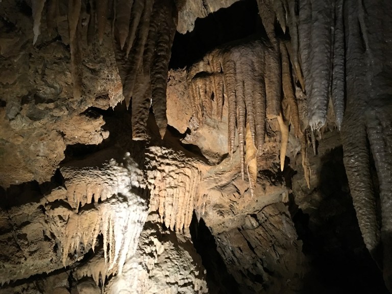
Back at the Visitor Center, we got on the bus for the ride down the mountain to our boat waiting on Lake Shasta. Once the boat got to the other side, we had the long hike back up to the parking lot. The sites were beautiful, but it was definitely a workout.
Sunday, December 3, 2017
Today we are heading south to Redding, California. Not a long drive, but one that takes us into the mountain passes. As we make our way down I-5, we can see snow on the hilltops where there is no vegetation. The farther we drive, the lower the snow line. It is coming closer and closer to the road. And then, there it is, snow! It doesn’t last real long, but it is a site to see. Just as it gradually came, it gradually disappears.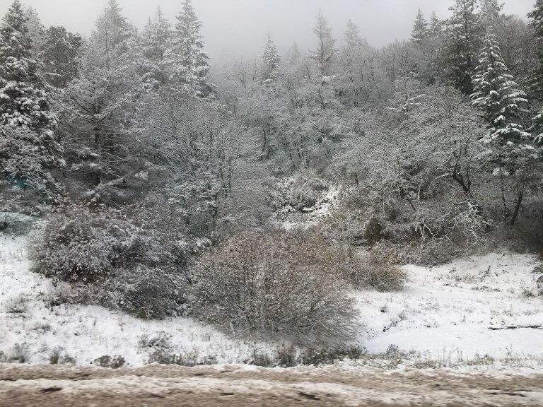
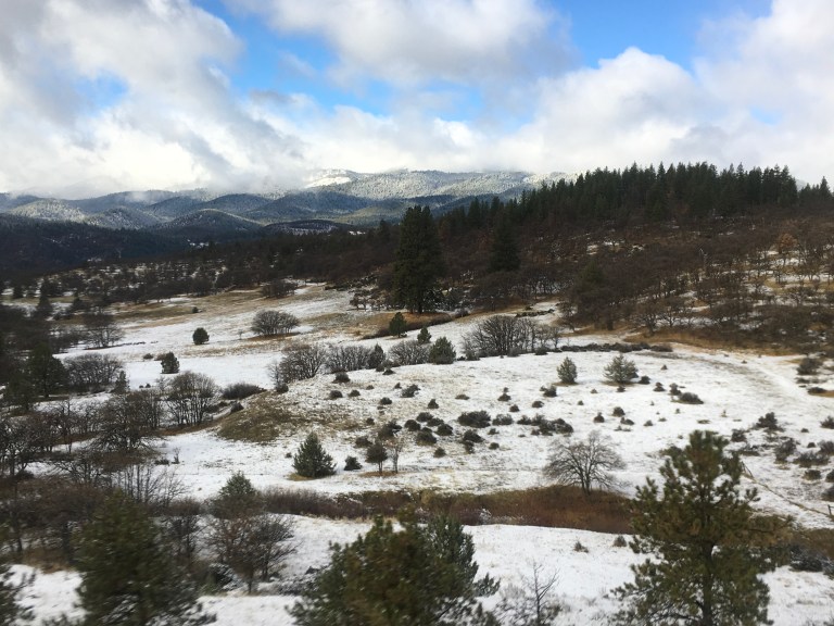
When we get to the California border, we have to stop for an agricultural inspection. California is very strict with what can come into the state. Their agricultural economy depends on not having infected fruits and vegetables contaminate their crops. Once we get through the inspection station, we are cruising to Redding.
We are staying at Redding RV Park, off I-5. In fact, the park sits on the hill overlooking the highway. There are 109 sites, each stepped into the hill. We have a pull through site that actually has enough length to keep the car attached, if you want. It’s not very wide though, you only have a small grass patch between the coaches. You can pass the Gray Poupon to your neighbor from your window, so I don’t think we will be sitting outside. We can see snow capped Mount Shasta through the trees to our right.
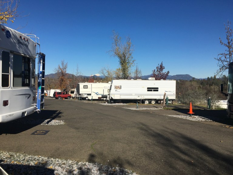
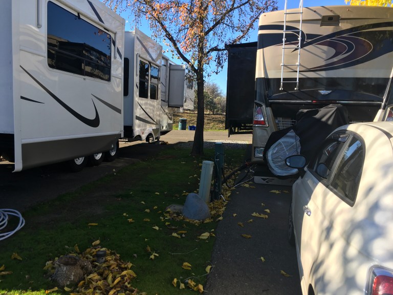
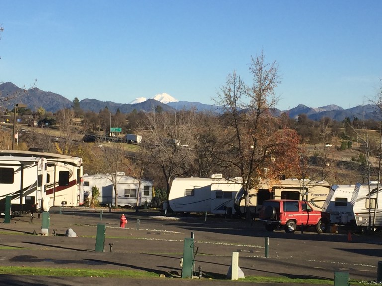
Tomorrow we start our exploring.
Saturday, December 2, 2017
It’s raining today. The forecast is for rain all day. Excluding the rain and cold, it’s like a day back when we had a house. I’m making red gravy today and HGTV is on the television. We aren’t planning on going to the Casino tonight, but instead eating pasta and sausage. Too much wine before and during dinner made us lazy, so we vegged out watching television. No hot tub.
Friday, December 1, 2017
With the laundry finished, we stroll around the RV Resort, checking everything out. It’s not raining. You can see some blue sky, although most of the sky has a white wisp of clouds covering it.  It’s a very large campground, with mountains surrounding it. There are a total of 191 campsites, some pull through and some back in, in four different areas. Across the street from our site, there are more sites.
 Behind them is Jordan Creek.
 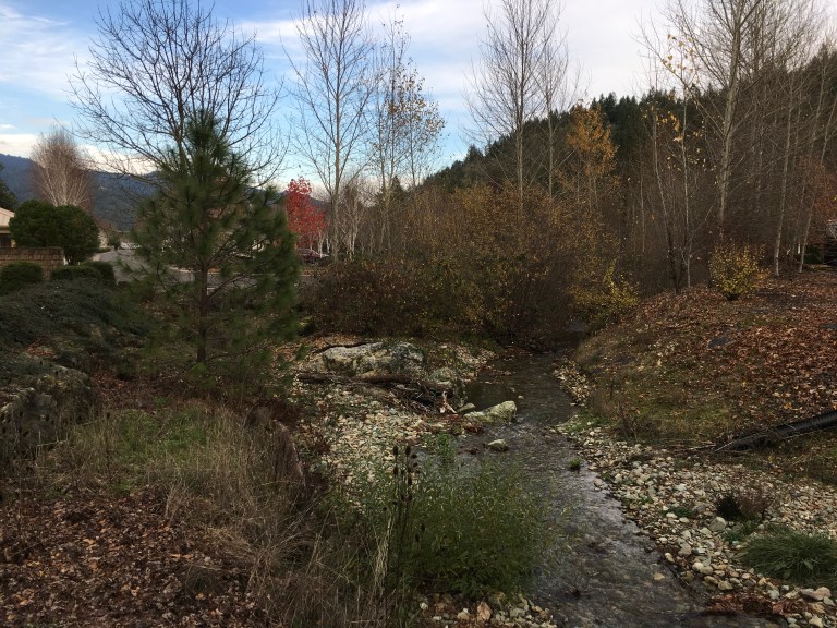 On the other side of the creek there are more campsites. We are towards the back end of the campground. There is one section behind us, but there are more then one hundred sites in the front of us.
We have lunch and head to our happy place, the hot tub. There is one man on the phone in the hot tub, no one else. He decides it’s time to go when we arrive, but hangs out with us chatting for awhile. A few minutes after he goes, there are several people who arrive. Today, we’re not as lucky when it comes to having the place to ourselves. At four, we pack up and head home to get ready for tonight’s all you can eat buffet, Steak and Sushi for $15.99.
Thursday, November 30, 2017
It’s been almost three months since we have had a site with sewer. Sewer translates into a good interior cleaning and lots of laundry. And we need it with the coach having had all the work done. Most of my morning is cleaning, while the washing machine goes non stop washing rugs, afghans, bedding, towels and clothes. That makes it seem like we have been living in filth, but that’s not the case. Without sewer, I’m limited to one wash per dump cycle, so everything takes its turn. With sewer, everything can get done at once.
One challenge we have is keeping the kitties from getting under the bed and breaking the electric connections that allow the bed to go up and down. They think it’s a great hiding place, us, not so much. So, while I play Mr. Clean, Alex works on making cardboard boxes to fit between the wall and the bed, one for each side. This will replace the towels we have stuffed in the space that are unsuccessful in keeping them out. Even if they push the boxes in, they won’t be able to get under and reek havoc.
After the cleaning frenzy and lunch, we pack up and walk to the indoor pool and hot tub. The place is empty. We have it all to ourselves, at least for an hour.

It is wonderful to be sitting in warmth. You can feel the cold leaving your aching bones. This has been the warmest I have been in eight months. And the big pool is refreshing after the hot tub.
At four, we head back to get ready to go to the Casino for the all you can eat Seafood buffet. And what a buffet! 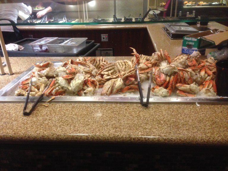
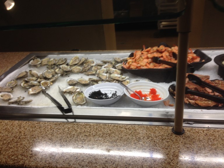
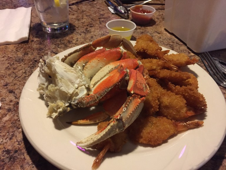 Mountains of Dungeness crab, fried shrimp, shrimp cocktail, oysters, salmon and cod cooked various ways, Asian and Mexican food all for $20.99. Well worth the money. For the second night in a row, we wattle out to catch the shuttle back to the RV Resort.
Wednesday, November 29, 2017
Miracle of miracles we are leaving REVtown today!
Rick, the fellow RVer we met here, has returned to pick up his coach and he comes in for coffee and an update on his world and ours. Once he leaves, we have breakfast and start packing up. We can’t check into Seven Feathers until two, so we plan on leaving around noon. It’s one hundred miles south and we need to get fuel first.
Fortunately, it’s not raining as we pull in the utilities and hook up Sergio. We even have sunglasses on, but not for long. While driving south, the clouds roll in. It’s strange getting back on the road again. Princess Poco Loco has no problem remembering what to do, she was on my lap before we left REVtown’s parking lot. Before we know it, we are at Seven Feathers Casino Resort.
I decided I could live here, if it weren’t for the cold and rain! This is a resort, so the sites have concrete pads, easy to level the coach. The picnic table is on concrete as well. I like this because it keeps the mess outside the coach, you don’t track dirt, grass and leaves in, especially with all the rain.  The landscape between sites has grass, trees and Rhododendrons galore. This would be absolutely gorgeous in the summer when everything is in bloom, being winter, we need an imagination. But here’s the best part, they have an indoor pool, hot tub, fitness room and library.
What more could you ask for? Oh wait, there’s the Casino with buffets and a free shuttle service that can even take you into the town of Canyonville proper. And there’s cable television. Now if they could only get the temperature up about forty degrees and stop the rain, I would be in heaven.
It’s Wednesday, so tonight’s buffet is barbecue. By the time we check in and set up, it is after three. We haven’t had any lunch, so we get dressed, hop on the shuttle and head over to the Casino. First stop is getting a Players Club card so we get the discount buffet price. The buffet doesn’t open until four, so we check out the casino floor and then the gift shop.
It official, we’re old! We are walking into a casino buffet and it’s not even five o’clock. Yeah, we’re old!
The buffet is all you can eat for $18.99 with your Players Club card. Not a bad price and not bad food. Barbecue pork and beef ribs, chicken and plenty of fixings. Tacos, salads, soups. If you can’t find something to eat, there’s something wrong. Dessert and your beverage are included, unless you want alcohol. I tried that, only to learn they take your credit card and hold it for your tab. I’m am not a big fan of having my card out of my site for the duration of my meal, so that ended very quickly.
After we stuffed ourselves, we wattled outside to get the shuttle.
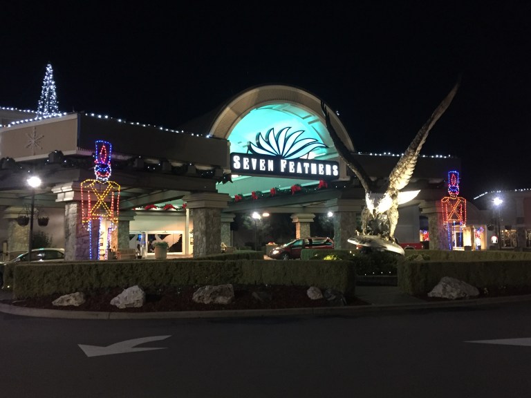 On the trek back to the RV resort, we passed through the Seven Feathers Truck and Travel Center. Wow! The Center was the size of some of the grocery stores we’ve been in. And the truck parking was immense. The truckers are here all year, with the shuttle taking them to the Casino for food and gambling. This place is hopping all year long. Definitely a great place to stop for awhile.

One thought on “ESCAPE FROM PURGATORY, AGAIN OR CALIFORNIA HERE WE COME CHAPTER SEVEN NOVEMBER 29, 2017 – JANUARY 22, 2018”