Monday, June 19, 2017
Today we come come back into the good ole U.S. of A. Hopefully. We’re hoping for an easy ride and a smooth border crossing.
As soon as we leave the campground, and all the way to the border, there is culvert construction and frost heaves. So much for the smooth ride.
 We spot a male moose hanging out in the water. As usual, it’s raining, misting and whatever other form of wet can come from the sky. The mountains are disappearing into the clouds. We might be disappearing into the clouds.
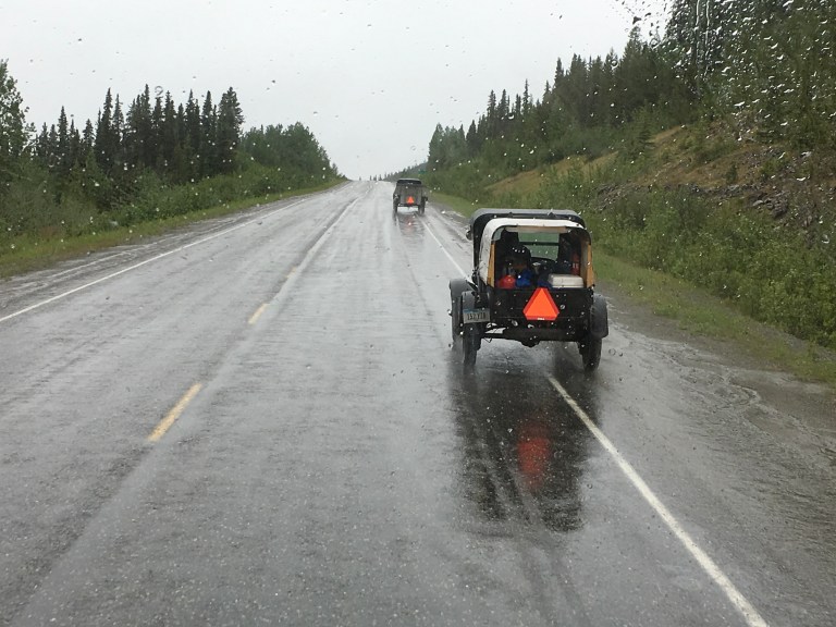
 When we get to the US border crossing, we notice a sign for maximum height of 12′ 10″. We are exactly 12′ 10″. There is a red, green traffic light that tells you not to proceed until it turns green. A shorter trailer in front of us seems to sail right through the check point. The light is red. Out comes the border guard, heading straight for us. Oh, boy! She’s eying us up. She’s deciding if we can fit. Alex says we can drop the air to get us under the canopy. She thinks we can make it without losing the air. The light turns green. She starts us forward. When we clear the cable with the hanging sign, she tells us we will clear without having to drop the coach. She asks a few questions, wants our passports, we joke about coming back home to the US, and we’re back in the USA.
 One of the first things we see as we enter Alaska is a bald eagle bathing in lake. What a nice welcome home!
We’re heading to Tok, our first stop in Alaska. Tok RV Village, right on the Alaskan Highway, will be home for the night. They have big rig friendly, full hookup sites with 30 and 50 amp service. Laundry, fire rings, firewood, LP gas and a great gift shop are some of the amenities. There is a vehicle wash for cars and RVs. We took advantage of it and washed Sergio for $6.50 for forty-five minutes. We stopped at the liquor store to replenish our supplies and picked up ammunition and an Alaskan fishing license for Alex at Three Bear Sporting Goods. When Barb, from Wolfhawk Gun Shipping called back, we went to her place to get our guns. This business operates out of their house and we got to see how Alaskans really live in the woods. It was a tiny house, about 500 square feet that served as a kitchen, eating area, living room, and office, all in one, with a loft for sleeping. A screened in front and back porch stored can goods, a washer and everything else. There was a firewood shack and an few other outbuildings. A big, beautiful black Maine Coon cat named Shadow, called this place home.
When we were done, we stopped at Fast Eddy’s for a takeout pizza with green bell peppers and onions. It was the heaviest pizza I have ever picked up, but it wasn’t too bad. Still waiting for great pizza again!
Saturday, June 18, 2017
Happy Father’s Day! Thank you for all you do.
We woke to 49 degrees with a 4:27 sunrise!
Today it is off to Beaver Creek, Yukon, last night stop before the US border. Surprisingly, it is a sunny day! We definitely are getting closer to the US!
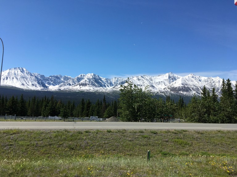
There are wild horses grazing on the road. Beautiful creatures totally unconcerned with the humans speeding by. We get to Haines Junction, where you can head south to Skagway and Haines. Not on our itinerary this times around. The St. Elias Range, with whitecap mountains, are on our left. The Dawson Range is on our right. Mountains are all around. There is something about looking at mountains that make your feel small and totally insignificant. They are giants, you are small. They have been here for thousands, if not millions of years. You are here for the blink of an eye. It puts humans in perspective, or at least it should.
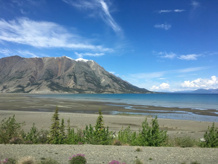
 We come to Kluane Lake and Kluane Lake National Park. Again, water the color of the tropics. Gorgeous blue green and crystal clear. The lake is huge, at 158 sq miles and 50 miles long. Destruction Bay resides on its shores. I don’t know if the town is named for the road conditions, but holy crap it had some of the worst frost heaves. A frost heave is an upwards swelling of soil during freezing conditions caused by an increasing presence of ice. It causes the road to create huge humps followed by equally huge dips. It is like riding a roller coaster. Not bad in a car, but forty feet of motorhome, not good. Somehow, we survive.
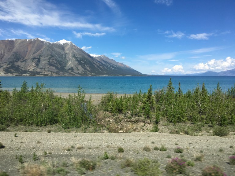
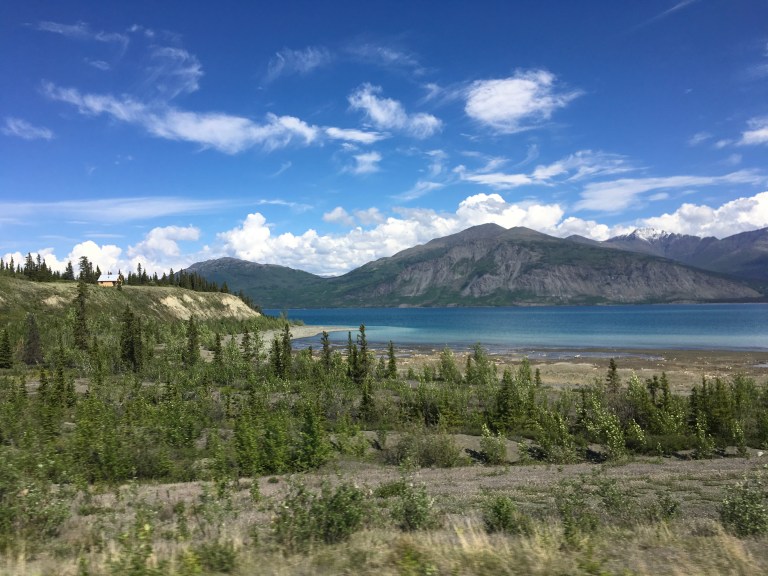
 We finally get to Discovery Yukon Lodgings & RV Park, right on the Alaskan Highway, about thirty miles before Beaver Creek. Full hookups, but only 30 amp service. It’s not hot out, we don’t need air conditioning, so it’s not a big problem. It has all usual things at an RV park, with one unique exception, the power goes out every day between 11 AM and 2, or maybe 3 PM. Something you don’t find out about till you’re there. Another thing, the office does have as rather interesting roof!
Saturday, June 17, 2017
I woke a few minutes before two to answer nature’s call. When I looked out the window, I thought it must be dawn, until I looked at the clock. So this is what it is like to live in the extreme north. It doesn’t get pitch black. All night, during what should be the night hours, it always looks like twilight. With the sun setting after eleven and it rising at four, there is no darkest night.
After our destructive day yesterday, Alex used foam core board and duct tape to cover Sergio’s headlights. We look totally weird, but worth it to keep us from more damage. Guess we fit in with all the other strange on the Alcan.
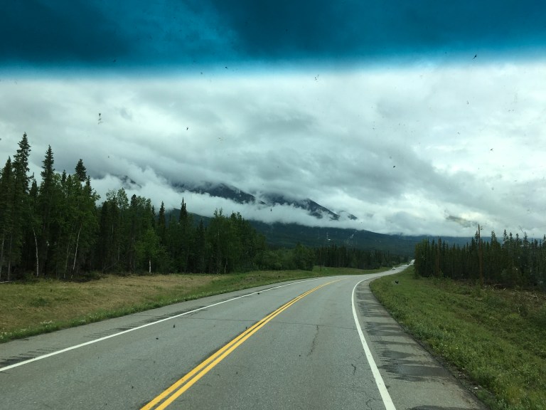
The drive to Whitehorse, Yukon was, a unique experience. There were mountains so high with clouds so low they intermingle. Clouds are ringing the middle of the mountains. The lines between the two are obscured. It is surreal. Everything is shades of gray, not the book or movie. The tree line only goes so far up the side of the giant mountain, then it looks like someone wiped everything away.
We cross the Continental Divide. Rain again. Or is that yet? There is a sole house in the middle of nowhere with barrels across the drive. No welcome mat out here. Two old antique car/trucks are broken down in the rain on the side of the road.
Rain, rain and more rain. Alex got his wish for rain to wash off all the dirt. A miserable, cold, raw day. The temperature is only 43. We’ve been checking temperatures in Tok and Fairbanks. The weather is warmer and sunnier there than in Canada.
More construction. We get hit by another rock to put another hole in Claudia’s windshield. This time it was a semi flying by. Sergio got more chips in his windshield. We stopped at Teslin for lunch. It’s the typical one stop, all in one place you find along the road. The food wasn’t bad. Good tomato bacon soup for a day like today.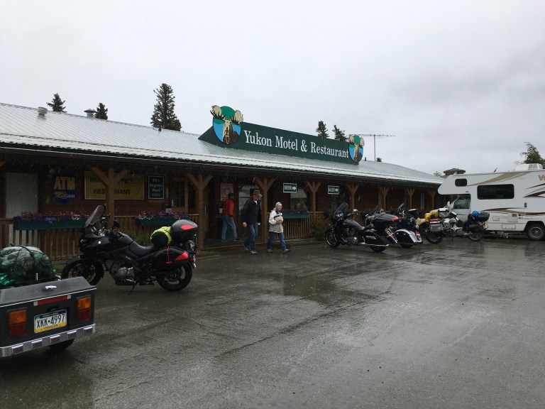 After we leave, there is more construction. This one is a long stretch. The broken down antique car/trucks got going again and we pass them. They are moving very slowly.
We get to Caribou RV Park in Whitehorse in the early afternoon. It is a tight site, not really made for big rigs, even though there are many there. So we are all packed in. There is the Wolf’s Den Restaurant, for Swiss and Western food, where you can get a discount on food. Again, showers and laundry are coin operated.
It got nice towards evening, sunny, in the 60s, so we barbecued ribs. Not exactly gourmet conditions. Oh, and FYI, the sun sets at 11:33. With all the daylight, your night gets a whole lot longer.
Friday, June 16, 2017
Today we’re on our way to Watson Lake, our first stop in the Yukon Province. The weather says it is 39 with snow showers. It rained during night, again. I am really getting tired of rain, and gray skies and no sun.
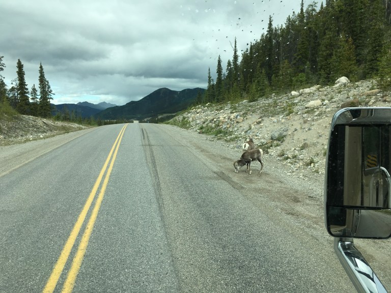
We are moving farther into the Canadian Rockies. The road to get here may have been a bit crazy at times, but the scenery is out of this world. This make it all worthwhile. Just the wildlife along puts a smile on your face. We saw black bear cubs on side of road. After straining and craning our necks for hundreds of miles looking at every cliff for Big Horn sheep, where do we find them? Running all over the sides of the road.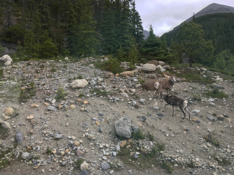
 The Bison are plentiful and we even saw one chasing an RV. We got to see our first, and at this point only moose, a female. There are white tail deer roaming around too. It’s weird to see moose, elk and caribou crossing signs on the road. Something I’m not used to.
A few of the strange things we have seen on the Alaskan Highway are loads of motorcycles. I’ve spent many a year riding my own bike in snow and other lousy weather. Even rode for nine months with a towel as a seat waiting for my custom seat to arrive, but I am happy to say I’m not crazy enough to ride a motorcycle on this highway. Between the rain and the gravel and dust from the road construction, it’s got to make for one miserable ride. And this highway is nothing but rain and construction.
Another strange site is seeing bicycles. You will see groups of cyclists along the Highway. They tent camp in turn outs or commercial driveways. Rain, cold, animals. In the dirt mound hills on the side of road, people use stones to write their names, peace signs, their romantic love interest surrounded with a stone heart. Like I said, strange!
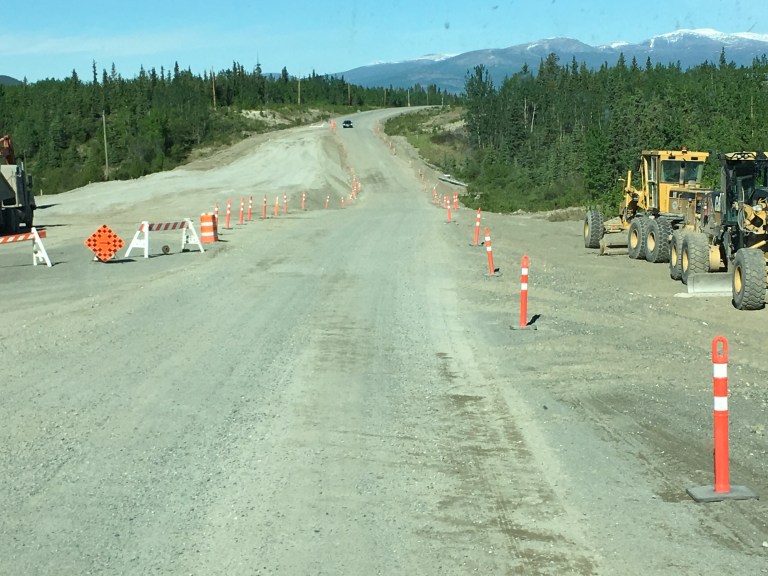
We came upon Muncho Lake. The water was turquoise, like in the islands. There are campgrounds along the lake. Great place for boating. Not far after this beautiful place, we encounter road construction. The wonderful loose gravel and dust for miles. The signs warn you to go slow, there is loose gravel and extreme dust. This is an understatement! The signs say to turn on headlights so you can see. You can’t! You can smell and taste the dust as it finds its way into the coach! There is a layer of dust forming on everything inside. We are descending a hill. The climbing side has two lanes, typical so the left lane can pass slower vehicles. There is a pickup truck in the right lane. As he speeds past, he throws up a rock that smashes into the coach windshield right above the driver windshield wiper. We’ve got a nice big ding. It looks like the kind of crack that can e repaired. So much for making it to Alaska unscathed.
The rest of the trip to Watson Lake was the trip from hell. Construction, gravel, dust, dirt, rain, sun, wind and no cell service. And the damage continues. Sergio suffered two cracks and five chips in his windshield, plus two broken fog lamps. He’s got rocks in every space imaginable.
We pull into Baby Nugget RV Park about eleven miles past Watson Lake. It has only 30 amp service, no sewer, and limited fuzzy cable. Laundry and showers are coin operated. There is an RV wash for $2 for two minutes.
When we get to our pull through site, we discover all the services are at the road. Your car would be right next to the utilities, not your coach. You would need very long cables and hoses to cover the distance. So even though it is a pull through, we have to disconnect Sergio and back Claudia up to reach.
Not a fun day!
Thursday, June 15, 2017
The sun rises here at 3:59 AM. It didn’t wake us this morning because we were fogged in.
After breakfast, we get ready to take off. We start down the road, but the jack sensors won’t stop screaming. We suspect all the mud and stone is confusing the sensors. When we pull over, Alex finds this to be the case. Once he gets the jacks cleared of the campground remains, we’re off again, this time in peace and quiet.
Our destination is Fort Nelson, about 283 miles north on the Alaskan Highway. This is a one night stop and our last in British Columbia. We cross the Peace River, with high, rocky cliffs. We’re entering the Canadian Rockies. There is a windy, 3 mile stretch of road in fog with a 6% downgrade that turns to 10%. At the bottom, trees and rocks. There are lots of hills to climb and decent. Each with its own unique bends and twists. These hills, especially with the fog and rain And wind and 40,000 pounds of vehicles, put a strain on the driver. And can scare the passenger into cardiac arrest! They don’t believe in guard rails in this country. If you can’t keep it on the road, you become road kill. And since it so desolate here, I don’t think you’d be found by humans before the wildlife has a tasty meal of you.
Along the highway, you find a few “towns”, little more than one stop shopping, with a gas pump, restaurant, hotel and campground all in one. Oddly, in the middle of nowhere, there was a modern electric billboard, announcing the Alaska Highway’s 75th birthday. It seems out of place. You see very strange things along this road.
We arrive at the Triple “G” Hideaway RV Park right on the Alaskan Highway in Fort Nelson. This is a cool place! There is a saloon that serves food and, of course, alcohol. I know what we’re doing for dinner.
They have large rig sites that are easy pull throughs with easy leveling. Showers and laundry at the campgrounds in Canada seem to be all coin operated, like at truck stops in the states. They have limited cable and only 30 amp service. In this cool weather, 50s, we don’t need any air conditioning. With these temps and the rain, we don’t even need to open the windows. The downside to 30 amp is no laundry and no using the microwave or oven. What a shame!
After we settle in, we discovered the people in the site next to us were the same people that were next to us at Northern Lights RV in Dawson Creek. We chatted for awhile then head over to the saloon for dinner. It was around five when we got there. We had our pick of tables, but within fifteen minutes or so, the place was packed. Guess we weren’t the only ones not wanting to cook. I had chicken noodle soup that had way too much salt and a steak. Alex had meatloaf, two big pieces, that he said had way too much salt. He tried Kokanee, a local beer, that he said was very good.


Then we took the short walk home to our coach to rest up for the next days trek.
Wednesday, June 14, 2017
Today we go to the infamous city of Dawson Creek, in British Columbia, Canada, the start of the Alaskan Highway. Mile marker 0, the equivalent of Key West in the states. If you have ever been to the Keys, everything is based on mile markers. Same for the Alcan.
The Alaskan Highway was built was during World War II, and completed in 1942, to connect the lower forty-eight with Alaska through Canada. It starts at the junction of several Canadian highways in Dawson Creek in British Columbia and runs to Delta Junction in Alaska through Whitehorse, Yukon. The first 613 miles of the Alcan are in British Columbia and are called BC Highway 97 North. When it crosses into the Yukon, it becomes Yukon Highway 1, all 577 miles of it. It has a name change once it crosses into Alaska and becomes Alaska Route 2. It’s then 200 miles to Delta Junction, the official end of the highway. It is another 296 miles to Fairbanks, the unofficial end. It is completely paved, if you can call their construction areas paved. The construction sites are loose gravel that fly through the air like missiles and spew dust and dirt like it was a volcano.
We encounter rain off and on for the drive from Valleyview to Dawson Creek. Not the severe kind, but heavy enough to require windshield wipers, which is a good thing. The combination of rain and wipers cleans off the bug carcasses, not to mention road dirt. Crossing into British Columbia changes time zones to Pacific Time. We keep pushing that five o’clock cocktail hour back. We decide to use the “It’s five o’clock somewhere” rule.
Our campground destination is Northern Lights RV. This is one of those campgrounds you see advertised everywhere the word Alaska is printed. Magazine articles, travel info, brochures, you name it.
The campground is a dirt parking lot with some stone, mostly at the sites. I counted six trees in the whole campground. It has been raining, so the place is a mud hole. There are holes, now puddles, that range from basketball to swallow a small child size. Our utilities are on a post in a sea of water, as is most of our site and everyone else’s. You definitely need muck boots here. It is raw out. The temperature is only in the 50s. Add in the rain and wind and it is downright miserable. Our timing seems to be good today. Just as we finish hooking up, the rains come again. This time, it is pouring down hard. We get dinner going in the coach and check out the radar. This storm is here for awhile. We’re in for the night.
Tuesday, June 13, 2017
Today the sun rose at 5:09. I am becoming a morning person. Somewhere my father is laughing.
We are heading to Valleyview, our last stop in Alberta. It’s about 180 miles northwest of the Edmonton area on 43. Our campground for the night is Sherk’s RV Park. The name reminds me of one of my granddaughter’s favorite movies, Shrek. It is a very quiet and restful park. There are a few residents, but the owner tells us everyone here is on there way to Alaska. That is their bread and butter.
There is pretty much nothing in Vallyview besides the gas and convenience stores, so we decide to keep Sergio hooked up and barbecue some steaks. It is one of the rare sunny days. In the low 60s, but very nice anyway.
There is still no antenna television, so thanks to unlimited data on Verizon, we bing watch our shows on Netflix. Still getting used to the 10:29 sunset.
Monday, June 12, 2017
I screwed up!
We had sent away for Canadian Park passes so we could get into the parks for free. They were doing this in celebration of Canada’s 150 birthday. That should have told me something, but no it didn’t register. Our next stops are Banff National Park, then Jasper National Park. But, no, sadly, they are not. We can’t get into any of the campgrounds. Most of the campgrounds don’t have electric service. The two that do are booked. The few others that can fit a large rig, only allow a generator to run twice a day, for two hours in the morning and two in the evening. If you are off somewhere and miss the time frame, you are out of luck. And why would I be sitting in the campground all day instead of playing in the park? After spending an hour or so dealing with their not so user friendly web site, and going round and round with both the information and reservation people on the phone, we decided to pack it in and head for Alaska. Banff and Jasper would have to be another trip, one where I make reservations.
Instead of heading west past Calgary, to where Banff and Jasper are located, we go north toward Edmonton, the capital of Alberta. We decide on a Good Sam Park, Diamond Grove RV Campground in Spruce Grove, on Century Close, a suburb west of Edmonton. We’re not planning on site seeing, but we do need to hit Walmart and a bank to change more US money into what Alex calls funny money, Canadian dollars. Their paper money is different colors with, what I can only describe as, a cellophane like strip running through it. Then, of course, you have Loonies, one dollar coins, and Toonies, two dollar coins. They also have the five cent, ten cent and twenty-five cent coins.
Diamond Grove RV Campground is a fairly large park with level sites and 30/50 amp service. The only problem we had here was with the circuit breaker. Alex kept flipping it on with nothing happening. Turned out there was a second one that he didn’t know about hidden on the other side of the post. We had to get someone to help us out. They never mentioned it when they brought us to the site. Other than that, it was a nice quiet, open space. One little thing about the owners. They must be dog lovers and have a unique sense of humor. All of the roads are named after breeds of dogs; Pekingese Parkway, Terrier Terrace, Labrador Lane. We were on Husky Haven. Okay that’s the dog lover part. The humorous part, the dump is on Shih Tzu Circle.
We set off for the bank and Walmart, which are within two miles of the campground. The bank was the first stop on the highway. That taken care of, it was off to Wallyworld. I noticed a western shop in the strip mall next door and brought it to Alex’s attention. He has been looking for a new cowboy hat of a particular color with no luck so far. A trip to the western store found the perfect hat, but it had a stain on the front that couldn’t be brushed out. They didn’t have another in his size. Even with a 10% discount, Alex thought the stain would drive him crazy, so we took the manufacturer, model and color information so find somewhere else. Then it was off to do the grocery shopping and home to a 10:28 PM sunset.
Sunday, June 11, 2017
Today we are taking the 111 miles trek south to the Brooks area again to Dinosaur Provincial Park, another UNESCO World Heritage Site. The morning started out with rain, again, so we took our time getting out, watching the radar till we thought the weather gods were in our favor. By the time we got down to the Brooks area around midday, we had sun.
As you are driving along, looking at pretty much flat land, you start to wonder where these hills and hoodoos are. It isn’t until you make the turn into the park entrance and start down this tremendous decent, that you see it in all its majesty.
The first stop, or last if you want on your way out, is the overlook. This, not to be missed, panoramic view of the entire park and surrounding areas, is absolutely incredible. This whole area, even into the States, had once been a sea, a hot, tropical like area with dinosaurs. After the sea was gone, glaciers moved through and created the hills, all of these changes leaving behind bones and fossils that are still being found. Canada takes their fossils seriously. They have one of the strictest laws prohibiting anyone from removing or destroying fossils. It is punishable with fines up to $50,000 and a year in prison. Signs tell you what to do if you uncover anything you think might be a fossil.
There is a campground at the park, not for the faint of heart, due to the vertical decent of the hill to get to the bottom. It only has 30 amp service, but it is a nice campground with plenty of trees and greenery and spectacular views. Plus you have hiking trails at your doorstep. At the campground entrance, there is a concession and convenience store, where we grabbed a burger and fries for lunch. A little fortification for our hiking adventures. But first, we drive through the campground and take the Public Loop Road, to get the lay of the land. There are Fossil Houses along the 2 mile road that contain the remains of dinosaurs that were found in the park.
We go up one level in the hill to the Park Visitor Center & Royal Tyrrell Museum Field Station to get info and a trail map, which doesn’t do you much good on the Coulee Viewpoint Trail. With runoff from rain and melted snow, it pretty much is find your way to the top any way you can, mountain goat style. Both gorgeous and scary once you get to the top. We opted not to check out the Museum, even though it was free for seniors this week, because we had just been to the real deal yesterday and I really wanted to hit the trails. The park has five different trails you can hike, ranging from you need to be a mountain goat to wheelchair accessible. Badlands Trail starts off the Public Loop, is a little under a mile and offers Badlands landscape. Prairie Trail is another wheelchair accessible trail of only a few hundred feet that starts from the overlook. Then there is Trail of the Fossil Hunters. This is about three quarters of a mile that begins at one of the Fossil Displays and ends at a historic quarry site.
We put on our hiking boots and set off down Cottonwood Flats Trail towards the river. This wheelchair accessible trail is a little under a mile and takes you through the cottonwoods down to the Red Deer River. Then we go to the Coulee Viewpoint Trail. The trail map says it is a little more than half a mile to ridge tops and offers beautiful views. They were half right. The views were beautiful, but the trail was none existent. No markers, no trail. Mountain goat time. You had to find ways to keep moving upward and then downward. The one part of the trail that was marked, was marked by big rocks on the sandstone hill creating a path to the stairs. Between our scoping out the views and the challenge of finding a trail, this took us about two hours.
It was about 5:30 when we started for home. It would be after 7:30 by the time we got back to Drumheller with rain coming again, so we decided to get pizza. Alex goggled pizza places and after careful consideration, we got good old Pizza Hut. We’ve had more Pizza Hut pizzas in the last few months than we’ve had in years. What I wouldn’t give for a real pizza!!!
Lakes in front of us in parking lot covered with white fuzzies
Saturday, June 10, 2017
It is a rainy day here in Drumheller. What else is new? I think I’m starting to grow webbing between my fingers and toes. I think I can count the sunny days since we left Florida on two hands.
We’re staying local today by going to the Royal Tyrrell Museum of Palaeontology, (English spelling), in Drumheller, which houses one of the world’s largest collections of dinosaurs. They have educational activities, ever-changing exhibits and self-guided tours, as well as a Badlands Interpretive Trail and an observation platform that takes 108 steps to get to, but once you do the climb, the view of the Badlands is pretty cool! I love looking at these sandstone hills, all the colors and design patterns. A marvel!
The Museum reminds me of the Museum of Natural History in NYC. When you first walk in, you are greeted by dinosaurs in what would have been their natural habitat.


You can wander through the exhibits on your own, reading about them or you can rent the audio that tells you their story. There are dinosaur bones and fossils of flora and fauna. As you progress through, you are taken through the periods of earth, showing what was alive and prospering at the time. There is a laboratory where you can see actual bones being excavated from the stones where they were imbedded. The Auditorium shows videos and you can go through the Distance Learning Studio. And of course, no museum is complete without a cafeteria and gift shop.


We spent the day there, including having lunch in the cafeteria. We sat at a counter looking out onto the patio and the hills. There were crazy people sitting outside having lunch in the icky rain wearing shorts, tee shirts, and sandals acting like it was summer?!? It’s in the low 50s!! There are signs telling you not to feed the wildlife, but no one has told the wildlife not to be eating the food. Prairie dogs are wandering throughout the patio scavenging food, totally unafraid of the humans, including the kids running around.
A quick trek through the gift shop to look for a magnet and we are on our way home.
Friday, June 9, 2017
Today we are driving 100 miles south, to the Brooks Aqueduct, the largest aqueduct of its kind in the world.
Trying to GPS the site gives me two different addresses. We head off using the first. Sergio is low on gas. If we don’t find a gas station, excuse me, petro station, we will be rolling into Brooks on fumes, if we’re lucky. Naturally, we didn’t think of this till we were on the road. So now we’re looking for a station in the midst of the rolling sea of green farms. I take my foot off the gas and let gravity take Sergio down the hills to save gas. We finally find an Esso station. For those of us who are old, this brings back memories of the rounded Esso sign. For the younger folks, this is who Exxon was before it grew up. With enough go-go juice in Sergio, we’re back in business and on the road. We stop at an A&W for lunch. Another throwback to the old days. Alex is loving his root beer. With our tummies happy, we start out again.
Sophie takes us to the address listed for the aqueduct. Only problem is, it isn’t the aqueduct. It’s a government office building. Next address is who knows what. Time for a phone call. The young girl at the aqueduct is telling us to get back on the highway and there is a sign. Doesn’t know where it is, how far or an exit number, but there is a sign somewhere that tells you to turn right. They don’t have a street address. The only thing we got from the conversation was we didn’t drive far enough. Off we go again on the treasure hunt. We finally find the sign, turn right and make our way towards the aqueduct on a dirt road, when we get stopped by a train, with 146 cars. Patience is wearing out! In addition, we are fighting yet another big, black storm rolling in. Everywhere you look in Brooks, you see the evidence of last night’s storm that came with tornado warnings. This area got hit hard with trees down and a mess everywhere. Finally, the train passes and we get to the site. It is quite impressive.
It was built between 1912 and 1914 by the Canadian Pacific Railroad as part of a major irrigation project known as the Eastern Irrigation District (EID), at a cost of $569,287. The Aqueduct and the Bassano Dam were the two major components required to bring water to the plains area now known as Millicent, Patrica and Tilley. It was the longest concrete structure of its kind in the world at almost two miles. At 61 feet tall, it required 300 workers and 25,000 yards of steel-reinforced concrete. Trains brought 30,000 gallons of water to the construction site every day. It was declared a Provincial (State) Historic Resource in 1980 and a National Historic Site in 1983.


Afterward, we are standing up top looking at the storm trying to decide what to do. The NOAA weather radar shows it heading straight for us with lots of yellow, orange and red. I am not a happy camper! We got hit hard last night at our campground, not as hard as here, but bad enough. We really don’t want to stay here and wait it out. That will be hours and it’s two hours back to our campground. Taking off now means driving right into the storm. The radar is showing it changing shape. We decide to give it a shot and head back, hoping the worse would be passed us before we got to it.


The ride home was long and wet. But we made it. It was dinner and relax to the sound of rain.
Thursday, June 8, 2017
We are off to Drumheller, Alberta, land of the dinosaur. Drumheller is a town in the Red Deer River valley in the Canadian Badlands in east-central Alberta. It is about 68 miles northeast of Calgary. It is often referred to as Dinosaur Valley, and with just cause. Many of the dinosaur bones and fossils that you have seen have come from this area.
Alberta is farms, farms and more farms, broken up with the occasional cattle ranch and a few sheep. Towns are small, so small, if you blink, you’ll miss them. Wind turbines and oil rigs live together, side by side. There is something eerily weird and strange seeing these two energies living together. One positive and one negative. Do they cancel each other out?
When you get to Drumheller, be prepared for dinosaurs. Everywhere. Our campground for the next four nights is Dinosaur RV Park on North Dinosaur Trail. Told ya, everything dinosaurs. Wire dinosaurs on the street lights, statutes of all sizes and colors all over everything. All street names, businesses and whatever have dinosaur or a specific dinosaur as their monicker.
We had a very cool spot at the campground, private and secluded. It was a back in right in the corner with our back side on the street and our driver side facing the Badland hills. Our other side had the owner’s son’s house. Fences blocked us off from everything and everyone. Like I said, private. We had an old cottonwood for shade and a nice picnic table, which we did utilize for our jigsaw puzzle. It was an easy spot for leveling. The down side was that it was very, very tight. Absolutely no room backing in between the shrubbery, fence and utilities. If Alex sneezed, we would have had big problems. Once we were in, it was great. Again, there is no TV antenna service.
We decided to go into Drumheller and walk around the downtown area. They have an historic main street with the usual mix of tourist shops and local businesses. We wander over to the World’s Largest Dinosaur. Climb the 106 steps to the top of the fiberglass and steel T Rex, and get a great view of the Badlands and the Drumheller Visitor Information Centre below. After going through some shops, we head back to the coach for the night.


Wednesday, June 7, 2017
Today we are true tourists. We are going to Head-Smashed-In Buffalo Jump.
Head-Smashed-In Buffalo Jump was designated a World Heritage Site by the United Nations Educational Scientific and Cultural Organization, UNESCO, in 1981. It sits right up there with the Pyramids and Stonehenge. Evidence in the area shows human activity for at least 11,000 years. The buffalo jump dates back 6,000 years and is said to have been used up to a thousand years ago. Originally, the cliff was about sixty feet high, but over thousands of years and thousands of buffalo carcasses, it is only about thirty feet now.
I should explain what a buffalo jump is and how it works. The native Americans understood the topography and the bison or buffalo’s behavior. They used both to herd the bison, cause them to stampede and run right off a precipice, killing them selves and thus giving a winter’s supply of food, clothing, shelter and tools to the natives. While it may sound simple enough, it wasn’t. It required many people and a great deal of preparation. First they had to locate a herd. Then they created a channel with rocks and vegetation, up to five miles long, to keep the buffalo moving in the right direction towards the sandstone cliff. A butchering camp was set up below the jump, close enough to get the buffalo there quickly, but far enough away from the fray. They needed a person to pose as a baby buffalo in distress, complete with a buffalo skin and scent, so he could walk among the buffalo and not get trampled. A distressed calf would get the herd’s attention. The herd would always protect their young. Bison have bad eyesight but a keen sense of smell. Next, they needed two people in wolf skins complete with the scent to circle the herd to keep them on edge. Two lone wolves weren’t a great threat in and of themselves, they were just enough to stir the pot. The combination of the lost calf and the circling wolves made for a jittery herd. Along the stone and vegetation channel were other people covered in skins waiting for the signal. When the wind was blowing in the right direction, everyone took their positions. The wolves circled, the calf cried out running to the cliff. The wolves moved the nervous herd to the channel. Once in the channel, it was all but over for the herd. Then all the people jumped up from the rocks and vegetation shouting and waving the skins causing the herd to stampede toward the cliffs still keeping them in the channel. Those buffalo that did not die in the fall were killed by hunters at the bottom. The natives believed if any escaped, they would warn other herds and the people would not have any more successful hunts. For the natives, the buffalo meant life.
You might ask, how did Head-Smashed-In Buffalo Jump get its name? According to oral traditions, a young Blackfoot boy wanted to witness the buffalo plunging to their death. So he stood under the shelter of a ledge as he watched the buffalo fall. It was a particularly good hunt and as the bodies piled up, he was trapped between the cliff and the buffalo. After the butchering, he was found by his people with his skull crushed from the weight of the buffalo carcasses. That is why this is called Head-Smashed-In Buffalo Jump.
The Interpretive Centre at the site has five floors of information on the people, culture and the role of the buffalo in their lives. I recommend you watch the 15 minute video reenactment of the hunt in The Theatre. You get a sense of what it took to make this happen. On the top floor, you can walk out to where the buffalo met their end. You stand at the edge of the jump and look down to where the buffalo fell. Take the Lower Trail beneath the jump to see where the camp was set up and see the cliff from a different perspective.


I should mention, this is not the only buffalo jump. They exist throughout the American Great Plains, in the US and in Canada. Native Americans were practicing this type of hunt for thousands of years. This one is well preserved and has provided a great deal of valuable information. As you travel in the Great Plains, you will see signs or markers for others, though I don’t think any can compare to this.
After spending the better part of the day there, we headed home for dinner and rest. Tomorrow we are heading to dinosaur country!
Tuesday, June 6, 2017
Canada! The day we have been looking forward to and dreading at the same time. We have heard and read horror stories about the border crossing, with border guards tearing apart coaches. We agree to the strategy of answering the questions asked and offering no other information. Keep it simple. We don’t want to antagonize the guard or give them reason to have a bad day and us be the recipient of said bad day. We’ll keep our fingers crossed!
After breakfast, we pack up and head the 120 miles north to the Sweetgrass, Montana border crossing. Before we know it, we are driving into the RV lanes. We have our passports and the cat’s health certificates ready. There is one travel trailer with Alaska tags in front of us. The RV in front of him moves out and he moves up. We are next. Alaska is there at the guard window less than two minutes. A good sign, but he’s going home. We move up to the window. The guard asks where we are going. Alex tells him we are traveling through Canada to Alaska. He asks the state we are registered. Alex tells him Florida. He wants the tag number. We tell him. He asks for our passports and we give them to him. He asks what we do for a living. Alex says we are retired, still getting used to that. What did we do before? Alex tells him. Do we have any guns? No. Alcohol? Yes, four bottles of wine and a six pack. Wait for it! Nothing! Have a safe trip and hands us back our passports, unstamped, I might add. Nothing about pets, fresh meat or fresh produce! Nothing, not one question! We’re done so fast you hardly had time to grasp it. If we were sitting at the crossing all total for five minutes, it was a lot. All that worrying for nothing. Welcome to Canada! What a relief!!!
Now that we are safely in Canada, I call to make a reservation at the Daisy May Campground in Fort Macleod, Alberta, our destination for the next two days. Didn’t want to do that before hand just in case there was a problem.
First adjustment to Canada is the speed limit, which is now kilometers per hour, not miles per hour. Claudia, our coach, does have KPH on the speedometer, but being old, you really can’t see that small lettering while driving without reading glasses. Getting old ain’t for sissies! Fortunately, Sophie, our MapQuest GPS app, does the conversion for us, but I google the conversion for times when we might not be using her or when she isn’t picking up a speed. Believe me, with mountains and international cell and wifi service, it happens.
Next difference is rest areas, which they call roadside turnouts. They can be anything from a simple lane off the side of the road to something with bathrooms and vending. Every once in a while, they do call the more elaborate ones rest areas.
We quickly learn that, this more rural area of Canada at least, is not big on navigation signs or street addresses. Their exits, off what we would call interstate highways, are not the well signed, off ramps we are used to. They say “Important Intersection” on the signs. They are nothing more than a cross street, off a major highway! You will be driving down the road at 110 kmh, 68 mph, ands see a sign for such-and-such place, with a right arrow and number of kilometers. You don’t know if that is the distance to the exit or how far off the road to that place. Turns out, the sign is telling you that somewhere not too far ahead, there is an intersection, aka exit off the highway, where you need to make a right turn, Clyde. Okay, so now you are hopefully going to the town you want to go to, but next challenge is finding the exact place. Street address, right? Wrong. Rarely will you get a street address, and if you do, GPS may or may not find it. What you will get is, “3 km northeast of such-and-such” or “15km southwest of so-and-so off blah-blah road”. If I knew that, I would know where I was going!
Anyway, we soldier on.
We’re following Sophie’s directions to the campgrounds, which she says is a ways off, when a sign pops up to turn right to get to Daisy May, so we take the turn abandoning Sophie’s direction. And there’s the campground. Fun adventures in Canada.
We check in at the office and tell the woman we want to pay cash, don’t want to incur international credit card fees, but her exchange rate is below what we can get at a bank, so she agrees to let us come back later to pay.
The campground, like most in Canada, is older and setup for 15 or 30 amp service and not for really large rigs. Some, like this one, have made a few spots that can handle 40 feet and 50 amp. They have made space for four. We are on the edge of the campground in a field. That is the only way to describe it. We know that there will be another rig coming in behind us later in the day. The woman told us that when we checked in. We have some trees to our left. Kind of a private area. There are birds and prairie dogs and one very large cat that reminds me of our deceased Maine Coon, Leira, to keep the kitties amused.
After we setup, we hop in Sergio and head to town. First order of business, convert US dollars to Canadian dollars at a local bank. That done, and it still being early, we go the the Fort, which is home to the Royal Canadian Mounted Police. After growing up on Dudley Do-Right, we had to see the real deal. The Mounties were created in 1873 when Prime Minister John A. MacDonald proposed to the House of Commons that a police force be established to bring order to the Canadian Wild West. The proposal was accepted and the Mounties were born on May 23, 1873. On July 8, 1874, the Mounties started a three month trek west, eventually building, first one small post and then a larger one to accommodate their growing numbers, aka Fort Macleod, named after the man that lead them. You can wander through the museum and learn all about the Mounties from their inception on. There are buildings within the post with exhibits to learn about their daily life.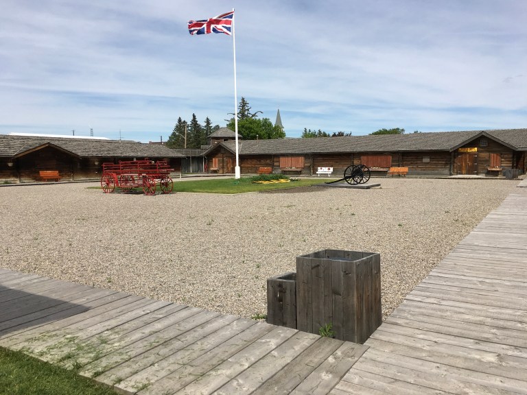
After our visit with the Royal Canadian Mounted Police, we headed to a Chinese restaurant, New Hong Kong Restaurant, on 25th Street, for an early dinner. No lunch again today. The food was very good and they had an exceptional iced tea. I was driving, so no drinking. I had dry garlic rubbed ribs and wonton soup, which was like I used to get in Chinatown in NYC. Really good! Alex raved about the egg roll with his sweet and sour ribs.
We went back to the coach for some R&R. Another new discovery, no antenna TV stations. None. So it’s Hulu, Netflix or whatever. Fort Macleod is really the first stop getting us ready for those long days of Alaska. Here the sunrise is at 5:26 AM and the sun sets at 9:26 PM, which means, add civil twilight into the equation, and it isn’t dark before 10:30! Takes some getting used to.
